Chats, California
| Chats | |
|---|---|
| Former settlement | |
 Chats Location in California | |
| Coordinates: 39°46′27″N 120°04′24″W / 39.77417°N 120.07333°WCoordinates: 39°46′27″N 120°04′24″W / 39.77417°N 120.07333°W | |
| Country | United States |
| State | California |
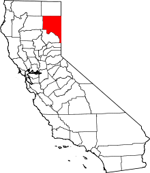
| County | Lassen County |
| Elevation[1] | 4,810 ft (1,466 m) |
Chats (also, Chat)[2] is a former settlement in Lassen County, California.[1] It was located on the Nevada–California–Oregon Railway 2 miles (3.2 km) east-southeast of Beckwourth Pass and 3.5 miles (5.6 km) southeast of Summit,[2] at an elevation of 4810 feet (1466 m).[1] Chats still appeared on maps as of 1894.[1]
The Chat post office operated from 1885 to 1894, and from 1896 to 1900.[2] The name is of Native American origin.[2]
References
This article is issued from Wikipedia - version of the 1/18/2011. The text is available under the Creative Commons Attribution/Share Alike but additional terms may apply for the media files.