Calneva, California
| Calneva | |
|---|---|
| Unincorporated community | |
 Calneva  Calneva Location in California | |
| Coordinates: 40°09′10″N 120°00′32″W / 40.15278°N 120.00889°WCoordinates: 40°09′10″N 120°00′32″W / 40.15278°N 120.00889°W | |
| Country | United States |
| State | California |
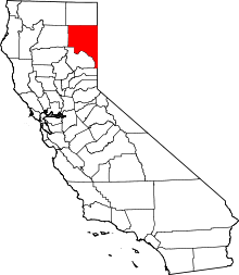
| County | Lassen County |
| Elevation[1] | 4,009 ft (1,222 m) |
Calneva is an unincorporated community in Lassen County, California.[1] It is located 10 miles (16 km) north-northeast of Doyle,[2] at an elevation of 4009 feet (1222 m).[1] Calneva is on the Nevada state line—its name is a portmanteau of California and Nevada.[3]
A post office operated at Calneva from 1911 to 1919, and from 1920 to 1933.[2]
References
- 1 2 3 U.S. Geological Survey Geographic Names Information System: Calneva, California
- 1 2 Durham, David L. (1998). California's Geographic Names: A Gazetteer of Historic and Modern Names of the State. Clovis, Calif.: Word Dancer Press. p. 361. ISBN 1-884995-14-4.
- ↑ Remington, Frank L. (Sep 8, 1969). "Take a Good Look at the US Map. Towns Have the Craziest Names". The Milwaukee Journal. p. 2. Retrieved 18 May 2015.
This article is issued from Wikipedia - version of the 7/5/2016. The text is available under the Creative Commons Attribution/Share Alike but additional terms may apply for the media files.