Châu Phú District
| Châu Phú District Huyện Châu Phú | |
|---|---|
| Rural district | |
 | |
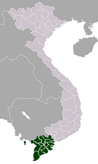
 Location in An Giang Province | |
| Country |
|
| Province | An Giang |
| Capital | Cái Dầu |
| Area | |
| • Total | 164 sq mi (426 km2) |
| Population (2003) | |
| • Total | 244,305 |
| Time zone | Indochina Time (UTC+07:00) |
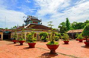
Châu Phú is a rural district (huyện) of An Giang Province in the Mekong Delta region of Vietnam. As of 2003, the district had a population of 244,305.[1] The district covers an area of 426 km². The district capital lies at Cái Dầu.[1] There are some festivals here: "Bình Thủy temple worshiping", "Sir Tây An worshiping"...
Châu Phú is located 20 km south of Long Xuyên and 20 km north of Châu Đốc, the main towns in the province.
The district comprises 12 communes and one thị trấn: Khánh Hòa, Mỹ Đức, Mỹ Phú, Ô Long Vĩ, Vĩnh Thạnh Trung, Thạnh Mỹ Tây, Bình Long, Đào Hữu Cảnh, Bình Phú, Bình Chánh, Bình Mỹ, thị trấn Cái Dầu.
The majority of the population follows the Hòa Hảo religious sect.
References
- 1 2 "Districts of Vietnam". Statoids. Retrieved March 13, 2009.
Coordinates: 10°34′59″N 105°10′01″E / 10.583°N 105.167°E
This article is issued from Wikipedia - version of the 11/18/2015. The text is available under the Creative Commons Attribution/Share Alike but additional terms may apply for the media files.