Cờ Đỏ District
| Co Do District Huyện Cờ Đỏ | |
|---|---|
| Rural district | |
| Country |
|
| Province | Cần Thơ |
| Capital | Thới Lai |
| Area | |
| • Total | 156 sq mi (403 km2) |
| Population (2003) | |
| • Total | 158,467 |
| Time zone | UTC + 7 (UTC+7) |
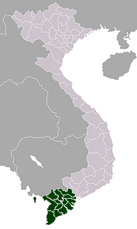
Cờ Đỏ is a rural district of Cần Thơ in the Mekong Delta region of Vietnam. As of 2003 the district had a population of 158,467.[1] The district covers an area of 403 km². The district capital lies at Thới Lai.[1]
The district borders Vĩnh Thạnh District to the west, Kiên Giang Province, Thốt Nốt District to the north.
The district is notable for being an important headquarters of agricultural research into rice production in the region and contains the office of top scientists.
The district was established under Decree No. 05/2004/ND-CP on January 2, 2004.
Administrative divisions
The district is divided into one urban municipality Cờ Đỏ and 9 communes, Thới Hưng, Đông Hiệp, Đông Thắng, Thới Đông, Thới Xuân, Trung Hưng, Thạnh Phú, Cần Thơ, Trung An, Trung Thạnh.
References
- 1 2 "Districts of Vietnam". Statoids. Retrieved March 13, 2009.
External links
Coordinates: 10°02′48″N 105°29′46″E / 10.04667°N 105.49611°E