Capshaw, Alabama
| Capshaw, Alabama | |
|---|---|
| Unincorporated community | |
 Capshaw, Alabama Location in Alabama. | |
| Coordinates: 34°46′23″N 86°47′34″W / 34.77306°N 86.79278°W | |
| Country | United States |
| State | Alabama |
| County | Limestone |
| Elevation | 676 ft (206 m) |
| Time zone | Central (CST) (UTC-6) |
| • Summer (DST) | CDT (UTC-5) |
| Area code(s) | 256 |
| GNIS feature ID | 115608[1] |
Capshaw, also known as Lux, is an unincorporated community in eastern Limestone County, Alabama, United States. It is located at the intersection of Capshaw, Sanderson and NW Dupree Worthey Roads.
History
Some residents think the community was named for an early settler, but most authorities think the name is derived from the Chickasaw phrase bok kapassa or oka kapassa, which mean 'cold creek' or 'cold water', respectively.[2] A post office under the name Capshaw was first opened in 1918.[3]
References
- ↑ "Capshaw". Geographic Names Information System. United States Geological Survey.
- ↑ Foscue, Virginia (1989). Place Names in Alabama. Tuscaloosa: The University of Alabama Press. p. 28. ISBN 978-0-8173-0410-2.
- ↑ "Limestone County". Jim Forte Postal History. Retrieved 6 November 2014.
Municipalities and communities of Limestone County, Alabama, United States | ||
|---|---|---|
| Cities | 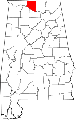 | |
| Towns | ||
| Unincorporated communities | ||
| Footnotes | ‡This populated place also has portions in an adjacent county or counties | |
This article is issued from Wikipedia - version of the 4/17/2016. The text is available under the Creative Commons Attribution/Share Alike but additional terms may apply for the media files.