Cardston County
| Cardston County | ||
|---|---|---|
| Municipal district | ||
|
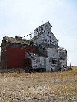
Oldest grain elevator in Alberta, located in Raley | ||
| ||
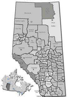 Location of Cardston County in Alberta | ||
| Coordinates: 49°12′9″N 113°18′7″W / 49.20250°N 113.30194°WCoordinates: 49°12′9″N 113°18′7″W / 49.20250°N 113.30194°W | ||
| Country |
| |
| Province |
| |
| Region | Southern Alberta | |
| Census division | No. 3 | |
| Established | 1954 | |
| Incorporated | 1999 (County) | |
| Government[1] | ||
| • Reeve | James Bester | |
| • Governing body | Cardston County Council | |
| • Office location | Cardston | |
| Area (2011)[2] | ||
| • Total | 3,414.87 km2 (1,318.49 sq mi) | |
| Population (2011)[2] | ||
| • Total | 4,167 | |
| • Density | 1.2/km2 (3/sq mi) | |
| • Dwellings | 1,102 | |
| Time zone | MST (UTC-7) | |
| Website |
cardstoncounty | |
Cardston County is a municipal district in southern Alberta, Canada. It is located in Census Division 3 around the Town of Cardston.
The municipal district was established on January 1, 1954, through the amalgamation of the Municipal District of Sugar City No. 5 and part of the Municipal District of Cochrane No. 6. On January 1, 2000, the name was changed from Municipal District of Cardston No. 6 to Cardston County[3]
Demographics
In the 2011 Census, Cardston County had a population of 4,167 living in 1,032 of its 1,171 total dwellings, a 3.2% change from its 2006 population of 4,037. With a land area of 3,414.87 km2 (1,318.49 sq mi), it had a population density of 1.2/km2 (3.2/sq mi) in 2011.[2]
The population of Cardston County according to its 2008 municipal census is 4,266.[4]
In 2006, Cardston County had a population of 4037 living in 1,102 dwellings, a 6.7% decrease from 2001. The municipal district has a land area of 3,414.87 km2 (1,318.49 sq mi) and a population density of 1.2/km2 (3.1/sq mi).[5]
In 2001, the county had a population of 4325 in 1118 dwellings, a 5.3% decrease from 1996. On a surface of 3416.24 km² it has a density of 1.3 inhabitants/km².[6] The largest ancestries were English (52.3%), German (33.0%), Scottish (27.3%), Danish (8.7%), Irish (7.4%).
Communities and localities
|
The following urban municipalities are surrounded by Cardston County:[7]
The following hamlets are located within Cardston County:[7] |
The following localities are located within Cardston County:[8]
|
See also
References
- ↑ "Municipal Officials Search". Alberta Municipal Affairs. November 18, 2016. Retrieved November 21, 2016.
- 1 2 3 "Population and dwelling counts, for Canada, provinces and territories, and census subdivisions (municipalities), 2011 and 2006 censuses (Alberta)". Statistics Canada. 2012-02-08. Retrieved 2012-02-08.
- ↑ Municipal Profile - Alberta Municipal Affairs
- ↑ Alberta Municipal Affairs (2009-09-15). "Alberta 2009 Official Population List" (PDF). Retrieved 2010-09-12.
- ↑ Statistics Canada. "Canada 2006 Census: Cardston County - Community Profile". Retrieved 2007-06-11.
- ↑ Cardston County community profile - Statistics Canada. 2002. 2001 Community Profiles. Released June 27, 2002. Last modified: 2005-11-30. Statistics Canada Catalogue no. 93F0053XIE
- 1 2 "Specialized and Rural Municipalities and Their Communities" (PDF). Alberta Municipal Affairs. 2012-03-01. Retrieved 2012-08-11.
- ↑ "Standard Geographical Classification (SGC) 2006, Economic Regions: 4803001 - Cardston County, geographical codes and localities, 2006". Statistics Canada. 2010-03-05. Retrieved 2012-08-11.
- ↑ Woolford Flat
External links

| Subdivisions | |||||||||||
|---|---|---|---|---|---|---|---|---|---|---|---|
| Communities | |||||||||||
| Cities and urban service areas | |||||||||||
| Rural municipalities |
| ||||||||||
| Specialized municipalities | |||||||||||
| |||||||||||