Bledsoe County, Tennessee
| Bledsoe County, Tennessee | |
|---|---|
 Bledsoe County Courthouse in Pikeville | |
|
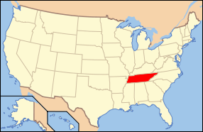
Location in the U.S. state of Tennessee | |
 Tennessee's location in the U.S. | |
| Founded | 1807 |
| Named for | Anthony Bledsoe[1] |
| Seat | Pikeville |
| Largest city | Pikeville |
| Area | |
| • Total | 407 sq mi (1,054 km2) |
| • Land | 406 sq mi (1,052 km2) |
| • Water | 0.3 sq mi (1 km2), 0.08% |
| Population | |
| • (2010) | 12,876 |
| • Density | 32/sq mi (12/km²) |
| Congressional district | 4th |
| Time zone | Central: UTC-6/-5 |
Bledsoe County is a county located in the U.S. state of Tennessee. As of the 2010 census, the population was 12,876.[2] Its county seat is Pikeville.[3]
History
Bledsoe County was formed in 1807 from land that was formerly Indian Land as well as land carved from Roane County. The county was named for Anthony Bledsoe (1739–1788), a soldier in the Revolutionary War and was an early settler of Sumner County. He was killed in an Indian attack at Bledsoe's Station.[4]
Like many East Tennessee counties, Bledsoe County opposed secession on the eve of the Civil War. In Tennessee's Ordinance of Secession on June 8, 1861, the county's residents voted against secession by a margin of 500 to 197.[5] General James G. Spears, a resident of Bledsoe, served as a vice president at the pro-Union East Tennessee Convention in May and June 1861, and fought for the Union Army in the war.[6]
Geography
According to the U.S. Census Bureau, the county has a total area of 407 square miles (1,050 km2), of which 406 square miles (1,050 km2) is land and 0.3 square miles (0.78 km2) (0.08%) is water.[7]
Adjacent counties

- Cumberland County (north)
- Rhea County (east/EST Border)
- Hamilton County (southeast/EST Border)
- Sequatchie County (southwest)
- Van Buren County (west)
State protected areas
- Bledsoe State Forest (part)
- Fall Creek Falls State Natural Area (part)
- Fall Creek Falls State Park (part)
Demographics
| Historical population | |||
|---|---|---|---|
| Census | Pop. | %± | |
| 1820 | 4,005 | — | |
| 1830 | 4,648 | 16.1% | |
| 1840 | 5,676 | 22.1% | |
| 1850 | 5,959 | 5.0% | |
| 1860 | 4,459 | −25.2% | |
| 1870 | 4,870 | 9.2% | |
| 1880 | 5,617 | 15.3% | |
| 1890 | 6,134 | 9.2% | |
| 1900 | 6,626 | 8.0% | |
| 1910 | 6,329 | −4.5% | |
| 1920 | 7,218 | 14.0% | |
| 1930 | 7,128 | −1.2% | |
| 1940 | 8,358 | 17.3% | |
| 1950 | 8,561 | 2.4% | |
| 1960 | 7,811 | −8.8% | |
| 1970 | 7,643 | −2.2% | |
| 1980 | 9,478 | 24.0% | |
| 1990 | 9,669 | 2.0% | |
| 2000 | 12,367 | 27.9% | |
| 2010 | 12,876 | 4.1% | |
| Est. 2015 | 14,502 | [8] | 12.6% |
| U.S. Decennial Census[9] 1790-1960[10] 1900-1990[11] 1990-2000[12] 2010-2014[2] | |||

As of the census[14] of 2000, there were 12,367 people, 4,430 households, and 3,313 families residing in the county. The population density was 30 people per square mile (12/km²). There were 5,142 housing units at an average density of 13 per square mile (5/km²). The racial makeup of the county was 94.44% White, 3.70% Black or African American, 0.38% Native American, 0.11% Asian, 0.02% Pacific Islander, 0.19% from other races, and 1.15% from two or more races. 1.12% of the population were Hispanic or Latino of any race.
There were 4,430 households out of which 31.30% had children under the age of 18 living with them, 61.50% were married couples living together, 9.10% had a female householder with no husband present, and 25.20% were non-families. 22.10% of all households were made up of individuals and 9.20% had someone living alone who was 65 years of age or older. The average household size was 2.53 and the average family size was 2.94.
In the county, the population was spread out with 23.10% under the age of 18, 8.40% from 18 to 24, 31.30% from 25 to 44, 25.80% from 45 to 64, and 11.40% who were 65 years of age or older. The median age was 37 years. For every 100 females there were 121.00 males. For every 100 females age 18 and over, there were 121.30 males.
The median income for a household in the county was $28,982, and the median income for a family was $34,593. Males had a median income of $26,648 versus $20,639 for females. The per capita income for the county was $13,889. About 14.90% of families and 18.10% of the population were below the poverty line, including 21.00% of those under age 18 and 23.20% of those age 65 or over.
Recreation
Bledsoe County is home to a portion of Fall Creek Falls State Resort Park.
Communities
City
- Pikeville (county seat)
Unincorporated Communities
- Cold Spring
- Dill
- Lees Station
- Lusk
- Melvine
- Mount Crest
- New Harmony
- Nine Mile
- Pailo
- Summer City
- Tiptop
See also
- National Register of Historic Places listings in Bledsoe County, Tennessee
- USS Bledsoe County LST-356
References
- ↑ Elizabeth Robnett, "Bledsoe County," Tennessee Encyclopedia of History and Culture. Retrieved: 31 March 2013.
- 1 2 "State & County QuickFacts". United States Census Bureau. Retrieved November 29, 2013.
- ↑ "Find a County". National Association of Counties. Archived from the original on 2011-05-31. Retrieved 2011-06-07.
- ↑ Origins Of Tennessee County Names, Tennessee Blue Book 2005-2006, pages 508-513
- ↑ Oliver Perry Temple, East Tennessee and the Civil War (R. Clarke Company, 1899), p. 199.
- ↑ Oliver Perry Temple, Mary Boyce Temple (ed.), "General James G. Spears," Notable Men of Tennessee (Cosmopolitan Press, 1912), pp. 186-190.
- ↑ "2010 Census Gazetteer Files". United States Census Bureau. August 22, 2012. Retrieved April 1, 2015.
- ↑ "County Totals Dataset: Population, Population Change and Estimated Components of Population Change: April 1, 2010 to July 1, 2015". Retrieved July 2, 2016.
- ↑ "U.S. Decennial Census". United States Census Bureau. Archived from the original on May 11, 2015. Retrieved April 1, 2015.
- ↑ "Historical Census Browser". University of Virginia Library. Retrieved April 1, 2015.
- ↑ Forstall, Richard L., ed. (March 27, 1995). "Population of Counties by Decennial Census: 1900 to 1990". United States Census Bureau. Retrieved April 1, 2015.
- ↑ "Census 2000 PHC-T-4. Ranking Tables for Counties: 1990 and 2000" (PDF). United States Census Bureau. April 2, 2001. Retrieved April 1, 2015.
- ↑ Based on 2000 census data
- ↑ "American FactFinder". United States Census Bureau. Archived from the original on 2013-09-11. Retrieved 2011-05-14.
External links
| Wikimedia Commons has media related to Bledsoe County, Tennessee. |
- Bledsoe County Chamber of Commerce
- TNGenweb
- Blesoe County – genealogical resources
- Bledsoe County at DMOZ
 |
Cumberland County | | ||
| Van Buren County | |
Rhea County | ||
| ||||
| | ||||
| Sequatchie County | Hamilton County |
Municipalities and communities of Bledsoe County, Tennessee, United States | ||
|---|---|---|
| City | ||
| Unincorporated communities | ||
Coordinates: 35°36′N 85°13′W / 35.60°N 85.21°W