Pickett County, Tennessee
| Pickett County, Tennessee | |
|---|---|
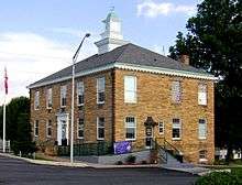 Pickett County Courthouse in Byrdstown | |
|
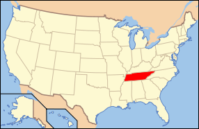
Location in the U.S. state of Tennessee | |
 Tennessee's location in the U.S. | |
| Founded | 1879 |
| Named for | Howard L. Pickett, state legislator[1] |
| Seat | Byrdstown |
| Largest town | Byrdstown |
| Area | |
| • Total | 174 sq mi (451 km2) |
| • Land | 163 sq mi (422 km2) |
| • Water | 12 sq mi (31 km2), 6.6% |
| Population | |
| • (2010) | 5,077 |
| • Density | 31/sq mi (12/km²) |
| Congressional district | 6th |
| Time zone | Central: UTC-6/-5 |
Pickett County is a county located in the U.S. state of Tennessee. As of the 2010 census, the population was 5,077,[2] making it the least populous county in Tennessee. Its county seat is Byrdstown.[3]
The city of Byrdstown and the Kentucky town of Albany, 11 miles (18 km) to the northeast, are positioned between two Army Corps of Engineers lakes: Dale Hollow Lake, mainly in Tennessee, and Lake Cumberland, in Kentucky. The area is known as "Twin Lakes" and Byrdstown is noted as "The Gateway To Dale Hollow Lake". Every year thousands of people vacation at the many resorts situated along the lakes.
History
Pickett County was created in 1879 from sections of Overton and Fentress counties. It was named for Howard L. Pickett, a member of the state legislature who had been instrumental in the county's formation.[1] Nobel Peace Prize winner Cordell Hull was born in the county. He won the prize for his role in establishing the United Nations.
Geography
According to the U.S. Census Bureau, the county has a total area of 174 square miles (450 km2), of which 163 square miles (420 km2) is land and 12 square miles (31 km2) (6.6%) is water.[4] It is the fourth-smallest county in Tennessee by land area and third-smallest by total area. The eastern part of the county, much of which is part of Pickett State Forest, lies atop the Cumberland Plateau, while the western, more populated half is located on the Highland Rim. The Wolf River and the Obey River, the lower parts of which are part of Dale Hollow Lake, pass through the county. The rivers converge just west of the county's border with Clay County.


Streams in the far eastern section of the county are part of the watershed of the Big South Fork of the Cumberland River.
Adjacent counties
- Wayne County, Kentucky (northeast)
- Scott County (east)
- Fentress County (southeast)
- Overton County (southwest)
- Clay County (west)
- Clinton County, Kentucky (north)
National protected area
- Big South Fork National River and Recreation Area (very small part)
State protected areas
- Cordell Hull Birthplace State Park
- Honey Creek State Natural Area
- Pickett State Forest (part)
- Pickett CCC Memorial State Park
- Twin Arches State Natural Area (part)
Demographics
| Historical population | |||
|---|---|---|---|
| Census | Pop. | %± | |
| 1890 | 4,736 | — | |
| 1900 | 5,366 | 13.3% | |
| 1910 | 5,087 | −5.2% | |
| 1920 | 5,205 | 2.3% | |
| 1930 | 5,615 | 7.9% | |
| 1940 | 6,213 | 10.7% | |
| 1950 | 5,093 | −18.0% | |
| 1960 | 4,431 | −13.0% | |
| 1970 | 3,774 | −14.8% | |
| 1980 | 4,358 | 15.5% | |
| 1990 | 4,548 | 4.4% | |
| 2000 | 4,945 | 8.7% | |
| 2010 | 5,077 | 2.7% | |
| Est. 2015 | 5,146 | [5] | 1.4% |
| U.S. Decennial Census[6] 1790-1960[7] 1900-1990[8] 1990-2000[9] 2010-2014[2] | |||

As of the census[11] of 2000, there were 4,945 people, 2,091 households, and 1,461 families residing in the county. The population density was 30 people per square mile (12/km²). There were 2,956 housing units at an average density of 18 per square mile (7/km²). The racial makeup of the county was 99.15% White, 0.10% Black or African American, 0.16% Native American, 0.04% Asian, 0.10% from other races, and 0.44% from two or more races. 0.83% of the population were Hispanic or Latino of any race.
There were 2,091 households, out of which 27.40% had children under the age of 18 living with them, 58.30% were married couples living together, 7.80% had a female householder with no husband present, and 30.10% were non-families. 27.20% of all households were made up of individuals and 12.90% had someone living alone who was 65 years of age or older. The average household size was 2.33 and the average family size was 2.83.
In the county, the population was spread out with 21.40% under the age of 18, 8.60% from 18 to 24, 24.70% from 25 to 44, 27.70% from 45 to 64, and 17.80% who were 65 years of age or older. The median age was 42 years. For every 100 females there were 96.80 males. For every 100 females age 18 and over, there were 94.20 males.
The median income for a household in the county was $24,673, and the median income for a family was $31,355. Males had a median income of $22,367 versus $17,173 for females. The per capita income for the county was $14,681. About 12.00% of families and 15.60% of the population were below the poverty line, including 19.40% of those under age 18 and 20.00% of those age 65 or over.
Education
- Pickett County High School - High school
- Pickett County K-8 - Elementary school/Junior high school
Communities


Town
- Byrdstown (county seat)
Unincorporated communities
Ghost town
See also
References
- 1 2 Anne-Leslie Owens, "Pickett County," Tennessee Encyclopedia of History and Culture. Retrieved: 18 March 2013.
- 1 2 "State & County QuickFacts". United States Census Bureau. Retrieved December 7, 2013.
- ↑ "Find a County". National Association of Counties. Retrieved 2011-06-07.
- ↑ "2010 Census Gazetteer Files". United States Census Bureau. August 22, 2012. Retrieved April 9, 2015.
- ↑ "County Totals Dataset: Population, Population Change and Estimated Components of Population Change: April 1, 2010 to July 1, 2015". Retrieved July 2, 2016.
- ↑ "U.S. Decennial Census". United States Census Bureau. Retrieved April 9, 2015.
- ↑ "Historical Census Browser". University of Virginia Library. Retrieved April 9, 2015.
- ↑ Forstall, Richard L., ed. (March 27, 1995). "Population of Counties by Decennial Census: 1900 to 1990". United States Census Bureau. Retrieved April 9, 2015.
- ↑ "Census 2000 PHC-T-4. Ranking Tables for Counties: 1990 and 2000" (PDF). United States Census Bureau. April 2, 2001. Retrieved April 9, 2015.
- ↑ Based on 2000 census data
- ↑ "American FactFinder". United States Census Bureau. Retrieved 2011-05-14.
External links
| Wikimedia Commons has media related to Pickett County, Tennessee. |
- Pickett County Government — DaleHollow.com
- Pickett County, TNGenWeb - free genealogy resources for the county
- Pickett County at DMOZ
 |
Wayne County, Kentucky and Clinton County, Kentucky | | ||
| Clay County | |
Scott County | ||
| ||||
| | ||||
| Overton County | Fentress County |
Municipalities and communities of Pickett County, Tennessee, United States | ||
|---|---|---|
| Town | ||
| Unincorporated communities | ||
| Ghost town | ||
| Footnotes | ‡This populated place also has portions in an adjacent county or counties | |
Coordinates: 36°34′N 85°05′W / 36.56°N 85.08°W