Davidson County, Tennessee
| Davidson County, Tennessee | ||
|---|---|---|
|
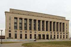
Davidson County Courthouse in Nashville | ||
| ||
|
Location in the U.S. state of Tennessee | ||
 Tennessee's location in the U.S. | ||
| Founded | October 6, 1783 | |
| Named for | William Lee Davidson[1] | |
| Seat | Nashville | |
| Largest city | Nashville | |
| Area | ||
| • Total | 526 sq mi (1,362 km2) | |
| • Land | 504 sq mi (1,305 km2) | |
| • Water | 22 sq mi (57 km2), 4.2% | |
| Population (est.) | ||
| • (2015) | 678,889 | |
| • Density | 1,326/sq mi (512/km²) | |
| Congressional district | 5th | |
| Time zone | Central: UTC-6/-5 | |
| Website | ||

Davidson County is a county located in the U.S. state of Tennessee. As of the 2010 census, the population was 626,681,[2] making it the second-most populous county in Tennessee. Its county seat is Nashville,[3] the state capital.
In 1963, the City of Nashville and the Davidson County government merged, so the county government is now known as the "Metropolitan Government of Nashville and Davidson County," or "Metro Nashville" for short.
Davidson County has the largest population in the 13-county Nashville-Davidson–Murfreesboro–Franklin Metropolitan Statistical Area. Nashville has always been the region's center of commerce, industry, transportation, and culture, but it did not become the capital of Tennessee until 1827 and did not gain permanent capital status until 1843.[1]
History
Davidson County is the oldest county in the 41-county region of Middle Tennessee. It dates to 1783, when the North Carolina legislature created the county and named it in honor of William Lee Davidson,[4] a North Carolina general who was killed opposing General Cornwallis and the British Army's crossing of the Catawba River on February 1, 1781. The county seat, Nashville, is the oldest permanent European (white) settlement in Middle Tennessee, founded by James Robertson and John Donelson during the winter of 1779-80. The first white settlers established the Cumberland Compact in order to establish a basic rule of law and to protect their land titles. Through much of the early 1780s, the settlers also faced a hostile response from Native American tribes who resented their encroaching on their territory and competing for resources. As the county's many known archaeological sites attest, Native American cultures had occupied areas of Davidson County for thousands of years. The first whites to enter the area were fur traders. Long hunters came next, having learned about the large salt lick, known as French Lick, where they hunted game and traded with Native Americans.[1]
In 1765, Timothy Demonbreun, a hunter, trapper, and former Governor of Illinois under the French, and his wife lived in a small cave (now known as Demonbreun's Cave) on the south side of the Cumberland River near present-day downtown Nashville. The first white child to be born in Middle Tennessee was born there.[5]
During the June 8, 1861, referendum, the closely divided population of Davidson County voted narrowly in favor of secession: 5,635 in favor, 5,572 against.[6] Middle Tennessee was occupied by Union troops from 1862, which caused widespread social disruption in the state.
Geography
According to the U.S. Census Bureau, the county has a total area of 526 square miles (1,360 km2), of which 504 square miles (1,310 km2) is land and 22 square miles (57 km2) (4.2%) is water.[7]
The Cumberland River flows from east to west through the middle of the county. Two dams within the county are Old Hickory Lock and Dam and J. Percy Priest Dam, operated by the United States Army Corps of Engineers. Important tributaries of the Cumberland in Davidson County include Whites Creek, Manskers Creek, Stones River, Mill Creek, and the Harpeth River.[8]
Adjacent counties
- Robertson County, Tennessee – north
- Sumner County, Tennessee – northeast
- Wilson County, Tennessee – east
- Rutherford County, Tennessee – southeast
- Williamson County, Tennessee – south
- Cheatham County, Tennessee – west
National protected area
- Natchez Trace Parkway (part)
State protected areas
- Bicentennial Mall State Park
- Couchville Cedar Glade State Natural Area (part)
- Harpeth River State Park (part)
- Hill Forest State Natural Area
- Long Hunter State Park (part)
- Mount View Glade State Natural Area
- Percy Priest Wildlife Management Area (part)
- Radnor Lake State Natural Area
Major highways
 I-24
I-24 I-40
I-40 I-65
I-65 I-440
I-440 US 31
US 31 US 31A
 US 31E
 US 31W
 US 41
US 41 US 41A
 US 70
US 70 US 70S
 US 431
 SR 155 / Briley Parkway
Demographics

| Historical population | |||
|---|---|---|---|
| Census | Pop. | %± | |
| 1790 | 3,459 | — | |
| 1800 | 9,965 | 188.1% | |
| 1810 | 15,608 | 56.6% | |
| 1820 | 20,154 | 29.1% | |
| 1830 | 28,122 | 39.5% | |
| 1840 | 30,509 | 8.5% | |
| 1850 | 38,882 | 27.4% | |
| 1860 | 47,055 | 21.0% | |
| 1870 | 62,897 | 33.7% | |
| 1880 | 79,026 | 25.6% | |
| 1890 | 108,174 | 36.9% | |
| 1900 | 122,815 | 13.5% | |
| 1910 | 149,478 | 21.7% | |
| 1920 | 167,815 | 12.3% | |
| 1930 | 222,854 | 32.8% | |
| 1940 | 257,267 | 15.4% | |
| 1950 | 321,758 | 25.1% | |
| 1960 | 399,743 | 24.2% | |
| 1970 | 448,003 | 12.1% | |
| 1980 | 477,811 | 6.7% | |
| 1990 | 510,784 | 6.9% | |
| 2000 | 569,891 | 11.6% | |
| 2010 | 626,681 | 10.0% | |
| Est. 2015 | 678,889 | [10] | 8.3% |
| U.S. Decennial Census[11] 1790-1960[12] 1900-1990[13] 1990-2000[14] 2010-2014[2] | |||
As of the census[15] of 2000, there were 569,891 people, 237,405 households, and 138,169 families residing in the county. The population density was 1,135 people per square mile (438/km2). There were 252,977 housing units at an average density of 504 per square mile (194/km2). The racial makeup of the county was 66.99% White, 25.92% Black or African American, 0.29% Native American, 2.33% Asian, 0.07% Pacific Islander, 2.42% from other races, and 1.97% from two or more races. 4.58% of the population were Hispanic or Latino of any race.
In 2005 the racial makeup of the county was 61.7% non-Hispanic white, 27.5% African-American, 6.6% Latino and 2.8% Asian.
In 2000 there were 237,405 households out of which 26.70% had children under the age of 18 living with them, 39.90% were married couples living together, 14.30% had a female householder with no husband present, and 41.80% were non-families. 33.40% of all households were made up of individuals and 8.20% had someone living alone who was 65 years of age or older. The average household size was 2.30 and the average family size was 2.96.
In the county, the population was spread out with 22.20% under the age of 18, 11.60% from 18 to 24, 34.00% from 25 to 44, 21.10% from 45 to 64, and 11.10% who were 65 years of age or older. The median age was 34 years. For every 100 females there were 93.80 males. For every 100 females age 18 and over, there were 90.80 males.
The median income for a household in the county was $39,797, and the median income for a family was $49,317. Males had a median income of $33,844 versus $27,770 for females. The per capita income for the county was $23,069. About 10.00% of families and 13.00% of the population were below the poverty line, including 19.10% of those under age 18 and 10.50% of those age 65 or over.
Politics
Federal officers
- U.S. Senators: Lamar Alexander (R) and Bob Corker (R)
- U.S. Representatives: Jim Cooper (D - District 5)
State officers
- State Senators: Thelma Harper (D), Steven Dickerson (R), Jeff Yarbro (D), and Ferrell Haile (R)
- State Representatives: Bo Mitchell (D), Bill Beck (D), Mike Stewart (D), Jason Powell (D), Brenda Gilmore (D), John Ray Clemmons (D), Beth Harwell (Speaker of the House, R), Harold Love, Jr. (D), Sherry Jones (D), Darren Jernigan (D)
Local officers
- Mayor: Megan Barry
- Vice Mayor: David Briley
- City Council: see Metropolitan Council of Nashville and Davidson County
Communities
All of Davidson County is encompassed under the consolidated Metropolitan Government of Nashville and Davidson County. However, several municipalities that were incorporated before consolidation retain some autonomy as independent municipalities. These are:
- Belle Meade
- Berry Hill
- Forest Hills
- Goodlettsville (partly in Sumner County)
- Oak Hill
- Ridgetop (primarily in Robertson County)
For U.S. Census purposes, the portions of Davidson County that lie outside the boundaries of the six independently incorporated municipalities are collectively treated as the Nashville-Davidson balance.
Unincorporated communities
In addition, several other communities in the county that lack the official status of incorporated municipalities (either because they were never incorporated or because they relinquished their municipal charters when consolidation occurred) maintain their independent identities to varying degrees. These include:
See also
References
- 1 2 3 Carroll Van West, "Davidson County," Tennessee Encyclopedia of History and Culture. Retrieved: 26 June 2013.
- 1 2 "State & County QuickFacts". United States Census Bureau. Retrieved 2013-11-29.
- ↑ "Find a County". National Association of Counties. Retrieved 2011-06-07.
- ↑ Gannett, Henry (1905). The Origin of Certain Place Names in the United States. Govt. Print. Off. p. 101.
- ↑ Thomas C. Barr, Jr., "Caves of Tennessee", Tennessee Division of Geology, Bulletin 64, 1961, p 148.
- ↑ Lovett, B.L. The African-American History of Nashville, Tn: 1780-1930 (p). University of Arkansas Press. p. 45. ISBN 9781610754125. Retrieved 2014-10-16.
- ↑ "2010 Census Gazetteer Files". United States Census Bureau. August 22, 2012. Retrieved April 4, 2015.
- ↑ Morris, Eastin (1834). Tennessee Gazetteer. Nashville: W. Hasell Hunt & Co.
- ↑ Based on 2000 census data
- ↑ "County Totals Dataset: Population, Population Change and Estimated Components of Population Change: April 1, 2010 to July 1, 2015". Retrieved July 2, 2016.
- ↑ "U.S. Decennial Census". United States Census Bureau. Retrieved April 4, 2015.
- ↑ "Historical Census Browser". University of Virginia Library. Retrieved April 4, 2015.
- ↑ Forstall, Richard L., ed. (March 27, 1995). "Population of Counties by Decennial Census: 1900 to 1990". United States Census Bureau. Retrieved April 4, 2015.
- ↑ "Census 2000 PHC-T-4. Ranking Tables for Counties: 1990 and 2000" (PDF). United States Census Bureau. April 2, 2001. Retrieved April 4, 2015.
- ↑ "American FactFinder". United States Census Bureau. Retrieved 2011-05-14.
Further reading
- Nashville, Chattanooga; St. Louis Railway (1898), "Davidson County", Information for immigrants concerning middle Tennessee, Nashville, Tenn: Marshall & Bruce Co., printers, OCLC 7110225
External links
- Metropolitan Nashville and Davidson County official site
- Davidson County, TNGenWeb – genealogy resources
| Wikimedia Commons has media related to Davidson County, Tennessee. |
 |
Robertson County | Sumner County | | |
| Cheatham County | |
Wilson County | ||
| ||||
| | ||||
| Williamson County | Rutherford County |
Municipalities and communities of Davidson County, Tennessee, United States | ||
|---|---|---|
| Cities | ||
| Neighborhoods | ||
| Footnotes | ‡This populated place also has portions in an adjacent county or counties | |
Coordinates: 36°10′N 86°47′W / 36.17°N 86.78°W