Carter County, Tennessee
| Carter County, Tennessee | ||
|---|---|---|
 Carter County Courthouse in Elizabethton | ||
| ||
|
Location in the U.S. state of Tennessee | ||
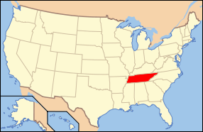 Tennessee's location in the U.S. | ||
| Founded | 1796 | |
| Named for | Landon Carter[1] | |
| Seat | Elizabethton | |
| Largest city | Elizabethton | |
| Area | ||
| • Total | 348 sq mi (901 km2) | |
| • Land | 341 sq mi (883 km2) | |
| • Water | 6.4 sq mi (17 km2), 1.8% | |
| Population | ||
| • (2010) | 57,424 | |
| • Density | 168/sq mi (65/km²) | |
| Congressional district | 1st | |
| Time zone | Eastern: UTC-5/-4 | |
| Website |
www | |

Coordinates: 36°18′N 82°7′W / 36.300°N 82.117°W
Carter County is a county located in the U.S. state of Tennessee. As of the 2010 census, the population was 57,424.[2] Its county seat is Elizabethton.[3] The county is named in honor of Landon Carter, an early settler active in the State of Franklin movement.
Carter County is part of the Johnson City, TN Metropolitan Statistical Area, which is a component of the Johnson City–Kingsport–Bristol, TN-VA Combined Statistical Area, commonly known as the "Tri-Cities" region of Northeast Tennessee.
History
The area was originally claimed by Britain as part of the Clarendon settlements of the Province of Carolina, although actually populated at the time by the Cherokee.
The area was part of (though seldom actually administered by) the following jurisdictions in its early history:
- New Hanover Precinct (1729-1734)
- Bladen County (1734-1749)
- Anson County (1749-1753)
- Rowan County (1753-1775)
Watauga Association
The county is named for General Landon Carter,[4] the son of John Carter of Virginia, who was "chairman of the court" of the first majority-rule system of American democracy, known as the Watauga Association of 1772. The association was the first permanent settlement established outside the original thirteen American colonies and included the area that is today's Carter County. In 1775, the Association was absorbed into North Carolina by petition, becoming known thereafter as the Washington District.
As Wayne County in the State of Franklin
J. G. M. Ramsey records within his 1853 Annals of Tennessee that the State of Franklin established Wayne County from sections of both Washington County and a part of Wilkes County "lying west of the extreme heights of the Apalachian or Alleghany Mountains, into a separate and distinct county by the name of Wayne... This new county covered the same territory now embraced in the limits of Carter and Johnson counties."[5]
The county seat, Elizabethton, is named for Carter's wife, Elizabeth MacLin Carter.[6]
Civil War
Like most East Tennessee counties, Carter Countians opposed secession on the eve of the Civil War. In Tennessee's Ordinance of Secession referendum on June 8, 1861, Carter Countians rejected secession by a vote of 1,343 to 86.[7] A railroad bridge at Carter's Depot (modern Watauga) was among those targeted by the East Tennessee bridge-burning conspiracy in November 1861.[8]
Early railroad
Carter County was served by the narrow gauge East Tennessee and Western North Carolina Railroad (The ET&WNC, nicknamed "Tweetsie") until the line ceased operations in 1950.
Geography
According to the U.S. Census Bureau, the county has a total area of 348 square miles (900 km2), of which 341 square miles (880 km2) is land and 6.4 square miles (17 km2) (1.8%) is water.[9]
Carter County is situated entirely within the Blue Ridge Mountains, specifically the Unaka Range and the Iron Mountains.[10] Roan Mountain, which at 6,285 feet (1,916 m) is the highest point in Tennessee outside the Great Smoky Mountains, straddles the county's eastern border with North Carolina. The county's boundary with Sullivan County is defined as the ridgeline of Holston Mountain.
Lakes
- Watauga Lake
- Wilbur Reservoir (immediately below the TVA Watauga Dam Lat: 36.3408 Lon: -82.1203]
- Ripshin Lake (6 km southwest of Roan Mountain Lat: 36.1838646 Lon: -82.1356583)[11]
Rivers
Waterfalls

|
|
Adjacent counties
- Sullivan County (north)
- Johnson County (northeast)
- Avery County, North Carolina (southeast)
- Mitchell County, North Carolina (south)
- Unicoi County (southwest)
- Washington County (west)
National protected areas
- Appalachian Trail (part)
- Cherokee National Forest (part)
State protected areas
- Hampton Creek Cove State Natural Area
- Roan Mountain State Park
- Sycamore Shoals State Historic Area
- Watauga River Bluffs State Natural Area
Major highways
Law enforcement
Carter County is served by the Carter County Sheriff's Department, located in Elizabethton. As of 2015, the Sheriff is Dexter Lunceford.
Climate
| Climate data for Carter County, Tennessee (Bristol-Johnson City) | |||||||||||||
|---|---|---|---|---|---|---|---|---|---|---|---|---|---|
| Month | Jan | Feb | Mar | Apr | May | Jun | Jul | Aug | Sep | Oct | Nov | Dec | Year |
| Average high °F (°C) | 43.7 (6.5) |
48.0 (8.9) |
58.9 (14.9) |
67.4 (19.7) |
75.2 (24) |
82.2 (27.9) |
84.6 (29.2) |
84.1 (28.9) |
79.1 (26.2) |
69.1 (20.6) |
58.2 (14.6) |
48.1 (8.9) |
66.6 (19.2) |
| Daily mean °F (°C) | 34.0 (1.1) |
37.4 (3) |
47.2 (8.4) |
55.2 (12.9) |
63.4 (17.4) |
71.1 (21.7) |
74.4 (23.6) |
73.6 (23.1) |
67.9 (19.9) |
56.7 (13.7) |
47.0 (8.3) |
38.2 (3.4) |
55.5 (13.1) |
| Average low °F (°C) | 24.3 (−4.3) |
26.8 (−2.9) |
35.4 (1.9) |
43.0 (6.1) |
51.6 (10.9) |
59.9 (15.5) |
64.1 (17.8) |
63.1 (17.3) |
56.6 (13.7) |
44.2 (6.8) |
35.9 (2.2) |
28.2 (−2.1) |
44.4 (6.9) |
| Average rainfall inches (mm) | 3.2 (81) |
3.4 (86) |
3.7 (94) |
3.3 (84) |
3.8 (97) |
3.5 (89) |
4.3 (109) |
3.2 (81) |
3.3 (84) |
2.6 (66) |
2.9 (74) |
3.4 (86) |
40.7 (1,034) |
| Average snowfall inches (cm) | 5.2 (13.2) |
4.2 (10.7) |
2.3 (5.8) |
0.4 (1) |
0.0 (0) |
0.0 (0) |
0.0 (0) |
0.0 (0) |
0.0 (0) |
0.0 (0) |
0.9 (2.3) |
2.6 (6.6) |
15.6 (39.6) |
| Average relative humidity (%) | 59.0 | 71.5 | 69.0 | 67.0 | 69.5 | 73.0 | 75.0 | 76.5 | 76.5 | 74.0 | 68.5 | 69.5 | 74.0 |
| Source: Climate-zone.com[12] | |||||||||||||
Demographics
| Historical population | |||
|---|---|---|---|
| Census | Pop. | %± | |
| 1800 | 4,813 | — | |
| 1810 | 4,190 | −12.9% | |
| 1820 | 4,835 | 15.4% | |
| 1830 | 6,414 | 32.7% | |
| 1840 | 5,372 | −16.2% | |
| 1850 | 6,296 | 17.2% | |
| 1860 | 7,124 | 13.2% | |
| 1870 | 7,909 | 11.0% | |
| 1880 | 10,019 | 26.7% | |
| 1890 | 13,389 | 33.6% | |
| 1900 | 16,688 | 24.6% | |
| 1910 | 19,838 | 18.9% | |
| 1920 | 21,488 | 8.3% | |
| 1930 | 29,223 | 36.0% | |
| 1940 | 35,127 | 20.2% | |
| 1950 | 42,432 | 20.8% | |
| 1960 | 41,578 | −2.0% | |
| 1970 | 42,575 | 2.4% | |
| 1980 | 50,205 | 17.9% | |
| 1990 | 51,505 | 2.6% | |
| 2000 | 56,742 | 10.2% | |
| 2010 | 57,424 | 1.2% | |
| Est. 2015 | 56,486 | [13] | −1.6% |
| U.S. Decennial Census[14] 1790-1960[15] 1900-1990[16] 1990-2000[17] 2010-2014[2] | |||

As of the census[19] of 2000, there were 56,742 people, 23,486 households, and 16,346 families residing in the county.[20] The population density was 166 people per square mile (64/km²). There were 25,920 housing units at an average density of 76 per square mile (29/km²). The racial makeup of the county was 97.49% White, 1.00% Black or African American, 0.20% Native American, 0.26% Asian, 0.01% Pacific Islander, 0.27% from other races, and 0.78% from two or more races. 0.89% of the population were Hispanic or Latino of any race.
There were 23,486 households out of which 28.50% had children under the age of 18 living with them, 54.90% were married couples living together, 11.00% had a female householder with no husband present, and 30.40% were non-families. 26.50% of all households were made up of individuals and 11.00% had someone living alone who was 65 years of age or older. The average household size was 2.35 and the average family size was 2.83.
In the county the population was spread out with 21.40% under the age of 18, 9.20% from 18 to 24, 29.00% from 25 to 44, 25.40% from 45 to 64, and 15.00% who were 65 years of age or older. The median age was 38 years. For every 100 females there were 94.50 males. For every 100 females age 18 and over, there were 91.60 males.
The median income for a household in the county was $27,371, and the median income for a family was $33,825. Males had a median income of $26,394 versus $19,687 for females. The per capita income for the county was $14,678. About 12.80% of families and 16.90% of the population were below the poverty line, including 23.00% of those under age 18 and 16.00% of those age 65 or over.
Education
|
|
|
Colleges
- Northeast State Community College and the Tennessee Colleges of Applied Technology have satellite campuses in Elizabethton.
- Milligan College's main campus and Emmanuel Christian Seminary are located in the community of Milligan College, part of Elizabethton.
Communities


Cities
- Elizabethton (county seat)
- Johnson City (mostly in Washington County and a small portion in Sullivan County)
- Watauga (small part in Washington County)
Census-designated places
Unincorporated communities
- Big Spring
- Bitter End
- Butler
- Fish Springs
- Hampton
- Milligan College
- Stoney Creek
- Tiger Valley
- Valley Forge
See also
References
- ↑ Carroll Van West, "Carter County," Tennessee Encyclopedia of History and Culture. Retrieved: 22 June 2013.
- 1 2 "State & County QuickFacts". United States Census Bureau. Retrieved November 29, 2013.
- ↑ "Find a County". National Association of Counties. Archived from the original on 2011-05-31. Retrieved 2011-06-07.
- ↑ Gannett, Henry (1905). The Origin of Certain Place Names in the United States. Geological Survey Bulletin, no. 258 (2nd ed.). Washington, D.C.: Government Printing Office. p. 70. OCLC 1156805.
- ↑ Ramsey, J. G. M. (1853). The Annals of Tennessee to the End of the Eighteenth Century. Charleston: John Russell. p. 295. OCLC 11827530.
- ↑ "History of Elizabethton". Elizabethton.org. Retrieved November 5, 2015.
- ↑ Oliver Perry Temple, East Tennessee and the Civil War (R. Clarke Company, 1899), p. 199.
- ↑ David Madden, "Unionist Resistance to Confederate Occupation: The Bridge Burners of East Tennessee," East Tennessee Historical Society Publications, Vols. 52-53 (1980-1981), pp. 22-40.
- ↑ "2010 Census Gazetteer Files". United States Census Bureau. August 22, 2012. Retrieved April 2, 2015.
- ↑ Tennessee Department of Environment and Conservation, et al., "Ambient Air Monitoring Plan," Environmental Protection Agency website, 1 July 2010. Accessed: 18 March 2015.
- ↑ Aerial image from USGS via Microsoft Research Maps
- ↑ "Bristol - Johnson City". Climate-zone.com. Retrieved August 16, 2013.
- ↑ "County Totals Dataset: Population, Population Change and Estimated Components of Population Change: April 1, 2010 to July 1, 2015". Retrieved July 2, 2016.
- ↑ "U.S. Decennial Census". United States Census Bureau. Archived from the original on April 22, 2013. Retrieved April 2, 2015.
- ↑ "Historical Census Browser". University of Virginia Library. Retrieved April 2, 2015.
- ↑ Forstall, Richard L., ed. (March 27, 1995). "Population of Counties by Decennial Census: 1900 to 1990". United States Census Bureau. Retrieved April 2, 2015.
- ↑ "Census 2000 PHC-T-4. Ranking Tables for Counties: 1990 and 2000" (PDF). United States Census Bureau. April 2, 2001. Retrieved April 2, 2015.
- ↑ Based on 2000 census data
- ↑ "American FactFinder". United States Census Bureau. Archived from the original on 2013-09-11. Retrieved 2011-05-14.
- ↑ Brown, Emily; DeBarros, Anthony; DeRamus, Kristin; et al. (2011). "Census 2010: Tennessee". USA Today. Retrieved March 17, 2011.
External links
| Wikimedia Commons has media related to Carter County, Tennessee. |
- Official site
- Elizabethton-Carter County Chamber of Commerce
- Carter County Tomorrow
- Carter County History.com
- Carter County, TNGenWeb - free genealogy resources for the county
- Carter County Landforms
- Cy Crumley ET&WNC Photo Collection
- Carter County Sheriff's Department
- Carter County at DMOZ
 |
Sullivan County | Johnson County | | |
| Washington County | |
|||
| ||||
| | ||||
| Unicoi County | Mitchell County, North Carolina | Avery County, North Carolina |
Municipalities and communities of Carter County, Tennessee, United States | ||
|---|---|---|
| Cities | ||
| CDPs | ||
| Unincorporated communities | ||
| Footnotes | ‡This populated place also has portions in an adjacent county or counties | |