Black Creek (Toronto)
| Black Creek | |
| River | |
 Black Creek at Eglinton Avenue West | |
| Country | Canada |
|---|---|
| Province | Ontario |
| Region | Golden Horseshoe |
| Source | retention basin |
| - location | Vaughan, Regional Municipality of York |
| - elevation | 209 m (686 ft) |
| - coordinates | 43°49′35″N 79°33′34″W / 43.82639°N 79.55944°W |
| Mouth | Humber River |
| - location | Toronto |
| - elevation | 106 m (348 ft) |
| - coordinates | 43°40′10″N 79°30′41″W / 43.66944°N 79.51139°WCoordinates: 43°40′10″N 79°30′41″W / 43.66944°N 79.51139°W |
| Basin | 66 km2 (25 sq mi) |
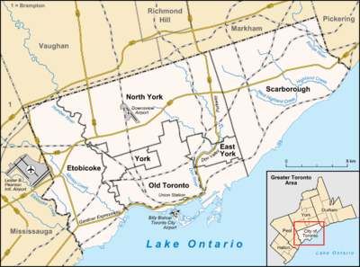 Location of the mouth of Black Creek in Toronto
| |
Black Creek is a river in the Golden Horseshoe region of Ontario, Canada. It flows from the city of Vaughan in Regional Municipality of York to the Humber River in Toronto.
Course
The creek begins in the Vellore neighbourhood of Vaughan at the outflow from a Retention basin just north west of the intersection of Weston Road and Rutherford Road at an elevation of 209 metres (686 ft). It flows southeast under Highway 400 at Langstaff Road, heads south, then turns sharply east to Jane Street, where it once again turns south into the neighbourhood of Edgeley. The creek continues south under Highway 7, Highway 407 and Steeles to reach Toronto at the eponymous Black Creek Pioneer Village open-air historic museum. It passes the main York University campus, heads into the Downsview area, and passes under Highway 401 to Jane Street. From that point, the creek valley provides the routing for the eponymous Black Creek Drive, which follows the creek south to past Eglinton Avenue West to Weston Road in the neighbourhood of Mount Dennis. The creek turns southwest, flows through Lambton Golf Club, and reaches its mouth as a left tributary of the Humber River near Scarlett Road and Dundas Street West at an elevation of 106 metres (348 ft).
Watershed
Black Creek is smaller than most of the waterways in the Greater Toronto Area. Much of the river consist of culverts south of Highway 401 and Jane Street. Along Humber Boulevard North from Weston Road to Alliance Avenue, Black Creek runs along a man-made concrete waterway.
August 2005 flooding
On August 19, 2005, Black Creek was the site of heavy flooding as a result of extremely heavy rains that afternoon. Its overflow destroyed a culvert on Finch Avenue. It is also one of the most polluted waterways as much of the Toronto section runs through industrial areas and industrial run off often enters the creek.
Communities
- Lambton, Toronto - residential area in Toronto
- Mount Dennis, Toronto - light to medium industrial area - including former home to Kodak Canada and new Toronto Transit Commission bus garage
- Downsview, Toronto
- Edgeley, Vaughan - commercial and light industrial area
- Vellore, Vaughan - residential area
Attractions and protected areas
- York University, Toronto
- Oakdale Golf and Country Club, Toronto
- Beechwood Cemetery, Vaughan
- Weston-400 North Industrial Area, Vaughan
- North York Sheridan Mall, Toronto
- Lambton Golf and Country Club, Toronto
- Chris Tonks Arena, Toronto
- Derrydowns Park
- Topcliffe Park
- Northwood Park
- Downsview Dells Park
- Chalkfarm Park
- Upwood Park
- Coronation Park
- Keelesdale Park
- Smythe Park
- Lambton Park
- Glen Scarlett Park
- Rockcliffe-Symthe Gulley
See also
References
- "Black Creek". Geographical Names Data Base. Natural Resources Canada. Retrieved 2010-08-29.
- "Topographic Map sheets 30M11, 30M12, 30M13". Atlas of Canada. Natural Resources Canada. 2010-02-04. Archived from the original on 2010-08-03. Retrieved 2010-08-29.