South Hill, Toronto
| South Hill | |
|---|---|
| Neighbourhood | |
|
| |
 Location of South Hill | |
| Country |
|
| Province |
|
| City |
|
South Hill is an area of Toronto, Ontario, Canada. It is located north of downtown covering the area west of Avenue Road, south of St. Clair Avenue, east of Spadina Road, and north of the Canadian Pacific railway tracks. The area is dominated by the steep hill of the former Lake Iroquois shoreline. The Nordheimer Ravine also cuts through the area, which is surrounded by Winston Churchill Park. This park covers the northwestern portion of South Hill.
History
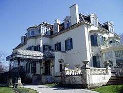
The first settlers of York, Upper Canada divided the area that would become South Hill into concessions in 1793. One large section of the area went to Peter Russell and Russell Hill Road continues to run through the centre of the neighbourhood. In the late nineteenth century the area became home to some of the wealthiest citizens of Toronto. They built a series of manors along the top of the hill. These included Senator John Macdonald's Oaklands, the Eaton family's Ardwold, Samuel Nordheimer's Glenedyth, James Austin's Spadina, William McMaster's Rathnelly, and most prominently Henry Pellatt's Casa Loma. The area was annexed to the city of Toronto in a series of sections beginning in 1905. It has remained an expensive residential area, though most of the manors have today either been demolished or converted to other uses.
Republic of Rathnelly
The southeastern section of South Hill is known as Rathnelly. Rathnelly takes its name from the former Rathnelly house built in 1830 by William McMaster, which was named after his birthplace in Rathnelly, Ireland. During the celebration of Canada's centennial on July 1, 1967, the Rathnelly neighbourhood declared itself an independent republic.[1] To mark its independence, the "Republic of Rathnelly" elected a queen, organized a parade, formed an "air farce" of 1,000 helium balloons, and issued Republic of Rathnelly passports to everyone in the neighbourhood. The Republic of Rathnelly continues to celebrate with a bi-annual street party.
Landmarks
References
- ↑ Carolyn Ireland. "Where are Toronto's prime real estate pockets?". The Globe and Mail.
- South Hill history from torontoneighbourhoods.net
- Rathnelly history from torontoneighbourhoods.net
- Nordheimer Reach from lostrivers.ca
Coordinates: 43°40′52″N 79°24′14″W / 43.681°N 79.404°W