Dufferin Grove
| Dufferin Grove | |
|---|---|
| Neighbourhood | |
 | |
 Neighbourhood map | |
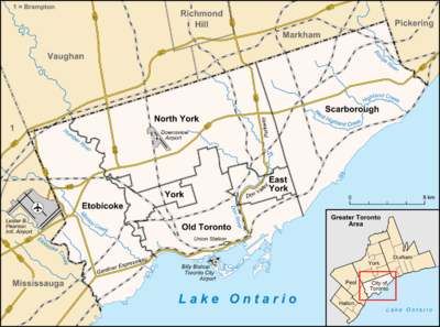 Location within Toronto | |
| Coordinates: 43°39′25″N 79°25′41″W / 43.657°N 79.428°WCoordinates: 43°39′25″N 79°25′41″W / 43.657°N 79.428°W | |
| Country |
|
| Province |
|
| City |
|
| Government | |
| • City Councillor |
Ana Bailão (Ward 18) Mike Layton (Ward 19) |
| • Federal M.P. |
Julie Dzerowicz (Davenport) Adam Vaughan (Trinity—Spadina) |
| • Provincial M.P.P. |
Cristina Martins (Davenport) Han Dong (Trinity—Spadina) |
Dufferin Grove is a neighbourhood located in Toronto, Ontario, Canada, west of downtown. The neighbourhood is bordered by Bloor Street West to the north, Ossington Ave to the east, College Street to the south, and Dufferin Street to the west.
Character
The area is very green, with many trees and some of largest gardens and yards in Toronto. The neighbourhood has a very active night life, with many "hip" and urban restaurants scattered along Bloor and College. There are also many small independent specialty shops like bakeries, smoothie shops, and bike stores. The main streets of the neighbourhood are Bloor, College and Dufferin Streets. Dufferin, a four-lane arterial, which is mostly residential with the exception of the Dufferin Mall on the west side south of Bloor. College Street is a four-lane arterial road, with a mix of commercial storefronts and residences.

- Houses
The neighbourhood is predominantly two or three-storey detached or semi-detached homes at a fairly mid-density.

The majority of Dufferin Grove houses were built between 1890 and 1930. Dufferin Grove's semi-detached and detached houses are larger than those found in most downtown Toronto neighbourhoods. The architectural style of the homes in Dufferin Grove range from early and late Victorian to Edwardian and English Cottage style designs. Dufferin Grove is a popular family-oriented neighbourhood due to the size of the houses and the amenities including a popular community park, a shopping centre, schools and access to public transit.
- Education
Dufferin Grove is home to two Elementary Public Schools, Ossington Old Orchard Public School and Dewson Street Junior Public School.
History
The Dufferin Grove district was first settled by the Denison Family, who emigrated to Canada from England in 1792. The Denisons were active participants in Toronto's early military and political affairs. Their country villas were Toronto landmarks, that had titles such as "Dover Court", "Rush Holme", and "Heydon Villa". In 1834, with the city encroaching at their doorstep, the Denisons decided to clear the dense forest covering their property, and began cultivating this land. The fertile soil in the area yielded abundant crops and brought the Denisons great wealth. However, by the 1880s, the value of the Denison estates lay in housing development not agriculture. Thus rows of crops were gradually replaced by rows of houses and the current neighbourhood was developed.
Demographics
In the west (and to an extent east) end of the neighbourhood there is a large population of Portuguese, spreading out from Little Portugal located to the south-west.
The area has a larger than average population (compared to the rest of Toronto) in the age groups between 25–39, according to 2006 census data.[1]
References
- ↑ "Gender & Age Profile" (PDF). City of Toronto.
External links
- City of Toronto - Dufferin Grove Neighbourhood Profile
- Friends of Dufferin Grove Park
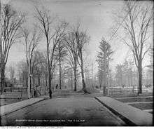
- Historic photos from the Dufferin Grove area
 |
Wallace Emerson | Bloordale Village, Dovercourt Park | | |
| Brockton | |
Palmerston-Little Italy | ||
| ||||
| | ||||
| Little Portugal |