Cliffside, Toronto
| Cliffside | |
|---|---|
| Neighbourhood | |
|
Homes in Cliffside | |
 Vicinity | |
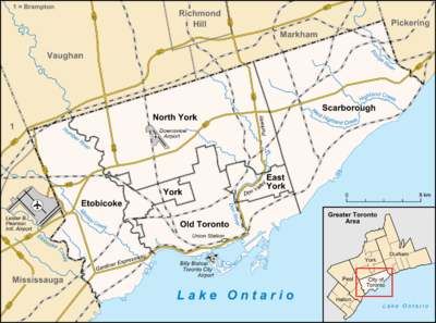 Location within Toronto | |
| Coordinates: 43°42′40″N 79°14′53″W / 43.71111°N 79.24806°WCoordinates: 43°42′40″N 79°14′53″W / 43.71111°N 79.24806°W | |
| Country |
|
| Province |
|
| City |
|
| Community | Scarborough |
| Established | (Postal village) 'Danforth' |
| Changed Municipality |
1998 Toronto from |
| Government | |
| • MP | Bill Blair (Scarborough Southwest) |
| • MPP | Lorenzo Berardinetti (Scarborough Southwest) |
| • Councillor | Gary Crawford (Ward 36 Scarborough Southwest) |

Cliffside is a neighbourhood in Toronto, Ontario, Canada, located along the Scarborough Bluffs in the district of Scarborough. Its boundaries are Kennedy Road to the west (where Kingston and Danforth Road merge), St. Clair Avenue East to the north, Brimley Road to the east, and the Bluffs on the lakeshore to the south. Most of the houses were built in the early to mid 1960's with the baby boom and the mass expansion of the surrounding Toronto suburbs (Scarborough, North York etc.) at the time.
The population consists of a large number of those with ancestral backgrounds from the British Isles: English 19.8% Scottish 14.4% Irish 11.8%, totalling 46% (source: 2001 Census).[1]
Landmarks
- St. Augustine's Seminary
- Scarborough GO Station
- St. Crispin Anglican Church
- Scarborough Bluffs

Half-way house on Kingston Rd at Midland (now in Black Creek Pioneer Village)
References
- ↑ Statistics Canada, 2001 Census, CT's 337 336 343, http://dc1.chass.utoronto.ca/cgi-bin/census/retrieve_census_2001_ct. 3.
External links
 |
Scarborough Junction | | ||
| Birch Cliff, Oakridge | |
Cliffcrest, Scarborough Village | ||
| ||||
| | ||||
| Lake Ontario |
This article is issued from Wikipedia - version of the 8/31/2016. The text is available under the Creative Commons Attribution/Share Alike but additional terms may apply for the media files.