Old East York
| Old East York | |
|---|---|
| Neighbourhood | |
|
Post-war bungalows are prevalent in the far northern extremities of Old East York | |
 Vicinity | |
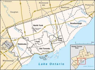 Location within Toronto | |
| Coordinates: 43°41′35.9″N 79°18′57″W / 43.693306°N 79.31583°WCoordinates: 43°41′35.9″N 79°18′57″W / 43.693306°N 79.31583°W | |
| Country |
|
| Province |
|
| City |
|
| Community | Toronto & East York |
| Changed Municipality |
1924 East York from York 1998 Toronto from East York |
| Government | |
| • MP | Craig Scott (Toronto—Danforth) Matthew Kellway (Beaches—East York) |
| • MPP | Peter Tabuns (Toronto—Danforth) Michael Prue (Beaches—East York) |
| • Councillor | Mary Fragedakis (Ward 29 Toronto—Danforth) Janet Davis (Ward 31 Beaches—East York) |

Old East York is a district of the city of Toronto, consisting of the southern, urban, portion of the former borough of East York. Old East York is continuous and functionally integrated with the old City of Toronto, bounded by the old municipal boundary on the south, by the Don River Valley on the west, by Taylor-Massey Creek on the north, and Victoria Park Avenue in the east. The southern border is the old boundary between East York and Old Toronto.
Most of Old East York, particularly south of Cosburn, was constructed before World War II in a traditionally urban, pedestrian-oriented block pattern. Originally populated by immigrants of predominantly British and Irish descent, Old East York is now home to a wide range of ethnicities, including people of Greek, Bangladeshi, and Chinese descent.[1]
Neighbourhoods

Broadview North is a neighbourhood bordered by Pape Avenue to the East, Chesterhill to the South and the DVP to the west and north. The area is dominated by renters and high rise buildings. There are numerous low income buildings in the area, however, renting (at over 70%) is certainly the norm in this area. However at the very north the area contains many bungalows, many of which are being redone into 2-storey houses because of the decent area and the considerably low housing price. The area has significant Greek and Serbian populations.
Crescent Town was founded on the former site of the Crescent School to take advantage of the adjacent Victoria Park station. Crescent Town is today a diverse multicultural neighbourhood, whose population includes extensive numbers of Bengali, Jamaican, Pakistani, and Tamil Canadians. Housing stock is a pleasing mixture of mid-rise apartments, Victorian mansions, highrise condominiums, Edwardian workers cottages, and stately 1920s Craftsman homes. The adjoining stretch of Danforth Avenue (from Victoria Park to Main) hosts a high concentration of Bangladeshi grocers, restaurants, clothing stores and entertainment venues.
Glebe Land. Much of the central section of what became East York was first set aside as 'Clergy Reserves', called 'Glebe Land', a hotly debated feature of the original system of land granting in Ontario which retained land for the use of the church. Arguments over which church should have the use of this land led to the eventual sale of the clergy reserves, most of which had remained undeveloped for many years as surrounding areas were cleared and built on. The clergy lots between Donlands (originally a part of Leslie Street) and Woodbine only began to be developed after the construction of the Prince Edward Viaduct and Leslie Bridge and successful development of the old Todmorden postal village west of Donlands as Pape Village.
Todmorden Village is located north of O'Connor, at the very edge of Old East York. Much of the village lies atop the Don Valley Ravine which is lined with forest. Mature trees are a big presence in this area of the neighbourhood and create an extremely peaceful and natural area, rarely found this close to downtown Toronto. Where Pape and the Donlands head north past O'Connor is an area consisting of very few streets and beautiful homes.
Woodbine Heights is an Edwardian neighbourhood, straddling parts of Old East York and old Toronto. It is bounded by Coxwell on the West, Main on the East, the Taylor-Massey Creek Ravine on the north and Danforth on the south.[2][3] Aside from the Danforth, its main foci are the "East York Village", located Coxwell Avenue, north of Mortimer,[4] and the Woodbine Village, centered on the intersection of Woodbine and Mortimer. While Woodbine Heights is situated to the east of the Glebe Lands, it was actually developed earlier, around the railway station and horse-racing facilities at Main and Danforth. Housing stock and street patterns in this area are chiefly of Edwardian design, and are typified by distinctive, narrow-lot variants of the Dutch Colonial Revival, Classical, and Cotswold styles. Notable landmarks include the Toronto East General Hospital (Sammon & Woodington) a full-service teaching hospital founded in 1929, the Woodbine Heights Royal Canadian Legion (Woodbine-Barker), the Church of the Resurrection (Woodbine & Milverton), founded in 1912 and the Gledhill Public School (Gledhill-King Edward) built 1917. As late as 2010, this neighborhood was dominated by middle-aged residents and retirees. It is currently undergoing rapid social transformation, with an influx of young families attracted to car-free city living, and character-filled, yet affordable, Edwardian homes.[5]

Riding Divisions
The area west of Coxwell Avenue is the federal and provincial riding of Toronto-Danforth and Ward 29, the area east of Coxwell is the federal and provincial riding of Beaches-East York and Ward 31.
Landmarks
References
- ↑ City of Toronto. Old East York: Social Profile #2 Neighbourhoods Language and Ethnicity, 2008-07. Retrieved on 2009-01-17.
- ↑ http://www.woodbineheights.org/sample-page/
- ↑ http://www.propertyguidetoronto.com/neighbourhood-reviews/woodbine-heights/
- ↑ http://torontoneighbourhoods.net/regions/eastyork/63_shopping.html
- ↑ http://www.propertyguidetoronto.com/neighbourhood-reviews/woodbine-heights/
 |
Thorncliffe Park | | ||
| Pape Village | |
O'Connor-Parkview | ||
| ||||
| | ||||
| East Danforth (Toronto) |