Leaside
| Leaside | |
|---|---|
| Neighbourhood | |
|
Houses in Leaside | |
| Motto: Itineris Stabilitas Sanitas | |
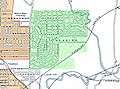
 Location of Leaside in Toronto | |
| Coordinates: 43°42′00″N 79°22′00″W / 43.70000°N 79.36667°W | |
| Country |
|
| Province |
|
| City |
|
| Community | Toronto & East York |
| Established | 1880s (Postal village) |
| Incorporated | April 23, 1913 (Town) |
| Changed Municipality |
1954 1998 Toronto from East York |
| Annexed | January 1, 1967 into East York |
| Government | |
| • MP | Rob Oliphant (Don Valley West) |
| • MPP | Kathleen Wynne (Don Valley West) |
| • Councillor | Jon Burnside (Ward 26 Don Valley West) |
| Time zone | EST (UTC-5) |
| • Summer (DST) | EDT (UTC-4) |
| Area code(s) | 416, 647 |

Leaside is a neighbourhood in Toronto, Ontario, Canada. It is located northeast of Downtown Toronto, in the vicinity of Eglinton Avenue East and Bayview Avenue. The area takes its name from William Lea and the Lea family, who settled there in the early years of the nineteenth century.[1] The area first developed as farmland along with Toronto through the nineteenth century. It was incorporated as a town in 1913. In 1967 it was amalgamated with the township of East York to form the borough of East York. In 1998 it became part of the city of Toronto.
History and development
Before the Leas
The general area of Toronto had been inhabited by various Natives at least as early as 3000 BCE, when the Laurentian peoples moved south into the area just east of Toronto.[2] The first European known to travel to the area was Étienne Brûlé, who passed through the area in the early part of the seventeenth century. Surveying and settlement by Europeans began in earnest in the 1780s, with the influx of Loyalists fleeing the American Revolution.
Lea family settles Lot 13
John Lea immigrated to York, Upper Canada in 1819, coming from Philadelphia.[3] He had come to the United States from England only a year previous. He purchased Lot 13 in the third concession from Alexander McDonnell on January 23, 1820 and settled there with his family.[4] John Lea had three children - William, John Jr. and Mary. In 1851, William Lea bought land just south of his father's farm, and began constructing a large, octagonal brick house, which he named "Leaside". The house was completed in 1854.[5] The building served not only as a home for Lea's family, but after he became a Magistrate in the County of York, soon served as a post office as well.[6] The property became the possession of his son Joseph upon his death in 1893.
Railways come to Leaside
In the 1870s, the Ontario and Quebec Railway Company purchased a few acres of land on the south-east corner of William Lea's property to run its railway across. The Ontario and Quebec Railway Company encountered financial difficulties in 1884, and leased part of its railway, including the section of track running through Leaside, to the Canadian Pacific Railway for 999 years.[7] The Canadian Pacific Railway decided to establish a maintenance stop and a sliding by-pass on the railway on the land purchased from William Lea, which was attractive because it was uniformly flat. The station was completed in September 1884 and named "Leaside" in honour of William Lea.[8] In 1892 a junction was built in the Leaside area, and a railway line was constructed south along the Don towards Union Station.[9]
Leaside: a model town
In 1912, William Mackenzie and Donald Mann, the owners of the Canadian Northern Railway hired landscape architect Frederick Todd to plan development for a community to be built around a maintenance yard for their railway,[10] which ran beside the CP lines through the Leaside area. Mackenzie and Todd founded the York Land Company to purchase land for such a town. The company purchased over 1,000 acres (4.0 km2) most of the third concession and some land north of Eglinton Avenue.[8] The purchased lands extended from the railway tracks in the south to three farms north of Eglinton Avenue, from Leslie Street in the east to Bayview Avenue in the west.[11] The town of Leaside was planned by Todd for the company, which put its name to many of the local streets; Laird Drive, Hanna Road and Wicksteed Avenue all bear the name of Canadian Northern Railway company executives.[10] The new community was planned with commercial areas, residential areas and a town centre west of Laird Drive, and space was laid out east of Laird Drive for industrial development. The goal of the company was to create Leaside as a new upper class residential area of Toronto, the "New Rosedale".[11] The developers first approached the town of North Toronto, hoping that North Toronto would annex the area and provide services such as streets, sewers and public transportation. The town council of North Toronto refused.[12] A similar request to the city of Toronto was met with a similar reply. With their attempts to include Leaside within another city or town rebuffed, Colonel Davidson and Randolph McRae applied to the province of Ontario to incorporate Leaside as a town.
The Town of Leaside was officially incorporated on April 23, 1913.[13] The population of Leaside was 43 individuals.[12] The Canadian Northern Railway company approved Todd's town plan on May 8, 1913.[14] A town council for Leaside was elected on May 8, 1913[12] and they approved the plan for the town on May 21, 1913, which was the final legal approval needed before the plan could be implemented. On June 21, 1913 the Toronto World carried the announcement that properties in Leaside's planned community would be marked in the fall of that year.[14] In September 1913 lots went on sale within the planned community.
In 1914 the industrial area that had been set aside east of Laird Drive received its first tenant. Canada Wire and Cable began construction of a factory for production of 9.2 inch shells for World War I.[15] In addition to the new factory, Canada Wire and Cable moved their other Toronto production plants to the same location to increase efficiency. Canada Wire and Cable also created the subsidiary company Leaside Munitions Company to oversee shell production.[15] Soon after construction began on a federal government owned airstrip, named Leaside Aerodrome. The York Land Company leased about 220 acres (0.9 km2) to the government for the airfield, between Wicksteed Avenue and Eglinton Avenue.[15] On May 21, 1917 construction began on the airfield. At the close of the war, there were accommodations for around 1000 military personnel.[16]
While the industrial development in the area went ahead as planned during World War One, the anticipated residential development did not occur.[17] As late as 1929 the population remained under 500.[18] World War I spurred the demand for industrial output but diminished the call for new housing. The bankruptcy of Canadian Northern Railway left the project at a loss and Leaside's isolated location made it unappealing to workers from Toronto.
 Proposed Leaside development plan as it appears in the National Atlas of Canada's 2nd edition, 1915, with Leaside highlighted in Green, and Toronto highlighted in Peach. This plan was never implemented.
 An aerial photograph of south Leaside taken April 29, 1942, highlights the growth of the area, as well as the old Pottery Road
 Detailed Aerial Photograph of Leaside, 1942
Leaside: a growing Toronto suburb


After the war, the strip became the site of Canada's first delivery of airmail on June 18, 1918 when pilot Brian Peck delivered 120 letters from Montreal.[10] This delivery was initially organised at the behest of some of his friends in Montreal who wanted letters delivered to Toronto; however when Canada Post heard of the plans, they gathered together the letters as a test of an airmail system.[16] After the war there was little need for shells and other war materials, and the factories of the Leaside Munition Company were closed. These buildings were quickly occupied by the Durant Motor Company, which produced cars named Durants and Stars as well as the Rugby truck.[16]
Leaside's growth slowed after World War I, with its primary industry being war industry. The existing houses had all been built for employees of the Leaside Munitions Company by the company.[19] However, at this time Leaside stood on the edge of Toronto and was increasingly an appealing place for investment. Investors from Baltimore bought property that had previously belonged to Robert T. Davies for the construction of a race track. They formed the Thorncliffe Park Racing and Breeding Association Ltd. to operate the track.[19]
The Leaside Viaduct was completed on October 29, 1927 providing easy connection between east Toronto and Leaside. This led to the rapid growth of Leaside at the time, and in the future.[20] The impassibility of the Don River valley had previously made it difficult for people employed in Toronto to reside in Leaside. The same month, an underpass on Millwood Road was opened through the valley.[17]
In 1928, the Lincoln Electric Company of Canada Ltd. relocated from Toronto's west end to Leaside. The company originally sold Lincoln motors in Canada, but incorporated in 1930 and began the manufacture of motors in Leaside.[21] At the onset of the Great Depression, the Durant Motor Company ran into financial troubles. The last cars were produced in 1933, and the buildings were occupied by the Canada Wire and Cable company.[16][22]
At the start of World War II, Lincoln Electric moved their operations to Leaside industrial park, adjacent to the Canada Wire and Cable plant. The new location, constructed in 1940, covered 30 0 square feet (0 m2).[23] On July 16, 1940, Research Enterprises Limited was incorporated. The company operated only during the war, closing in 1946. It was, however, the largest single employer in Leaside's history, employing over 7500 men and women at its peak.[24] The site manufactured military radio equipment and optical supplies, with a total value of $220 million (CDN) in goods produced during the war.
As part of a Royal Canadian Air Force public relations plan, the town of Leaside officially "adopted" No. 432 Squadron RCAF of No. 6 Group RCAF. Formed and adopted on 1 May 1943 the squadron took the town's name as its nickname, becoming 432 "Leaside" squadron RCAF. The sponsorship lasted the duration of the war.
In 1945 at the end of World War II the population of Leaside stood at 9800.[25] In 1949, Leaside's population had grown to 14 826.[25]
In 1951, Sunnybrook Plaza, located on the north-east corner of Bayview Avenue and Eglinton Avenue East, became one of the first shopping centres in Toronto.
In 1952 the Lincoln Electric company expanded to a 220 0-square-foot (0 m2) plant, and their site expanded to cover almost 7 acres (28,000 m2).[23] They leased an additional 50 0-square-foot (0 m2) building in Leaside to house their distribution center.
The last horse race at Thorncliffe Park was run on June 23, 1952.[20] Investors from Toronto bought the racetrack that year.
The rapid growth of Thorncliffe in the 1950s necessitated the construction of a second north-south bridge across the Don Valley. In 1955, Leaside's population had grown to 16 779 [25] and the Leaside town council approved the second bridge. Construction of the bridge was completed on September 7, 1960 and it was opened by Leslie Frost. The bridge was named the Charles Hiscott Bridge in honour of Leaside's mayor at the time.[20]
Amalgamations
On January 1, 1967 Leaside was amalgamated with the township of East York to form the borough of East York. As such Leaside became a neighbourhood within East York.
Passenger train service to Leaside Station ended in 1970, and the station was closed.[26] The station would reopen briefly in the 1980s as a restaurant, but would see no further passenger traffic. Leaside Airport fell into disuse, and in 1971 the last hangar was demolished.[27]
Canada Wire and Cable was purchased by Alcatel in 1991, and the operations relocated to Markham in 1996, with the location being converted to a shopping centre.[28] The plant had expanded through the years and been a major influence in Leaside, employing over 2700 workers at its peak. It had also been a strong influence over the community in other ways, investing in the community in various ways, including the construction of a water main in 1918.[29]
East York merged with five other municipalities and a regional government in 1998 to form the new City of Toronto.
Politics
The first town council for Leaside was elected on May 8, 1913.[12] The council had five members: Randolph McRae, who served as the mayor, and Harvey Fitzsimmons, Laurence Boulton, George Saunders and Archibald McRae who served as aldermen. All were acclaimed in the election, all were members of the Canadian Northern Railway.
From 1954 to 1966, Leaside had its own mayor. There were four individuals who held this post - Howard T. Burrell (1954–1955); Charles H. Hiscott (1956–1961); Lloyd M. Dickinson (1962); Beth Nealson (1963–1966).[30]
In 1967, Leaside was amalgamated with the township of East York to form the borough of East York, from this point forward Leaside was a community within East York, and governed by the municipal council of East York. Amalgamation was opposed by Leaside residents fearing residential tax increases and the loss of the Leaside community identity. Taxes in Leaside were lower than the surrounding regions as residential taxes in Leaside were subsidized by those from industrial areas, and residential taxes did climb in Leaside every year from 1967 - 1972.[31] Beth Nealson, the last mayor of Leaside ran against True Davidson (the reeve of East York) for mayor of the amalgamated borough. Nealson lost to Davidson.
In 1998, East York (including Leaside) was amalgamated with the City of Toronto to form the City of Toronto, from this point forward Leaside was a community within Toronto, and governed by the municipal council of Toronto.
In 2006, incumbent councillor Jane Pitfield left the Don Valley West riding (which Leaside is a part of, along with Bennington Heights, Thorncliffe) to run for mayor. Her spot was closely contested, but with just 20% of the popular vote former Progressive Conservative MPP John Parker won his spot in city council, replacing Pitfield. In the 2010 Toronto municipal election that saw Rob Ford elected to the office of Mayor of Toronto, Parker won another tight race for councillor of Ward 26, beating runner up Jon Burnside by only 415 votes. After a tumultuous term of increased traffic in the neighbourhood and rapid development along the Laird Drive corridor and in Thorncliffe Park,[32] Parker lost the seat to Jon Burnside by a margin of 3,248 votes.[33]
Geography
Leaside lies on the Iroquois Plain.[34] The actions of the glacial Lake Iroquois made the Leaside area into a flat plateau, surrounded on three sides by deep river valleys.
Culture
Demographics
Demographically, the Leaside community is made up predominantly of single-family homes housing upper-middle-class families.
The most famous house in Leaside is James Lea's, located at 201 Sutherland Drive. Built in 1909, it is unique in that the back of the house faces Sutherland Drive. It was originally built to face a street that no longer exists.
Former Prime Minister Stephen Harper was also born in Leaside and attended Northlea Public School for his primary education.
Due to city expansion, Leaside has become prime real estate with the GTA, and has attracted many local celebrities, such as NHL goaltender Trevor Kidd, Avalanche winger Darcy Tucker, Ex-NHL player Doug Gilmour, and comedian Colin Mochrie and his actress wife Deb McGrath.

Recreation
The largest recreation centre in Leaside is Leaside Memorial Community Gardens which includes an indoor swimming pool, two ice rinks, a curling rink and a large auditorium.It also was where Peter Mahovlich Sr. father of the famous NHL brothers worked after coming to Toronto in the 50s from the Timmins area because of Franks impressive hockey skills as a youth in the Porcupine.[35]
Serena Gundy Park is located in the north-east corner of Leaside.[35] The parkland was donated to Leaside in 1960 by the estate of James H. Gundy.[36] The park covers 62.6 acres (253,000 m2) which are generally in a natural state. The park is used for picnicking and hiking in the summer and cross country skiing in the winter.[37]
Trace Manes Park is located in south Leaside.[35] The park is home to the Leaside Tennis club and sports six tennis courts. Other facilities in the park include a playground, a baseball diamond and an outdoor ice rink in winter.[38]
Howard Talbot park in south-west Leaside features two baseball diamonds.[35] Additionally it features a "splash pad", a water playground for young children.[39]
Education
Northlea Elementary and Middle School is located on the site of the old Divadale Estate on Rumsey Road north of Eglinton Avenue. It was opened in 1944 and had 15 classrooms. In 1991-93 the school underwent extensive renovations and the school now educates over 800 students. The renovation provided additional classroom space to the school as well as a new library and a second gymnasium. The school is operated by the Toronto District School Board. Northlea is a dual track school offering regular English programs from Junior Kindergarten to Grade 8, and French Immersion programs from Senior Kindergarten to Grade 8.
Bessborough Elementary and Middle School, located on the same road as Leaside High School in South Leaside, has offered education to those living in the older part of Leaside. St. Anselm Catholic School, also located on Bessborough Drive, opened in 1939 and presently has an enrollment of 340 students from Junior Kindergarten to Grade 8. Leaside High School began on the top floor of Rolph Road School in 1945. The "new" high school opened in September 1948 and welcomed back local students who had been attending Lawrence Park and Jarvis Collegiate.
Rolph Road Elementary School, an elementary school for junior kindergarten to grade 6, is the other elementary school in the neighbourhood. Located on Rolph Road, it is in South Leaside and is a feeder school to Bessborough.
Along with the growth of these schools in the 1940s and 1950s, the growing population of Leaside also supported one of North Toronto’s first preschools. Sunnybrook School was founded in 1952 in the basement of St. Augustine of Canterbury Church in Leaside. In 1960 the school moved to its present 469 Merton Street location, just west of Leaside in Davisville.
Notable people
- The 22nd Prime Minister of Canada, Stephen Harper
References
Citations
- ↑ Brown, p. 198.
- ↑ Pitfield, p. 4.
- ↑ Rempel, p. 2.
- ↑ Rempel, p. 3.
- ↑ Rempel, p. 4.
- ↑ Pitfield, p 8.
- ↑ Rempel, p. 13.
- 1 2 Rempel, p. 14.
- ↑ Pitfield, p 17.
- 1 2 3 Brown, p. 199.
- 1 2 Pitfield, p. 22.
- 1 2 3 4 Pitfield, p. 32.
- ↑ Rempel, p. 1.
- 1 2 Rempel, p. 17.
- 1 2 3 Rempel, p. 21.
- 1 2 3 4 Rempel, p. 22.
- 1 2 Pitfield, p. 23.
- ↑ "The Town of Leaside". The Toronto Green Community. Retrieved 2007-10-01.
- 1 2 Rempel, p. 25.
- 1 2 3 Rempel, p.26.
- ↑ Pitfield, p. 66.
- ↑ Pitfield, p. 54.
- 1 2 Pitfield, p67.
- ↑ Pitfield, p. 84.
- 1 2 3 James B. Milner (February 1957). "The Metropolitan Toronto Plan". University of Pennsylvania Law Review. The University of Pennsylvania Law Review. 105 (4): 570–587. doi:10.2307/3310370. JSTOR 3310370.
- ↑ Pitfield, p. 20.
- ↑ Brown, p. 200.
- ↑ Pitfield, p 46.
- ↑ Pitfield, p.42
- ↑ "The Town of Leaside - Mayors". City of Toronto. Retrieved 2007-09-30.
- ↑ Pitfield, p. 26.
- ↑ "Jon Burnside wins Ward 26, Don Valley West".
- ↑ "2014 General Election Results for City Ward 26 - Don Valley West".
- ↑ Pitfield, p. 2.
- 1 2 3 4 "Leaside". Toronto Neighbourhoods.
- ↑ "Serena Gundy Park Additional Information". City of Toronto. Retrieved 2007-10-01.
- ↑ "Serena Gundy Park". City of Toronto. Retrieved 2007-10-01.
- ↑ Rasha Mourtada (October 2006). "Family Benefits". Toronto Life. Retrieved 2007-10-01.
- ↑ "Media Advisory: REMINDER City of Toronto officially opens new water play facility at Talbot Park". City of Toronto. June 25, 2004. Retrieved 2007-10-01.
Further reading
- Ron Brown (1997). Toronto's Lost Villages. Toronto: Polar Bear Press. p. 198. ISBN 1-896757-02-2.
- Jane Pitfield, ed. (2000) [1999]. Leaside (2nd ed.). Toronto: National Heritage Books. p. 324. ISBN 1-896219-54-3.
- Jack I. Rempel (1982). The Town of Leaside - a brief history. Toronto: East York Historical Society.
External links
| Wikimedia Commons has media related to Leaside. |
- Leaside-Bennington neighbourhood profile
- The story of Leaside. Leaside, Ont. : Leaside Town Council, 1931. 32 p. : ill., map, ports. Accessed 4 January 2014, in PDF format.
 |
Sunnybrook (North York) | | ||
| Davisville Village (Toronto) | |
Thorncliffe Park | ||
| ||||
| | ||||
| Pape Village |
Coordinates: 43°42′29″N 79°22′05″W / 43.708°N 79.368°W