Bi'ina
Bi'ina
| |
|---|---|
 Bi'ina | |
| Coordinates: 32°55′46″N 35°16′22″E / 32.92944°N 35.27278°ECoordinates: 32°55′46″N 35°16′22″E / 32.92944°N 35.27278°E | |
| Grid position | 175/259 PAL |
| District | Northern |
| Government | |
| • Type | Local council |
| Population (2015)[1] | |
| • Total | 7,918 |
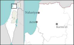
Bi'ina or al-Bi'na[2] is an Arab town in the Northern District of Israel. It is located east of Akko. In 2003, Bi'ina merged with Majd al-Krum and Deir al-Asad to form the city of Shaghur, but was reinstated as a local council in 2008 after Shaghur was dissolved. Bi'ina has a mostly Muslim population with a small Christian minority; in 2015 its population was 7,918.
History
Ottoman era
In 1517, Bi'ina, with the rest of Palestine, was incorporated into the Ottoman Empire after it was captured from the Mamluks, and by 1596 appeared in tax registers as belonging to the Nahiya of Akka of the Liwa of Safad. It had a population of 16 Muslim households and 15 Christian households and paid taxes on wheat, barley, olives, cotton, goats or beehives and a press for grapes or olives.[3][4] A map from Napoleon's invasion of 1799 by Pierre Jacotin showed the place, named as "El Bena".[5]
French scholar Victor Guérin visited in the 1870s, and wrote that the population was divided between Druze and Greek Orthodox Christians. He listed a mosque and a Greek church, both of which were built on the sites of older churches.[6] In the late 19th century, it was described as a village of 300 Muslims and 100 Christians, surrounded by olives and arable land. Water was supplied by a spring.[7]
British Mandate era
In the 1922 census of Palestine conducted by the British Mandate authorities, Al Ba'na had a population of 518; 311 Muslims and 207 Christians,[8] where all the Christians were Orthodox.[9] By the 1931 census the population had increased to 651; 441 Muslims and 210 Christians, in a total of 133 houses.[10]
In 1945, Bi'ina had 830 inhabitants; 530 Muslims and 300 Christians.[11] They owned 14,839 dunams of land, while 57 dunams were public.[11][12] 1,619 dunams were plantations and irrigable land, 5,543 used for cereals,[11][13] while 57 dunams were built-up (urban) land.[11][14]
1948, aftermath
During Operation Hiram, 29–31 October 1948, the village surrendered to the advancing Israeli army. Many of the villagers fled north but some remained and were not expelled.[15] The village remained under Martial Law until 1966.
In 1981, a Bedouin neighborhood was created in the village, populated by members of the Sawaed tribe from Rame.
Notable residents
References
- ↑ "List of localities, in Alphabetical order" (PDF). Israel Central Bureau of Statistics. Retrieved 16 October 2016.
- ↑ from personal name, according to Palmer, 1881, p. 41
- ↑ Hütteroth and Abdulfattah, 1977, p. 191
- ↑ Note that Rhode, 1979, p. 6 writes that the register that Hütteroth and Abdulfattah studied from the Safad-district was not from 1595/6, but from 1548/9
- ↑ Karmon, 1960, p. 166.
- ↑ Guérin, 1880, p. 445, as translated by Conder and Kitchener, 1881, SWP I, p. 150
- ↑ Conder and Kitchener, 1881, SWP I, p. 150
- ↑ Barron, 1923, Table XI, Sub-district of Acre, p. 36
- ↑ Barron, 1923, Table XVI, p. 50
- ↑ Mills, 1932, p. 100
- 1 2 3 4 Department of Statistics, 1945, p. 4
- ↑ Government of Palestine, Department of Statistics. Village Statistics, April, 1945. Quoted in Hadawi, 1970, p. 40
- ↑ Government of Palestine, Department of Statistics. Village Statistics, April, 1945. Quoted in Hadawi, 1970, p. 80
- ↑ Government of Palestine, Department of Statistics. Village Statistics, April, 1945. Quoted in Hadawi, 1970, p. 130
- ↑ Morris, 1987, p. 226
Bibliography
- Barron, J. B., ed. (1923). Palestine: Report and General Abstracts of the Census of 1922. Government of Palestine.
- Conder, Claude Reignier; Kitchener, Herbert H. (1881). The Survey of Western Palestine: Memoirs of the Topography, Orography, Hydrography, and Archaeology. 1. London: Committee of the Palestine Exploration Fund. (p. 153)
- Department of Statistics (1945). Village Statistics, April, 1945. Government of Palestine.
- Guérin, Victor (1880). Description Géographique Historique et Archéologique de la Palestine (in French). 3: Galilee, pt. 1. Paris: L'Imprimerie Nationale. (Deir al-Asad: p. 446, Majd al-Kurum: pp 437, 444)
- Hadawi, Sami (1970). Village Statistics of 1945: A Classification of Land and Area ownership in Palestine. Palestine Liberation Organization Research Center.
- Hütteroth, Wolf-Dieter; Abdulfattah, Kamal (1977). Historical Geography of Palestine, Transjordan and Southern Syria in the Late 16th Century. Erlanger Geographische Arbeiten, Sonderband 5. Erlangen, Germany: Vorstand der Fränkischen Geographischen Gesellschaft. ISBN 3-920405-41-2.
- Karmon, Y. (1960). "An Analysis of Jacotin's Map of Palestine" (PDF). Israel Exploration Journal. 10 (3,4): 155–173; 244–253.
- Mills, E., ed. (1932). Census of Palestine 1931. Population of Villages, Towns and Administrative Areas (PDF). Jerusalem: Government of Palestine.
- Morris (1987). The Birth of the Palestinian Refugee Problem. Cambridge University Press. ISBN 0-521-33028-9.
- Palmer, E. H. (1881). The Survey of Western Palestine: Arabic and English Name Lists Collected During the Survey by Lieutenants Conder and Kitchener, R. E. Transliterated and Explained by E.H. Palmer. Committee of the Palestine Exploration Fund.
- Pringle, Denys (1993). The Churches of the Crusader Kingdom of Jerusalem: A-K (excluding Acre and Jerusalem). Cambridge University Press. (p.80 -92 )
- Rhode, Harold (1979). Administration and Population of the Sancak of Safed in the Sixteenth Century. Columbia University.
- Röhricht, Reinhold (1893). (RRH) Regesta regni Hierosolymitani (MXCVII-MCCXCI) (in Latin). Berlin: Libraria Academica Wageriana. (p. 188 no 674; p. 248 no 934; p. 256 no 974; p. 308 no 1175)
External links
- Survey of Western Palestine, Map 3: IAA, Wikimedia commons