Kfar Vradim
Kfar Vradim
| |
|---|---|
| Hebrew transcription(s) | |
| • ISO 259 | Kpar Wradim |
 | |
 Kfar Vradim | |
| Coordinates: 32°59′45.64″N 35°16′30.75″E / 32.9960111°N 35.2752083°ECoordinates: 32°59′45.64″N 35°16′30.75″E / 32.9960111°N 35.2752083°E | |
| District | Northern |
| Founded | 1984 |
| Government | |
| • Type | Local council |
| • Head of Municipality | Sivan Yechieli |
| Area | |
| • Total | 4,701 dunams (4.701 km2 or 1.815 sq mi) |
| Population (2015)[1] | |
| • Total | 5,446 |
| Name meaning | Village of Roses |
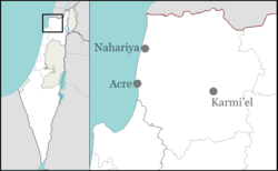
Kfar Vradim (Hebrew: כְּפַר וְרָדִים) is a town (local council) in northern Israel, with a population of 5800 (2008). It is situated south of Ma'alot-Tarshiha and about 14 kilometres (8.7 mi) south of the border with Lebanon. Kfar Vradim is close to Nahariya (20 kilometers) and Karmiel (16 kilometers). In 2015 it had a population of 5,446.
History
Kfar Vradim was established in September 1984 by Stef Wertheimer to create an industrial town in rural surroundings. The first families were mostly workers of ISCAR Metalworking, owned by Wertheimer, which manufactures metal blades and high performance cutting tools. Kfar Vradim is located near Ma'alot-Tarshiha and Yanuh-Jat, and is connected to the highway by Road 854. Road 8721 runs through the town, connecting it to Yanuh-Jat.
Climate
Kfar Vradim is situated between 550–620 meters (1800–2050 feet) above sea level, providing for a relatively dry and Mediterranean climate. Peak temperatures in Kfar Vradim in summer typically reach about 38 °C (100 °F), while its January and February temperatures can drop to as low as −2 °C (28 °F). Average temperatures range from 10 to 15 °C (50 to 59 °F) in the winter to 28–32 °C (82–90 °F) at summer. Precipitation is mostly between October and March and is mainly made up of rain showers and scarce snowfall.
Education
Kfar Vradim has an elementary school (Keshet school) and a junior high school (Amirim Junior High) which is also a high school since 2013.
Notable residents
- Shani Boianjiu, novelist.
- Matti Caspi, musician.
Twin towns
Kfar Vradim is twinned with:
References
- ↑ "List of localities, in Alphabetical order" (PDF). Israel Central Bureau of Statistics. Retrieved 16 October 2016.
External links
| Wikimedia Commons has media related to Kfar Vradim. |
- Kfar Vradim website (Hebrew)