Nahariya
Nahariya
| ||
|---|---|---|
| Hebrew transcription(s) | ||
| • ISO 259 | Nahriya | |
 | ||
| ||
 Nahariya | ||
| Coordinates: 33°00′21″N 35°05′56″E / 33.00583°N 35.09889°ECoordinates: 33°00′21″N 35°05′56″E / 33.00583°N 35.09889°E | ||
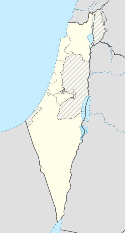
| District | Northern | |
| Sub-district | Acre | |
| Founded | 1935 | |
| Government | ||
| • Type | City (from 1961) | |
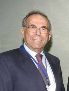
| • Mayor | Jacky Sabag | |
| Area | ||
| • Total | 10,233 dunams (10.233 km2 or 3.951 sq mi) | |
| Population (2015)[1] | ||
| • Total | 54,305 | |
Nahariya (Hebrew: נַהֲרִיָּה) is the northernmost coastal city in Israel. In 2015 it had a population of 54,305.
Etymology
Nahariya takes its name from the stream of Ga'aton (river is nahar in Hebrew), which bisects it.
History
Late Bronze Age
The ruins of a 3,400-year-old Bronze Age citadel were found in the coastal city of Nahariya near the beach on Balfour Street,[2] at a site known to archaeologists as Khirbet Kabarsa.[3] The citadel was an administrative center serving the mariners who sailed along the Mediterranean coast. There are evidence of commercial and cultural relations with Cyprus and the rest of the Mediterranean region. The fortress was destroyed four times by conflagration and rebuilt each time.
Byzantine Period
A church from the Byzantine period, dedicated to St. Lazarus, was excavated in the 1970s.[4] It was destroyed by fire, probably at the time of the Persian invasion in 614.[4]
British Mandate of Palestine
In the years 1934/35 Nahariya was founded as an agricultural village by a company limited by shares and headed by the agronomist Dr. Selig Eugen Soskin (1873-1959), the civil engineer Joseph Loewy (1885-1949), the financial expert Heinrich Cohn (1895-1976) and the engineer Simon Reich (1883-1941). The company acquired an area of land by purchase from the Arab landowner family Toueini. After ameliorisation and parcelling the plots have been offered to new German Jewish immigrants who had escaped from Nazi persecution. The first two families permanently settled in Nahariya on February 10, 1935, which is now considered the official founding date of Nahariya.[5] After an accumulation of economic, financial and climatic problems the residents soon realized that agriculture was impractical and chose to focus on tourism, taking advantage of the natural surroundings and beaches. During the British Mandate of Palestine, many British officers coming from Khartoum stopped in Nahariya.
State of Israel
Nahariya became a development town in the 1950s after the nearby ma'abara was integrated. The town hence become a home to many Jewish refugees from North Africa, the Middle East and Europe. During the 1990s, the city absorbed a significant number of immigrants from the former Soviet Union and Ethiopia. In the late 1990s and early 2000s, Nahariya experienced a construction boom.
Due to its geographic location, 9.6 km (6.0 mi) down the coast from Israel's border with Lebanon, Nahariya had been a frequent target of cross-border terrorist attacks by Palestinian militants, mortar attacks and Katyusha rocket fire during the 1970s. The most notable of those were the 1974 attack and the 1979 Nahariya attack.
During the 2006 Lebanon War in July–August 2006, Nahariya sustained a barrage of several hundreds of Katyusha rockets launched by Hezbollah from southern Lebanon. As a result, the city suffered multiple civilian casualties and 5 fatalities. Significant damage was also inflicted on property and physical infrastructure. Nahariya's economy suffered a major blow, as two-thirds of the city's population had to evacuate, with the rest spending weeks in bomb shelters.[6]
Economy

Nahariya is home to some of Israel's leading entrepreneurs: the Strauss, Soglowek and Wertheimer families. Successful private sector industrial enterprises founded in Nahariya are the Strauss dairy company, Soglowek meat processing company, and Iscar—the high-precision metalworks and tool-making giant, which was recently purchased by Berkshire Hathaway for US $5 billion.[7]
According to the CBS, as of 2000 there were 17,916 salaried workers in the city and 1,283 were self-employed. The mean monthly wage in 2000 for a salaried worker in the city was ILS 5,736, a real growth of 7.0% over the previous year. Salaried men have a mean monthly wage of ILS 7,353 (an increase of 7.6%) versus ILS 3,950 for women (increase of 2.5%). The mean income for the self-employed was 9,078. In the same year, there were 886 people who received unemployment benefits and 3,611 people living on fixed income (Social Security.)
Tourism
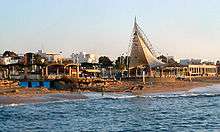
Sderot Ga'aton, the city's main boulevard, runs east-west from the Coastal Highway junction to the sea, and is divided down the middle by the Ga'aton River. Shaded by the thick greenery of towering eucalyptus trees and lined with numerous shops, boutiques, open-air cafes, restaurants and ice cream parlors, Sderot Ga'aton is Nahariya's main tourist attraction and its central business and entertainment district.[8] The beach area is an attraction in its own right, with a public park, a waterfront promenade, two public beaches, several hotels, a small marina and a lively nightlife in the multitude of beachfront cafes, bars, restaurants and nightclubs.
Transportation

Highway 4, the coastal highway, is the main north–south road in the city. Highway 89 starts at the Nahariya Junction in the city, and connects it with the rest of the Upper Galilee and Safed. Nahariya's public transportation hub is located at the eastern end of Sderot Ga'aton, near the intersection with Highway 4, and contains the city's train station and central bus station. Nahariya's train station is the northernmost station of the Israel Railways network. Sderot Ga'aton runs westward where the mouth of the Ga'aton River spills into the Mediterranean Sea.
Demographics
According to Israel Central Bureau of Statistics (CBS), in 2001 the ethnic makeup of the city was 97.3% Jewish and other non-Arabs, without significant Arab population. In 2001 there were 355 immigrants. See population groups in Israel. According to the CBS, in 2001 there were 22,200 males and 23,700 females. The population of the city was spread out with 29.5% 19 years of age or younger, 16.3% between 20 and 29, 18.8% between 30 and 44, 17.3% from 45 to 59, 4.1% from 60 to 64, and 13.9% 65 years of age or older. The population growth rate in 2001 was 4.2%.
Following Israel's withdrawal from Lebanon in 2000 many ex South Lebanon Army soldiers and officers who fled from Lebanon settled in Nahariya.
Schools and public institutions

According to the CBS, Nahariya has 22 schools with 7,541 students, which are divided into 15 elementary schools with 4,074 students, and 7 middle and high schools with 3,467 students. In 2001, high school (12th grade) matriculation rate in the city was 56.5%.
Nahariya Hospital, located on the outskirts of Nahariya, three kilometers (1.9 miles) from the city center, serves half a million residents of the western Galilee, from Karmiel to the coast. During the 2006 Lebanon War, the hospital was hit by rocket fire that destroyed an outer wall and eight rooms.[6]
Notable residents
- Stef Wertheimer (born 1926), German-born Israeli entrepreneur, industrialist, and politician
- Dalia Dorner, (born 1934), former Justice of the Supreme Court of Israel
- Gilad Shalit
Twin towns — Sister cities
Nahariya is twinned with:
 Alzey, Rhineland-Palatinate, Germany
- Offenbach, Hesse, Germany
- Darmstadt, Hesse, Germany
- Paderborn, NRW, Germany
 Issy-Les-Moulineaux, France
- Tempelhof, Berlin, Germany
- Bielefeld, NRW, Germany
 Miami Beach, Florida, United States
- Delray Beach, Florida, USA
 Kecskemét, Bács-Kiskun, Hungary
References
- ↑ "List of localities, in Alphabetical order" (PDF). Israel Central Bureau of Statistics. Retrieved 16 October 2016.
- ↑ http://news.discovery.com/history/archaeology/3400-year-old-citadel-found-in-basement-160106.htm
- ↑ Raphael Frankel and Israel Finkelstein, The Northwest Corner of Eretz-Israel in the Baraita ‘Boundaries of Eretz-Israel’, p. 43 (note 11) (Hebrew). (See: Finkelstein, Israel (1983). "'The Northwest Corner of Eretz-Israel' in the Baraita 'Boundaries of Eretz-Israel'". Cathedra: For the History of Eretz Israel and Its Yishuv. 27: 39–46. JSTOR 23398920. (registration required (help)).).
- 1 2 Asher Ovadiah and Carla Gomez de Silva (1981). "Supplementum to the Corpus of the Byzantine Churches in the Holy Land, Part I". Levant. 13: 200–261.
- ↑ Klaus Kreppel: Nahariya’s Early Years 1934-1949
- 1 2 Civilians Under Assault: Hezbollah's Rocket Attacks on Israel, Human Rights Watch
- ↑ Nahariya
- ↑ "Nahariya". Retrieved 2007-12-17.
External links
| Wikimedia Commons has media related to Nahariyya. |
| Wikivoyage has a travel guide for Nahariyya. |
- Official website (Hebrew)