Julis
Julis
| ||
|---|---|---|
| Hebrew transcription(s) | ||
| • ISO 259 | Ǧúlis | |
 | ||
| ||
 Julis | ||
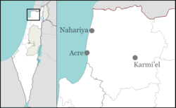
| Coordinates: 32°56′39″N 35°11′9″E / 32.94417°N 35.18583°ECoordinates: 32°56′39″N 35°11′9″E / 32.94417°N 35.18583°E | ||
| Grid position | 167/260 PAL | |
| District | Northern | |
| Government | ||
| • Type | Local council (from 1967) | |
| • Head of Municipality | Salman Amar[1] | |
| Area | ||
| • Total | 3,970 dunams (3.97 km2 or 1.53 sq mi) | |
| Population (2015)[2] | ||
| • Total | 6,118 | |

Julis (Arabic: جولس, Hebrew: ג'וּלִס)[3] is a Druze village and local council in the Northern District of Israel. In 2015 it had a population of 6,118.
Etymology
According to local legend, the name is derived from "Julius," the name of a Roman commander who camped in the area. Others say it is from the Arabic word for "sitting" - "jalis", as it is located on lower hills than the surrounding villages, and thus seems to be sitting.
History
Ottoman era
According to the 1596 Ottoman tax records Julis had a predominantly Muslim (Druze?) population, with a total of 79 households. The taxable produce comprised wheat, barley, "summer crops", fruit trees, and "goats and bees". Julis also had a press for olive oil or grape syrup.[4] During the 16th century there was also a small Jewish population.[5]
In the early part of the 18th century Julis was one of the major cotton producing villages in the area.[6] Later in the same century it was one of five villages in nahiya ("subdistrict") Sahil Akka (Acre coast), which were owned directly by the governor of Acre, and were exempt from the usual Ottoman taxes.[7]
A map by Pierre Jacotin from Napoleon's invasion of 1799 showed the place, named as Gioules.[8]
In 1875, the French explorer Victor Guérin visited the village, which he called Djoules.[9] He noted that "before arriving at Julis I came upon a small plateau pierced by many cisterns. The cisterns and the cut stones which are built up in the modern houses show that the place is the site of an ancient town or village. On a neighbouring hill a waly is consecrated to the Sheikh Aly.'"[10] In 1881, the Palestine Exploration Fund's Survey of Western Palestine described Julis as "a village built of stone containing about 200 Druzes, surrounded by olives and arable land."[11]
British rule
In the 1922 census of Palestine, conducted by the British Mandate authorities, Jules had a total population of 446 residents; 442 Druzes, 3 Christians and 1 Muslim.[12] All the Christians were Orthodox.[13]
In the 1931 census it had increased to a population of 614; 586 Druse, 26 Christians, and 2 Muslims, in a total of 123 houses.[14]
In 1945 the population of Julis was 820, all Arabs, and the total land area was 14,708 dunams, according to an official land and population survey.[15] Of this, 1,347 dunams were plantations and irrigable land, 6,568 used for cereals,[16] while 63 dunams were built-up (urban) land.[17]
State of Israel
.JPG)
Julis was captured by the Israeli army during Operation Dekel, 8–14 July 1948. Unlike many of the neighboring villages the inhabitants remained in their homes.[18]
In 1967, Julis achieved local council status. The head of the council was Salman Hino. At the end of 2007, the town had 5,400 residents.[19] The annual population growth rate was 1.8%. The residents are Druze.
In 2000, a high percentage (72.1%, compared to 60.3% in Tel Aviv) of all high school students received a matriculation certificate. The mean income was NIS 5,067 per month (2007), compared to a national average of NIS 6,743.
Landmarks
- Druze Center House[20]
- Maqam Shaykh al-Farsi - This is located to the south of the old village, consisting of two older buildings and a domed one. In an open area there are two cenotaphs with inscriptions which record the life of Shaykh al-Farsi. His date of death is given as 1167 H (1753-1754 C.E.).[21]
- Sheik Ali Faris cave - Located about 2 kilometers North-East of Julis. In this cave Sheik Ali Faris resided and did his contemplation.
Notable residents
References
- ↑ Mayor of Julis shoots contractor in argument
- ↑ "List of localities, in Alphabetical order" (PDF). Israel Central Bureau of Statistics. Retrieved 16 October 2016.
- ↑ Palmer, 1881, p.43
- ↑ Hütteroth and Abdulfattah, 1977, p. 191. Quoted in Petersen, 2001, p. 191
- ↑ Alex Carmel, Peter Schäfer and Yossi Ben-Artzi (1990). The Jewish Settlement in Palestine, 634–1881. Beihefte zum Tübinger Atlas des Vorderen Orients : Reihe B, Geisteswissenschaften; Nr. 88. Wiesbaden: Reichert. p. 94.
- ↑ Cohen, 1973, p. 12. Cited in Petersen, 2001, p.191
- ↑ Cohen, 1973, pp. 126, 133. Cited in Petersen, 2001, p. 191
- ↑ Karmon, 1960, p. 162
- ↑ Guérin, 1880, p. 8
- ↑ Guérin, 1880, p. 8, as translated by Conder and Kitchener, 1881, SWP I, p. 169
- ↑ Conder and Kitchener, 1881, SWP I, p. 146. Cited in Petersen, 2001, p. 191
- ↑ Barron, 1923, Table XI, Sub-district of Acre, p. 36
- ↑ Barron, 1923, Table XVI, p. 50
- ↑ Mills, 1932, p. 101
- ↑ Government of Palestine, Department of Statistics. Village Statistics, April, 1945. Quoted in Hadawi, 1970, p. 40
- ↑ Government of Palestine, Department of Statistics. Village Statistics, April, 1945. Quoted in Hadawi, 1970, p. 80
- ↑ Government of Palestine, Department of Statistics. Village Statistics, April, 1945. Quoted in Hadawi, 1970, p. 130
- ↑ Morris, 1987, p. 198
- ↑ "Table 3 - Population of Localities Numbering Above 1,000 Residents and Other Rural Population" (PDF). Israel Central Bureau of Statistics. 2008-06-30. Retrieved 2008-10-04.
- ↑ The Druze Center House - Hebrew Website
- ↑ Petersen, 2001, p.191
Bibliography
| Wikimedia Commons has media related to Julis. |
- Barron, J. B., ed. (1923). Palestine: Report and General Abstracts of the Census of 1922. Government of Palestine.
- Cohen, Amnon (1973). Palestine in the Eighteenth Century: Patterns of Government and Administration. Jerusalem: Magnes Press, Hebrew University. ISBN 1-59045-955-5. Cited in Petersen, (2001)
- Conder, Claude Reignier; Kitchener, H. H. (1881). The Survey of Western Palestine: Memoirs of the Topography, Orography, Hydrography, and Archaeology. 1. London: Committee of the Palestine Exploration Fund.
- Guérin, Victor (1880). Description Géographique Historique et Archéologique de la Palestine (in French). 3: Galilee, pt. 2. Paris: L'Imprimerie Nationale.
- Hadawi, Sami (1970). Village Statistics of 1945: A Classification of Land and Area ownership in Palestine. Palestine Liberation Organization Research Center.
- Hütteroth, Wolf-Dieter; Abdulfattah, Kamal (1977). Historical Geography of Palestine, Transjordan and Southern Syria in the Late 16th Century. Erlanger Geographische Arbeiten, Sonderband 5. Erlangen, Germany: Vorstand der Fränkischen Geographischen Gesellschaft. ISBN 3-920405-41-2. Cited in Petersen, 2001.
- Karmon, Y. (1960). "An Analysis of Jacotin's Map of Palestine" (PDF). Israel Exploration Journal. 10 (3,4): 155–173; 244–253.
- Mills, E., ed. (1932). Census of Palestine 1931. Population of Villages, Towns and Administrative Areas. Jerusalem: Government of Palestine.
- Morris, Benny (1987). The Birth of the Palestinian refugee problem, 1947-1949. Cambridge University Press. ISBN 0-521-33028-9.
- Palmer, E. H. (1881). The Survey of Western Palestine: Arabic and English Name Lists Collected During the Survey by Lieutenants Conder and Kitchener, R. E. Transliterated and Explained by E.H. Palmer. Committee of the Palestine Exploration Fund.
- Petersen, Andrew (2001). A Gazetteer of Buildings in Muslim Palestine (British Academy Monographs in Archaeology). 1. Oxford University Press. ISBN 978-0-19-727011-0.
External links
- News website of Julis
- Welcome To Julis
- Survey of Western Palestine, Map 3: IAA, Wikimedia commons
- Map, 1946