Rameh
Rameh
| |
|---|---|
| Hebrew transcription(s) | |
| • ISO 259 | Ráma |
| • Also spelled |
Rame (official) al-Rama (unofficial) |
 | |
 Rameh | |
| Coordinates: 32°56′21.3″N 35°22′1.61″E / 32.939250°N 35.3671139°ECoordinates: 32°56′21.3″N 35°22′1.61″E / 32.939250°N 35.3671139°E | |
| Grid position | 184/260 PAL |
| District | Northern |
| Government | |
| • Type | Local council (from 2005) |
| Area | |
| • Total | 6,118 dunams (6.118 km2 or 2.362 sq mi) |
| Population (2015)[1] | |
| • Total | 7,433 |
| Name meaning | "Lofty" or "Elevated"[2] |
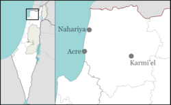
Rameh (Arabic: الرامة; Hebrew: רָמָה; also ar-Rame or ar-Rama) is an Arab town in the Northern District of Israel. Located east of Nahef and Karmiel, in 2015 it had a population of 7,433.
History
Edward Robinson identifies Rameh with the ancient Ramah of Asher (Joshua 19:29), citing its location and ancient sarcophagi discovered on a hill outside the village as evidence.[3]
The village is situated on an ancient site, atop a hill at the edge of Beit HaKerem Valley. To the east are remains of Roman baths, dating to the 2nd to 4th century, and oil presses from the same period. South and southeast are remains of buildings foundations, including an Aramaic inscription on a lintel, which indicate a 3rd to 4th century synagogue. To the northeast of the Roman bath are the remains of a large basilica. This was excavated in 1972, and very large column bases were found, together with polychrome mosaics representing fauna and flora.[4]
Many remains of pottery vessels dated to the Late Roman period (fourth–fifth centuries CE) have also been found,[5] together with building remains from the Byzantine period.[6]
Rameh was a major town during the rule of the Crusaders.
Ottoman era
In 1517, Rameh was with the rest of Palestine incorporated into the Ottoman Empire after it was captured from the Mamluks, and by 1596, it was a village under the administration of the nahiya ("subdistrict") of Akka, (Liwa ("District") of Safad), with a population of 96 households, all Muslim. It paid taxes on silk spinning (dulab harir),[7] goats, beehives, and a press that was used for processing either olives or grapes, in addition to paying a fixed, or lump sum.[8] A map from Napoleon's invasion of 1799 by Pierre Jacotin showed the place, named as "Ramah".[9]
The French explorer Victor Guérin visited the village in 1875, and found it to have 800 inhabitants, half Christian and half Druze.[10] In 1881 the Palestine Exploration Fund's Survey of Western Palestine (SWP) described it as "a village, built of stone, of good materials, containing a Greek chapel and about 600 Christians and 500 Druzes; it is situated in plains, with large olive-groves, gardens and vineyards; five perennial springs near the village, and several cisterns in it."[11]
British Mandate era
It was one of the largest villages in the Galilee during the period of Ottoman Empire control. In 1923, Rameh became the first village in Palestine to receive self-governing status granted by the British Mandate and had the largest olive orchards in the area. It was granted permission to self-govern through a village council.[12]
In the 1922 census of Palestine conducted by the British Mandate authorities, Al Rameh had a total population 847, 28 Muslims, 624 Christians, and 195 Druze.[13] Of the Christians, 474 were Orthodox, 47 Catholics, 102 Greek Catholic (Melchite) and 1 Maronite.[14] This had increased in the 1931 census of Palestine, when Er Rama had 254 houses, with a total population of 1142. Of these, 70 were Muslim, 746 Christians, and 326 Druze.[15]
In 1945 Er Rama had a population of 1,690; 90 Muslims, 1,160 Christians and 440 "others"(=Druze),[16] with 24,516 dunams of land, according to an official land and population survey.[17] Of this, 8,310 dunams were plantations and irrigable land, 3,078 used for cereals,[18] while 56 dunams were built-up land.[19]
State of Israel
It was captured by Haganah forces in 1948, becoming a part of Israel, and later achieving local council status in 1954.
Demography
51% of the residents of Rameh are Christian, 29% are Druze and 20% are Muslim.
Notable residents
In alphabetical order by surname, article excluded:
- Mira Awad (born 1975) - Israeli Arab singer, actress, and songwriter
- Angelina Fares (born 1989) - gymnast, 2007 Miss Israel beauty pageant contestant and subject of "Lady Kul El-Arab" documentary film; born in Rameh
- Basel Ghattas (born 1956) - Israeli Arab politician, Balad party, member of the Knesset (2013–2015-...)
- Archbishop Theodosios (Hanna) of Sebastia (born 1965) - Arab clergyman, Greek Orthodox Patriarchate of Jerusalem
- Hanna Mwais (1913–1981) - Israeli Arab politician, member of the Knesset for Hadash (1977-1981)
- Elias Nakhleh (1913-1990) - Israeli Arab politician, member of the Knesset (1959-1974)
- Samih al-Qasim (1939-2014) - Arab Israeli poet of Palestinian Druze descent
See also
References
- ↑ "List of localities, in Alphabetical order" (PDF). Israel Central Bureau of Statistics. Retrieved 16 October 2016.
- ↑ Palmer, 1881, p. 92
- ↑ Robinson, 1856, pp. 64-65.
- ↑ Dauphin, 1998, p. 705
- ↑ Cinamon, 2009, Er-Rama
- ↑ Dalali-Amos, 2011, Er-Rama
- ↑ Rhode, Harold (1979). "The Administration and Population of the Sancak of Safed in the Sixteenth Century". PhD dissertation, Columbia University. Retrieved 2014-10-10. See p. 145 for the silk tax, and p. 5 for the date.
- ↑ Hütteroth and Abdulfattah, 1977, p. 190
- ↑ Karmon, 1960, p. 166.
- ↑ Guérin, 1880, p. 453
- ↑ Conder and Kitchener, 1881, p. 204
- ↑ Survey of Palestine British Mandate of Palestine. Vol. 1, p.132.
- ↑ Barron, 1923, Table XI, Sub-district of Acre, p. 36
- ↑ Barron, 1923, Table XVI, p. 50
- ↑ Mills, 1932, p. 102
- ↑ Department of Statistics, 1945, p. 4
- ↑ Government of Palestine, Department of Statistics. Village Statistics, April, 1945. Quoted in Hadawi, 1970, p. 41
- ↑ Government of Palestine, Department of Statistics. Village Statistics, April, 1945. Quoted in Hadawi, 1970, p. 81
- ↑ Government of Palestine, Department of Statistics. Village Statistics, April, 1945. Quoted in Hadawi, 1970, p. 131
Bibliography
| Wikimedia Commons has media related to Rameh. |
- Barron, J. B., ed. (1923). Palestine: Report and General Abstracts of the Census of 1922. Government of Palestine.
- Conder, Claude Reignier; Kitchener, H. H. (1881). The Survey of Western Palestine: Memoirs of the Topography, Orography, Hydrography, and Archaeology. 1. London: Committee of the Palestine Exploration Fund.
- Cinamon, Gilad (2009-05-04). "Er-Rama Final Report" (121). Hadashot Arkheologiyot – Excavations and Surveys in Israel.
- Dalali-Amos, Edna (2011-09-26). "Er-Rama Final Report" (123). Hadashot Arkheologiyot – Excavations and Surveys in Israel.
- Dauphin, Claudine (1998). La Palestine byzantine, Peuplement et Populations. BAR International Series 726 (in French). III : Catalogue. Oxford: Archeopress. ISBN 0-860549-05-4.
- Department of Statistics (1945). Village Statistics, April, 1945. Government of Palestine.
- Guérin, Victor (1880). Description Géographique Historique et Archéologique de la Palestine (in French). 3: Galilee, pt. 1. Paris: L'Imprimerie Nationale.
- Hadawi, Sami (1970). Village Statistics of 1945: A Classification of Land and Area ownership in Palestine. Palestine Liberation Organization Research Center.
- Hütteroth, Wolf-Dieter; Abdulfattah, Kamal (1977). Historical Geography of Palestine, Transjordan and Southern Syria in the Late 16th Century. Erlanger Geographische Arbeiten, Sonderband 5. Erlangen, Germany: Vorstand der Fränkischen Geographischen Gesellschaft. ISBN 3-920405-41-2.
- Karmon, Y. (1960). "An Analysis of Jacotin's Map of Palestine" (PDF). Israel Exploration Journal. 10 (3,4): 155–173; 244–253.
- Mills, E., ed. (1932). Census of Palestine 1931. Population of Villages, Towns and Administrative Areas (PDF). Jerusalem: Government of Palestine.
- Palmer, E. H. (1881). The Survey of Western Palestine: Arabic and English Name Lists Collected During the Survey by Lieutenants Conder and Kitchener, R. E. Transliterated and Explained by E.H. Palmer. Committee of the Palestine Exploration Fund.
- Robinson, Edward; Smith, Eli (1856). Biblical Researches in Palestine and adjacent regions: A Journal of Travels in the years 1838 and 1852, 2nd edition. 3. London: John Murray.
- Rhode, Harold (1979). Administration and Population of the Sancak of Safed in the Sixteenth Century. Columbia University.
- van de Velde, Carel Willem Meredith (1858). Memoir to Accompany the Map of the Holy Land. Gotha: Justus Perthes. (p. 341)
External links
- Welcome To al-Rama
- Survey of Western Palestine, Map 4: IAA, Wikimedia commons
- Rame, Dov. Gutterman