Kaukab Abu al-Hija
Kaukab Abu al-Hija
| |
|---|---|
| Hebrew transcription(s) | |
| • ISO 259 | Kawkaḅ ˀabbu ˀel-Hiǧaˀ |
| • Also spelled |
Kaokab Abu Al-Hija (official) Kawkab Abu al-Heija (unofficial) |
 | |
 Kaukab Abu al-Hija | |
| Coordinates: 32°49′52.83″N 35°14′55.33″E / 32.8313417°N 35.2487028°ECoordinates: 32°49′52.83″N 35°14′55.33″E / 32.8313417°N 35.2487028°E | |
| Grid position | 173/248 PAL |
| District | Northern |
| Government | |
| • Type | Local council (from 1984) |
| • Head of Municipality | Zaher Saleh |
| Area | |
| • Total | 2,567 dunams (2.567 km2 or 634 acres) |
| Population (2015)[1] | |
| • Total | 3,356 |
| Name meaning | Abu al-Hija's Star |
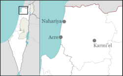
Kaukab Abu al-Hija (Arabic: كوكب أبو الهيجا; Hebrew: כַּוּכַּבּ אַבּוּ אל-הִיגַ'א), often simply Kaukab, (meaning "star" in Arabic),[2] is an Arab Muslim village and local council in the Northern District of Israel, in the Lower Galilee. It is located on Road 784, between Shefa-'Amr and Karmiel, and next to Kafr Manda. Kaukab was historically under the control of the Abu al-Hija family of the Galilee.[3]
In 2015 it had a population of 3,356,[4] and in 2008 was ranked low (3/10) on the Israeli socio-economic scale. Its jurisdiction is 2,567 dunams.[5]
History
Hellenistic through Byzantine periods
It is possible to discern the ruins of Greek, Roman, and Byzantine settlements on Kaukab's location, and it might be the location of the town Kokhva, mentioned in the Talmud,[6] however, many places in the area shared the name, and one cannot know which one was Kokhva.[7]
Ayyubid period
Kaukab was founded next to a grave attributed to Hussam ad-Din Abu al-Hija, one of Saladin's lieutenants, and is holy to the local Muslims. It is thus named Kaukab Abu al-Hija to differentiate it from several other Arab villages with the same name.[6][8][9]
The village was one of the "Al-Hija" villages founded by relatives of Emir Hussam al-Din Abu al-Hija.[9] Abu al-Hija ("the Daring") was an Iraqi Kurd and commander of the Kurdish forces that took part in Sultan Saladin's conquest of the Crusader Kingdom in the 1180s. He was renowned for his bravery, and commanded the garrison of Acre at the time of the Siege of Acre (1189–1192).
Abu al-Hija apparently returned to Iraq, but several members of his family remained in the country under orders from Saladin, and these family members settled on spacious tracts of land that they were granted in the Carmel region, in the Lower, Eastern and Western Galilee, and in the Hebron Highlands.[9] Other al-Hija villages were Hadatha and Sirin in the Lower Galilee, Ruweis in Western Galilee, and Ein Hawd on Mount Carmel. By tradition the residents today still claim to be blood relations of al-Hija.[9]
Emir Hassam returned to Iraq after Saladin's conquest of Jerusalem in 1187, and he apparently died and was buried there. His relatives who stayed behind in Palestine however, very much aware of his fame, declared Kaukab to be his burial place.[9]
Ottoman era
In 1517, the village was incorporated into the Ottoman Empire with the rest of Palestine, and in 1596 it appeared in the Ottoman tax registers under the name of "Kawkab Bani Krad" as being in the nahiya (subdistrict) of Akka under the Liwa of Safad, with a population of 41 households and 8 bachelors, all Muslim. It paid taxes on a number of crops, including wheat and barley, summer crops, fruit trees, as well as on goats and/or beehives.[10]
In 1875, the French explorer Victor Guérin visited Kaukab, and described it as a small village with about 250 inhabitants, situated on a mountain at an altitude of 425 meters above the sea level. He also noted a waly dedicated to Sheikh Ali. "Wali" is the term used by 19th-century scholars for a maqam, a Muslim shrine or mausoleum dedicated to a holy man[7]
British Mandate period
In the 1922 census of Palestine, conducted by the British Mandate authorities, Kaukab had a total population of 222, all Muslim,[11] which had increased in the 1931 census to 285, still all Muslim, in a total of 57 houses.[12]
In 1938, during the 1936–1939 Arab revolt in Palestine, the village was destroyed and its threshing floors burnt by British troops during a revenge mission.[13] In 1945, the population was 490, all Arabs, with 18,674 dunams of land, according to an official land and population survey.[14] Of this, 332 dunams were for plantations and irrigable land, 1,657 for cereals,[15] while 10 dunams were built-up land.[16]
1948 war and after
During Operation Hiram (29-31 October 1948) the village surrendered to the advancing Israeli army. Many of the villagers fled north but some stayed and were not expelled by the Israeli soldiers.[17] The village remained under Martial Law until 1966.
In 1973, the population had grown to 1,340. Kaukab was declared a local council in 1984.[3]
Shrine of Abu al-Hija

To the north of the village is the traditional shrine and tomb of Hassam Abu al-Hija[9] (also spelled Abu al-Hayja), a two-domed structure with a courtyard to the north. In the rectangular courtyard, there are two cenotaphs, one on each side of the door entering the shine. The cenotaph to the west of the door belongs to Ali Badawi Abu al-Hija, who died in 1183 H (1769 CE), the one east of the door carries an inscription dated to 1181 H (1767-1768 CE). Entering the shrine is done into the eastern domed chamber. This is a prayer chamber, and has a mihrab (prayer niche) set into the south wall. The next chamber has two cenotaphs, one which belong to the founder of the al-Hija villages of the Galillee.[18][19]
The village's cemetery surrounds the tomb. There are two other major tombs in the village: that of sheikhs Hassan and Sayeed, the latter a companion of Emir Hassam ad-Din al-Hija.[20]
Sculptures for Peace
After the signing of the Oslo agreements in 1993, the idea of establishing a sculpture garden in Kaukab was initiated by Kaukab local council together with Beit Hagefen, the Arab-Jewish Centre in Haifa. The garden was dedicated to the concept of peace and coexistence. The sculpture garden extends over two hill tops with other pieces scattered around the village and its entrance. The sculptures were donated by Israeli Arab and Jewish artists, and Palestinian artists.[21]
See also
- Ein Hod, another village which developed on lands previously owned by Hussam al-Din Abu al-Hija's family
- Arab localities in Israel
References
- ↑ "List of localities, in Alphabetical order" (PDF). Israel Central Bureau of Statistics. Retrieved 16 October 2016.
- ↑ Palmer, 1881, p.110
- 1 2 Kaokab Abu Al-Hija (Israel) Gutterman, Dov. Flags of the World.
- ↑ "Table 3 - Population of Localities Numbering Above 1,000 Residents and Other Rural Population" (PDF). Israel Central Bureau of Statistics. 2007-12-31. Retrieved 2008-05-26.
- ↑ "Local Authorities in Israel 2005, Publication #1295 - Municipality Profiles - Kaukab Abu al-Hija" (PDF) (in Hebrew). Israel Central Bureau of Statistics. Retrieved 2008-05-27.
- 1 2 HaReuveni, Immanuel (1999). Lexicon of the Land of Israel (in Hebrew). Miskal - Yedioth Ahronoth Books and Chemed Books. p. 476. ISBN 965-448-413-7.
- 1 2 Guérin, 1880, p. 488
- ↑ Vilnai, Ze'ev (1976). "Kaukab". Ariel Encyclopedia (in Hebrew). Volume 4. Israel: Am Oved. p. 3524.
- 1 2 3 4 5 6 Meron Benvenisti (2002). Sacred Landscape: The Buried History of the Holy Land Since 1948. University of California. pp. 193–195. ISBN 9780520234222. Retrieved 2 May 2015.
- ↑ Hütteroth and Abdulfattah, 1977, p. 194
- ↑ Barron, 1923, Table XI, Sub-district of Nazareth, p. 38
- ↑ Mills, 1932, p. 74
- ↑ Jacob Norris (2008). "Repression and Rebellion: Britain's response to the Arab Revolt in Palestine of 1936-39". The Journal of Imperial and Commonwealth History. 36: 25–45. doi:10.1080/03086530801889350.
- ↑ Government of Palestine, Department of Statistics. Village Statistics, April, 1945. Quoted in Hadawi, 1970, p. 62
- ↑ Government of Palestine, Department of Statistics. Village Statistics, April, 1945. Quoted in Hadawi, 1970, p. 109
- ↑ Government of Palestine, Department of Statistics. Village Statistics, April, 1945. Quoted in Hadawi, 1970, p. 159
- ↑ Morris, 1987, p. 226
- ↑ Petersen, 2001, pp. 196-197
- ↑ Slyomovics, 1998, pp, 130 -131.
- ↑ Slyomovics, Susan (1998). The object of memory: Arab and Jew narrate the Palestinian village (Illustrated ed.). University of Pennsylvania Press. ISBN 0-8122-1525-7.
- ↑ http://mfa.gov.il/MFA/MFA-Archive/1999/Pages/Sculptures%20for%20Peace%20at%20Kaukab%20Abu%20El-Hija.aspx
Bibliography
| Wikimedia Commons has media related to Kaukab Abu al-Hija. |
- Barron, J. B., ed. (1923). Palestine: Report and General Abstracts of the Census of 1922. Government of Palestine.
- Conder, Claude Reignier; Kitchener, Herbert H. (1881). The Survey of Western Palestine: Memoirs of the Topography, Orography, Hydrography, and Archaeology. 1. London: Committee of the Palestine Exploration Fund. ( p.268 )
- Guérin, Victor (1880). Description Géographique Historique et Archéologique de la Palestine (in French). 3: Galilee, pt. 1. Paris: L'Imprimerie Nationale.
- Hadawi, Sami (1970). Village Statistics of 1945: A Classification of Land and Area ownership in Palestine. Palestine Liberation Organization Research Center.
- Hütteroth, Wolf-Dieter; Abdulfattah, Kamal (1977). Historical Geography of Palestine, Transjordan and Southern Syria in the Late 16th Century. Erlanger Geographische Arbeiten, Sonderband 5. Erlangen, Germany: Vorstand der Fränkischen Geographischen Gesellschaft. ISBN 3-920405-41-2.
- Mills, E., ed. (1932). Census of Palestine 1931. Population of Villages, Towns and Administrative Areas. Jerusalem: Government of Palestine.
- Morris, Benny (1987). The Birth of the Palestinian refugee problem, 1947-1949. Cambridge University Press. ISBN 0-521-33028-9.
- Palmer, E. H. (1881). The Survey of Western Palestine: Arabic and English Name Lists Collected During the Survey by Lieutenants Conder and Kitchener, R. E. Transliterated and Explained by E.H. Palmer. Committee of the Palestine Exploration Fund.
- Petersen, Andrew (2001). A Gazetteer of Buildings in Muslim Palestine (British Academy Monographs in Archaeology). 1. Oxford University Press. ISBN 978-0-19-727011-0.
- Robinson, Edward; Smith, Eli (1856). Later Biblical Researches in Palestine and adjacent regions: A Journal of Travels in the year 1852. London: John Murray. (Robinson and Smith, 1856, pp. 104-105)
- Slyomovics, Susan (1998). The object of memory: Arab and Jew narrate the Palestinian village (Illustrated ed.). University of Pennsylvania Press. ISBN 0-8122-1525-7. (winner of the 1999 Albert Hourani Book Award)
External links
- Kawkab Abu El-Haija photos, by Dr. Moslih Kanaaneh
- Welcome To Kawkab Abu al-Heija
- Survey of Western Palestine, Map 5: IAA, Wikimedia commons