Daburiyya
Daburiyya
| |
|---|---|
| Hebrew transcription(s) | |
| • ISO 259 | Dabburiya |
| • Also spelled | Deburieh (unofficial) |
 | |
 Daburiyya | |
| Coordinates: 32°41′31″N 35°22′18″E / 32.69194°N 35.37167°ECoordinates: 32°41′31″N 35°22′18″E / 32.69194°N 35.37167°E | |
| Grid position | 185/232 PAL |
| District | Northern |
| Government | |
| • Type | Local council (from 1961) |
| Area | |
| • Total | 7,200 dunams (7.2 km2 or 2.8 sq mi) |
| Population (2015)[1] | |
| • Total | 9,889 |

Daburiyya (Arabic: دبورية; Hebrew: דַבּוּרִיָּה),[2] also Deburieh or Dabburieh, is an Arab village ca. 8 km. east of Nazareth in Israel's Northern District. Daburriya gained local council status in 1961. Its jurisdiction extends over 7,200 dunams. In 2015 it had a population of 9,889.
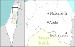
Daburiyya is located off of Highway 65 at the foot of Mount Tabor in the Lower Galilee, near the area where the prophetess Deborah judged.
History
Daburiyya is identified with the biblical city of Daberath (also spelled Davrat), which in Joshua 21:28 and in the Book of Chronicles was allotted to the tribe of Issachar, who gave it as a Levitical city to the Levites.[3][4] Its Greek name was Dabráth or Dabiroth and its Latin name was Dabareth.[4] Josephus called it Dabarittha (Greek: Δαβαρίθθων).[4][5]
Daburiyya has been identified with the locality of Helenopolis of the Roman-Byzantine period,[6] but Helenopolis is more commonly identified with Kafr Kama[7] or other town or region.[8][9][10]
Remains of a Crusader church can still be seen in Daburiyya (in the center of the town).[11] Daburiyya fell to Saladin in 1187[12] and a mosque, possibly constructed above an old Crusader tower,[13] has an inscription above the entrance stating that it was built in 610 H (1214 CE) by the Damascus-based Ayyubid ruler al-Mu'azzam 'Isa.[14]
Ottoman era
In 1517, the village was incorporated into the Ottoman Empire with the rest of Palestine, and in 1596 Dabburiya appeared in the Ottoman tax registers as being in the nahiya (subdistrict) of Tabariyya under the Liwa of Safad, with a population of 40 households and 3 bachelors, all Muslim. It paid taxes on a number of crops, including wheat and barley, fruit trees, cotton, as well as on goats and/or beehives.[15][16]
A map from Napoleon's invasion of 1799 by Pierre Jacotin showed the place, named as Dabouri.[17]
Victor Guérin visited in the 1875, and noted "Among the houses may be remarked the remains of an ancient edifice, measuring twenty-two paces in length by ten in breadth, and built from west to east. It was once constructed of cut stones and a certain number of courses are still standing. The interior is now occupied by a private house and a stable, above which rises the medafeh—a house set apart for strangers. In all probability this was a Christian Church.[18]
In 1881, the Palestine Exploration Fund's Survey of Western Palestine (SWP) described Deburieh as "A small village built of stone, with inhabited caves; contains about 200 Moslems and is surrounded by gardens of figs and olives. It is situated on the slope of the hill. Water is obtained from cisterns in the village."[19]
British Mandate era
In the 1922 census of Palestine, conducted by the British Mandate authorities, Dabburieh had a total population of 602, all Muslim,[20] which had increased in the 1931 census to 747; 728 Muslims and 19 Christians, in a total of 170 houses.[21]
In 1945 the population was 1,290, 1,260 Muslims and 30 Christians,[22] with 13,373 dunams of land, according to an official land and population survey.[23] Of this, 723 dunams were for plantations and irrigable land, 12,581 for cereals,[24] while 65 dunams were built-up land.[25]
Contemporary events
In 2008 and 2009 Daburiyya High School received the National Education Award, achieving second and third place. It was the first time that a school in Israel has won the award twice in a row. The principal, Abed Elsalam Masalcha, attributed the positive developments in the school to the introduction of a Transcendental Meditation program which solved student discipline problems.[26]
In 2009 the Israeli Education Ministry said it would shut down the town's high school of sciences, which had 210 students that year, because it was operating without a permit. The school, located in a building intended for a housing project, specialized in biology, physics, chemistry and computer science and had a 100% matriculation success rate. It was a branch of the I'billin-based Mar Elias School. According to the local parents' association, the school was opened because the local high school had become "chaotic and the police needed to frequently intervene between students."[27]
Archaeology
Archaeological excavations conducted in the village in 2004 and 2006 uncovered the remains of buildings from the Late Roman or Byzantine periods, a wall formation probably from the Middle Bronze Age or the Roman period, potsherds from the Iron Age and Hellenistic periods, and other installations such as winepresses and cupmarks.[28][29]
See also
References
- ↑ "List of localities, in Alphabetical order" (PDF). Israel Central Bureau of Statistics. Retrieved 16 October 2016.
- ↑ Palmer, 1881, p. 125
- ↑ Keil, 1857, p. 424.
- 1 2 3 Sharon, 2004, p. 1
- ↑ Josephus, The Jewish War (Book II, chapter XXI, verse 3).
- ↑ F. M. Abel (1938). Géographie de la Palestine. 2. Paris. pp. 205, 347.
- ↑ Yoram Tsafrir, Leah Di Segni and Judith Green (1994). Tabula Imperii Romani: Judaea, Palaestina. Jerusalem: Israel Academy of Sciences and Humanities. p. 142.
- ↑ James F. Strange. "Nazareth". Anchor Bible Dictionary. p. 1050.
- ↑ Petersen, 2005, p. X
- ↑ Michael Avi-Yonah (1976). Gazetteer of Roman Palestine. QEDEM 5. Institute of Archaeology, Hebrew University of Jerusalem, and CARTA. p. 64.
- ↑ Pringle, 1993, pp. 192, 193
- ↑ Abu Shama (RHC or, IV, pp. 301, 303), cited in Pringle, 1993, p. 192
- ↑ Pringle, 1997, p. 46
- ↑ Petersen, 2001, p. 131
- ↑ Hütteroth and Abdulfattah, 1977, p. 189
- ↑ Note that Rhode, 1979, p. 6 writes that the register that Hütteroth and Abdulfattah studied from the Safad-district was not from 1595/6, but from 1548/9
- ↑ Karmon, 1960, p. 167.
- ↑ Guérin, 1880, p. 140 ff, as translated by Conder and Kitchener, 1881, p. 384
- ↑ Conder and Kitchener, 1881, p. 363.
- ↑ Barron, 1923, Table XI, Sub-district of Nazareth, p. 38
- ↑ Mills, 1932, p. 73
- ↑ Department of Statistics, 1945, p. 8
- ↑ Government of Palestine, Department of Statistics, Village Statistics, April, 1945. Quoted in Hadawi, 1970, p. 62
- ↑ Government of Palestine, Department of Statistics. Village Statistics, April, 1945. Quoted in Hadawi, 1970, p. 109
- ↑ Government of Palestine, Department of Statistics. Village Statistics, April, 1945. Quoted in Hadawi, 1970, p. 159
- ↑ Forim, Jack. Transcendental Meditation. (2012). Hay House, Inc. ISBN 140193157X
- ↑ Arab parents battle ministry over science HS. Haaretz. 2009-10-18.
- ↑ Abu Raya, Rafeh (April 2009). "Dabburiya, Final Report". Retrieved 2010-08-28.
- ↑ Daniel, Zohar (February 2010). "Dabburiya, Final Report". Retrieved 2010-08-28.
Bibliography
| Wikimedia Commons has media related to Daburiyya. |
- Abu Raya, Rafeh (2009-04-30). "Dabburiya Final Report" (121). Hadashot Arkheologiyot – Excavations and Surveys in Israel.
- Barron, J. B., ed. (1923). Palestine: Report and General Abstracts of the Census of 1922. Government of Palestine.
- Conder, Claude Reignier; Kitchener, Herbert H. (1881). The Survey of Western Palestine: Memoirs of the Topography, Orography, Hydrography, and Archaeology. 1. London: Committee of the Palestine Exploration Fund. p 366
- Daniel, Zohar (2010-02-22). "Dabburiya Final Report" (122). Hadashot Arkheologiyot – Excavations and Surveys in Israel.
- Department of Statistics (1945). Village Statistics, April, 1945. Government of Palestine.
- Guérin, Victor (1880). Description Géographique Historique et Archéologique de la Palestine (in French). 3: Galilee, pt. 1. Paris: L'Imprimerie Nationale.
- Hadawi, Sami (1970). Village Statistics of 1945: A Classification of Land and Area ownership in Palestine. Palestine Liberation Organization Research Center.
- Hanna, Butros (2011-12-29). "Dabburiya Final Report" (123). Hadashot Arkheologiyot – Excavations and Surveys in Israel.
- Hanna, Butros (2012-12-31). "Dabburiya, Har Devora, Survey Final Report" (124). Hadashot Arkheologiyot – Excavations and Surveys in Israel.
- Hütteroth, Wolf-Dieter; Abdulfattah, Kamal (1977). Historical Geography of Palestine, Transjordan and Southern Syria in the Late 16th Century. Erlanger Geographische Arbeiten, Sonderband 5. Erlangen, Germany: Vorstand der Fränkischen Geographischen Gesellschaft. ISBN 3-920405-41-2.
- Karmon, Y. (1960). "An Analysis of Jacotin's Map of Palestine" (PDF). Israel Exploration Journal. 10 (3,4): 155–173; 244–253.
- Keil, Carl Friedrich (1857). "Commentary on the Book of Joshua". T. & T. Clark
- Mills, E., ed. (1932). Census of Palestine 1931. Population of Villages, Towns and Administrative Areas (PDF). Jerusalem: Government of Palestine.
- Palmer, E. H. (1881). The Survey of Western Palestine: Arabic and English Name Lists Collected During the Survey by Lieutenants Conder and Kitchener, R. E. Transliterated and Explained by E.H. Palmer. Committee of the Palestine Exploration Fund.
- Petersen, Andrew (2001). A Gazetteer of Buildings in Muslim Palestine (British Academy Monographs in Archaeology). 1. Oxford University Press. ISBN 978-0-19-727011-0.
- Petersen, Andrew (2005). The Towns of Palestine under Muslim Rule AD 600–1600. Archaeopress.
- Pringle, Denys (1993). The Churches of the Crusader Kingdom of Jerusalem: A-K (excluding Acre and Jerusalem). I. Cambridge University Press. ISBN 0 521 39036 2.
- Pringle, Denys (1997). Secular buildings in the Crusader Kingdom of Jerusalem: an archaeological Gazetter. Cambridge University Press. ISBN 0521 46010 7.
- RHC Or: Recueil des historiens des croisades : Historiens orientaux (in French). 4. Paris: Imprimerie nationale. 1898.
- Rhode, Harold (1979). Administration and Population of the Sancak of Safed in the Sixteenth Century. Columbia University.
- Robinson, Edward; Smith, Eli (1841). Biblical Researches in Palestine, Mount Sinai and Arabia Petraea: A Journal of Travels in the year 1838. 3. Boston: Crocker & Brewster. p, 210 179
- Sharon, Moshe (2004). Corpus Inscriptionum Arabicarum Palaestinae, D-F. 3. BRILL.
- le Strange, Guy (1890). Palestine Under the Moslems: A Description of Syria and the Holy Land from A.D. 650 to 1500. Committee of the Palestine Exploration Fund. p. 427
- Yoram Tsafrir, Leah Di Segni and Judith Green (1994). (TIR): Tabula Imperii Romani: Judaea, Palaestina. Jerusalem: Israel Academy of Sciences and Humanities. ISBN 9652081078.
- Wilson, Charles Williams, ed. (c. 1881). Picturesque Palestine, Sinai and Egypt. 2. New York: D. Appleton. (p. 44)
External links
- Welcome To Dabburiya
- Survey of Western Palestine, Map 6: IAA, Wikimedia commons
- Finds from a Burial Cave at Daburriya
- Israeli-Arab lifestyle change may create old-age home boom