Abu Snan
Abu Snan
| ||
|---|---|---|
| Hebrew transcription(s) | ||
| • ISO 259 | ʔabbu-Snaˀn | |
| ||
 Abu Snan | ||
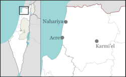
| Coordinates: 32°57′N 35°10′E / 32.950°N 35.167°ECoordinates: 32°57′N 35°10′E / 32.950°N 35.167°E | ||
| Grid position | 166/262 PAL | |
| District | Northern | |
| Government | ||
| • Type | Local council | |
| Area | ||
| • Total | 4,750 dunams (4.75 km2 or 1.83 sq mi) | |
| Population (2015)[1] | ||
| • Total | 13,358 | |
| Name meaning | "Produsing pasturage, especially such plants as "sorrel""[2] | |

Abu Snan (Arabic: أبو سنان, Hebrew: אַבּוּ סְנָן) is an Arab local council in the Galilee region of northern Israel, with an area of 4,750 dunams (4.75 km²). It achieved recognition as an independent local council in 1964. It is a religiously mixed town, with a Muslim majority and sizable Druze and Christian minorities.
History
Abu Snan is an ancient village site, where old dressed stones have been reused in modern houses. Graves, oil or vine -presses, and cisterns have been found cut in rock.[3]
Crusaders
In about 1250 Abu Snan is noted as a casale of the Teutonic Knights, called Busnen.[4] Under the name Tusyan, probably a corruption of Busenan, Abu Snan was mentioned as part of the domain of the Crusaders during the hudna between the Crusaders based in Acre and the Mamluk sultan al-Mansur (Qalawun) declared in 1283.[5] No Crusader remains have yet been identified in the village.[6]
Ottoman period
In 1517, Abu Snan was with the rest of Palestine incorporated into the Ottoman Empire after it was captured from the Mamluks, and by 1596, it appeared in the Ottoman tax registers as part of the Nahiya of Akka of the Liwa of Safad. It had a population of 102 households and 3 bachelors, all Muslims.[7]
A map by Pierre Jacotin from Napoleon's invasion of 1799 showed the place, named as Abou Senan.[8] When French explorer Victor Guérin visited the village in 1875, he estimated the population of Abu Snan to be 400, of whom 260 were Druzes and 140 Greek Orthodox Christians.[9] Guérin also wrote that "Abu Senan has succeeded an ancient town, as is proved by cisterns cut in rock, and a considerable quantity of cut-stones, now used for modern buildings."[10] Fragments from an older building is used in a chapel for St. George.[11]
In 1881, the Palestine Exploration Fund's Survey of Western Palestine described Abu Snan as a stone-built village situated on the low hill near the plain, surrounded by olive groves and arable land, and with many cisterns of rain-water. The population consisted of 150 Christians and 100 Muslims.[12]
British rule

In the 1922 census of Palestine, conducted by the British Mandate authorities, Abu Snan had a total population of 518. Of these, 43 were Muslim, 228 Druzes and 247 Christians.[13] Of Abu Snan's 247 Christians, 196 were Orthodox, 44 Roman Catholics, 4 Melkites and 3 Maronites.[14] In the 1931 census it had increased to a population of 605, in 102 inhabited houses. Of these, 20 were Muslim, 274 Christians, and 311 Druzes.[15]
In 1945 the population of Abu Snan was 820; 30 Muslims, 380 Christians and 410 other Arabs,[16] and the land area was a total of 13,043 dunams, according to an official land and population survey.[17] 2,172 dunams were plantations and irrigable land, 7,933 used for cereals,[18] while 69 dunams were built-up (urban) land.[19]
Demographics
Abu Snan had a population of 13,000 (2014), 7,000 of whom are Muslim, 4,000 Druze, and 2,000 Christian.[20]
Income
According to Israel's Central Bureau of Statistics, the town had a low ranking (3 out of 10) on the country's socioeconomic index (December 2001). Only 63.6% of students are entitled to a matriculation certificate after Grade 12 (2000). The average salary that year was NIS 3,629 per month, whereas the national average was NIS 6,835.
See also
References
- ↑ "List of localities, in Alphabetical order" (PDF). Israel Central Bureau of Statistics. Retrieved 16 October 2016.
- ↑ Palmer, 1881, p. 37
- ↑ Dauphin, 1998, p. 639
- ↑ Conder and Kitchener, 1881, p 153
- ↑ Barag, 1979, p. 204
- ↑ Pringle, 1997, p. 119
- ↑ Hütteroth and Abdulfattah, 1977, p. 191
- ↑ Karmon, 1960, p. 162.
- ↑ Guérin, 1880, p. 21, as translated by Conder and Kitchener, 1881, p. 144
- ↑ Guérin, 1880, p. 21, as translated by Conder and Kitchener, 1881, p. 160
- ↑ Dauphin, 1998, p. 639
- ↑ Conder and Kitchener, 1881, SWP I, p. 144
- ↑ Barron, 1923, Table XI, Sub-district of Acre, p. 36
- ↑ Barron, 1923, Table XVI, p. 50
- ↑ Mills, 1932, p. 99
- ↑ Department of Statistics, 1945, p. 4
- ↑ Government of Palestine, Department of Statistics. Village Statistics, April, 1945. Quoted in Hadawi, 1970, p. 40
- ↑ Government of Palestine, Department of Statistics. Village Statistics, April, 1945. Quoted in Hadawi, 1970, p. 80
- ↑ Government of Palestine, Department of Statistics. Village Statistics, April, 1945. Quoted in Hadawi, 1970, p. 130
- ↑ Hassan Shaalan, 'Muslim-Druze clashes started over kaffiyeh dispute,' Ynet 15 November 2014.
Bibliography
| Wikimedia Commons has media related to Abu Sinan. |
- Av‘iam, Mordechai (1996). "Abu Sinan" (15). Hadashot Arkheologiyot – Excavations and Surveys in Israel.
- Barag, Dan (1979). "A new source concerning the ultimate borders of the Latin Kingdom of Jerusalem". Israel Exploration Journal. 29: 197–217.
- Barron, J. B., ed. (1923). Palestine: Report and General Abstracts of the Census of 1922. Government of Palestine.
- Conder, Claude Reignier; Kitchener, Herbert H. (1881). The Survey of Western Palestine: Memoirs of the Topography, Orography, Hydrography, and Archaeology. 1. London: Committee of the Palestine Exploration Fund.
- Dauphin, Claudine (1998). La Palestine byzantine, Peuplement et Populations. BAR International Series 726 (in French). III : Catalogue. Oxford: Archeopress. ISBN 0-860549-05-4.
- Department of Statistics (1945). Village Statistics, April, 1945. Government of Palestine.
- Guérin, Victor (1880). Description Géographique Historique et Archéologique de la Palestine (in French). 3: Galilee, pt. 2. Paris: L'Imprimerie Nationale.
- Hadawi, Sami (1970). Village Statistics of 1945: A Classification of Land and Area ownership in Palestine. Palestine Liberation Organization Research Center.
- Hütteroth, Wolf-Dieter; Abdulfattah, Kamal (1977). Historical Geography of Palestine, Transjordan and Southern Syria in the Late 16th Century. Erlanger Geographische Arbeiten, Sonderband 5. Erlangen, Germany: Vorstand der Fränkischen Geographischen Gesellschaft. ISBN 3-920405-41-2.
- Karmon, Y. (1960). "An Analysis of Jacotin's Map of Palestine" (PDF). Israel Exploration Journal. 10 (3,4): 155–173; 244–253.
- Mills, E., ed. (1932). Census of Palestine 1931. Population of Villages, Towns and Administrative Areas (PDF). Jerusalem: Government of Palestine.
- Palmer, E. H. (1881). The Survey of Western Palestine: Arabic and English Name Lists Collected During the Survey by Lieutenants Conder and Kitchener, R. E. Transliterated and Explained by E.H. Palmer. Committee of the Palestine Exploration Fund.
- Pringle, Denys (1997). Secular buildings in the Crusader Kingdom of Jerusalem: an archaeological Gazetter. Cambridge University Press. ISBN 0521 46010 7.
External links
- Welcome To Abu Sinan
- Survey of Western Palestine, Map 3: IAA, Wikimedia commons