Bergholz, Ohio
| Bergholz, Ohio | |
|---|---|
| Village | |
|
Bergholz Museum | |
 Location of Bergholz, Ohio | |
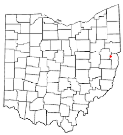
 Location of Bergholz in Jefferson County | |
| Coordinates: 40°31′14″N 80°53′2″W / 40.52056°N 80.88389°WCoordinates: 40°31′14″N 80°53′2″W / 40.52056°N 80.88389°W | |
| Country | United States |
| State | Ohio |
| County | Jefferson |
| Township | Springfield |
| Area[1] | |
| • Total | 0.56 sq mi (1.45 km2) |
| • Land | 0.56 sq mi (1.45 km2) |
| • Water | 0 sq mi (0 km2) |
| Elevation[2] | 925 ft (282 m) |
| Population (2010)[3] | |
| • Total | 664 |
| • Estimate (2012[4]) | 649 |
| • Density | 1,185.7/sq mi (457.8/km2) |
| Time zone | Eastern (EST) (UTC-5) |
| • Summer (DST) | EDT (UTC-4) |
| ZIP code | 43908 |
| Area code(s) | 740 |
| FIPS code | 39-05718[5] |
| GNIS feature ID | 1064416[2] |

Bergholz /ˈbɜːrɡ.hoʊlz/[6] is a village in Jefferson County, Ohio, United States. The population was 664 at the 2010 census. It is part of the Weirton-Steubenville, WV-OH Metropolitan Statistical Area.
History
Bergholz had its start in 1883 when the railroad was built through that territory in order to access a mine. The settlement was named Bergholz in honor of the mine owner. It was incorporated as a village in 1906.[7]
During Morgan's Raid, a Union victory in the Civil War in 1863, Confederate Brigadier General John Hunt Morgan traveled through Moorefield, Harrisville, New Athens, Smithfield, New Alexandria, Wintersville, Two Ridge, Richmond, East Springfield, Bergholz, and Monroeville on his way to defeat at the Battle of Salineville.
Geography
Bergholz is located at 40°31′14″N 80°53′2″W / 40.52056°N 80.88389°W (40.520509, -80.883815).[8]
According to the United States Census Bureau, the village has a total area of 0.56 square miles (1.45 km2), all land.[1]
Demographics
| Historical population | |||
|---|---|---|---|
| Census | Pop. | %± | |
| 1910 | 1,011 | — | |
| 1920 | 1,215 | 20.2% | |
| 1930 | 918 | −24.4% | |
| 1940 | 1,122 | 22.2% | |
| 1950 | 1,035 | −7.8% | |
| 1960 | 955 | −7.7% | |
| 1970 | 914 | −4.3% | |
| 1980 | 914 | 0.0% | |
| 1990 | 713 | −22.0% | |
| 2000 | 769 | 7.9% | |
| 2010 | 664 | −13.7% | |
| Est. 2015 | 636 | [9] | −4.2% |
2010 census
As of the census[3] of 2010, there were 664 people, 266 households, and 174 families residing in the village. The population density was 1,185.7 inhabitants per square mile (457.8/km2). There were 319 housing units at an average density of 569.6 per square mile (219.9/km2). The racial makeup of the village was 98.2% White, 0.8% African American, 0.3% Native American, 0.2% Asian, and 0.6% from two or more races. Hispanic or Latino of any race were 0.2% of the population.
There were 266 households of which 34.2% had children under the age of 18 living with them, 45.5% were married couples living together, 12.4% had a female householder with no husband present, 7.5% had a male householder with no wife present, and 34.6% were non-families. 30.1% of all households were made up of individuals and 15.8% had someone living alone who was 65 years of age or older. The average household size was 2.50 and the average family size was 2.99.
The median age in the village was 38.3 years. 24.2% of residents were under the age of 18; 9.1% were between the ages of 18 and 24; 27.7% were from 25 to 44; 24.9% were from 45 to 64; and 14% were 65 years of age or older. The gender makeup of the village was 47.7% male and 52.3% female.
2000 census
As of the census[5] of 2000, there were 769 people, 293 households, and 201 families residing in the village. The population density was 1,383.7 people per square mile (530.2/km²). There were 317 housing units at an average density of 570.4 per square mile (218.6/km²). The racial makeup of the village was 98.44% White, 0.52% African American, 0.65% Native American, 0.13% Asian, 0.13% Pacific Islander, and 0.13% from two or more races. Hispanic or Latino of any race were 0.13% of the population.
There were 293 households out of which 34.8% had children under the age of 18 living with them, 49.8% were married couples living together, 12.6% had a female householder with no husband present, and 31.1% were non-families. 25.6% of all households were made up of individuals and 14.7% had someone living alone who was 65 years of age or older. The average household size was 2.55 and the average family size was 3.04.
In the village the population was spread out with 24.7% under the age of 18, 9.2% from 18 to 24, 27.6% from 25 to 44, 20.9% from 45 to 64, and 17.6% who were 65 years of age or older. The median age was 37 years. For every 100 females there were 92.7 males. For every 100 females age 18 and over, there were 88.0 males.
The median income for a household in the village was $33,438, and the median income for a family was $43,542. Males had a median income of $36,938 versus $17,708 for females. The per capita income for the village was $14,986. About 9.5% of families and 16.2% of the population were below the poverty line, including 24.0% of those under age 18 and 12.1% of those age 65 or over.
Education
Public education in the village of Bergholz is provided by the Edison Local School District. Campuses serving the village include:
- Edison High School[11] (Grades 7-12).
Notable people
- Ray Grimes - Major League Baseball player
- Roy Grimes - Major League Baseball player, twin brother of Ray
- Joshua Wood - local legend
See also
References
- 1 2 "US Gazetteer files 2010". United States Census Bureau. Archived from the original on 2012-07-14. Retrieved 2013-01-06.
- 1 2 "US Board on Geographic Names". United States Geological Survey. 2007-10-25. Retrieved 2008-01-31.
- 1 2 "American FactFinder". United States Census Bureau. Retrieved 2013-01-06.
- ↑ "Population Estimates". United States Census Bureau. Archived from the original on 2013-06-17. Retrieved 2013-06-17.
- 1 2 "American FactFinder". United States Census Bureau. Archived from the original on 2013-09-11. Retrieved 2008-01-31.
- ↑ "A Pronunciation Guide to places in Ohio - E.W.Scripps School of". Scrippsjschool.org. 2012-06-22. Retrieved 2013-02-11.
- ↑ Doyle, Joseph Beatty (1910). 20th Century History of Steubenville and Jefferson County, Ohio and Representative Citizens. Richmond-Arnold Publishing Company. p. 529.
- ↑ "US Gazetteer files: 2010, 2000, and 1990". United States Census Bureau. 2011-02-12. Retrieved 2011-04-23.
- ↑ "Annual Estimates of the Resident Population for Incorporated Places: April 1, 2010 to July 1, 2015". Retrieved July 2, 2016.
- ↑ "Census of Population and Housing". Census.gov. Archived from the original on May 11, 2015. Retrieved June 4, 2015.
- ↑ Archived February 14, 2009, at the Wayback Machine.
Municipalities and communities of Jefferson County, Ohio, United States | ||
|---|---|---|
| Cities | 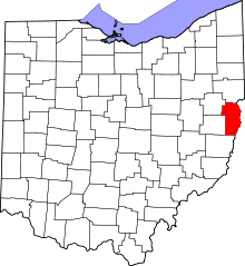 | |
| Villages | ||
| Townships | ||
| CDPs |
| |
| Unincorporated communities |
| |
| Ghost town | ||
| Footnotes | ‡This populated place also has portions in an adjacent county or counties | |
| Counties |  Map of the Pittsburgh Tri-State with green counties in the metropolitan area and yellow counties in the combined area. | |
|---|---|---|
| Major cities | ||
| Cities and towns 15k-50k (in 2010) | ||
| Airports | ||
| Topics | ||
| ||