Hugo, Oklahoma
| Hugo, Oklahoma | |
|---|---|
| City | |
|
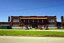
Broadway Street in Hugo | |
| Nickname(s): Circus City, USA | |
 Location of Hugo, Oklahoma | |
| Coordinates: 34°0′34″N 95°30′53″W / 34.00944°N 95.51472°WCoordinates: 34°0′34″N 95°30′53″W / 34.00944°N 95.51472°W | |
| Country | United States |
| State | Oklahoma |
| County | Choctaw |
| Area | |
| • Total | 6.42 sq mi (16.64 km2) |
| • Land | 6.40 sq mi (16.58 km2) |
| • Water | 0.02 sq mi (0.06 km2) |
| Elevation | 545 ft (166 m) |
| Population (2010) | |
| • Total | 5,310 |
| • Density | 830/sq mi (320.3/km2) |
| Time zone | Central (CST) (UTC-6) |
| • Summer (DST) | CDT (UTC-5) |
| ZIP code | 74743 |
| Area code(s) | 580 |
| FIPS code | 40-36300[1] |
| GNIS feature ID | 1094002[2] |
| Website |
www |
.jpg)
Hugo is a city and county seat of Choctaw County, Oklahoma, United States. It is located in southeastern Oklahoma about 9 miles (14 km) north of the Texas state line. As of the 2010 census, the city population was 5,310.[3]
The city was founded in 1901 and named for the French novelist Victor Hugo.[4] The city serves as winter quarters for some circus performers. It is adjacent to one of the oldest schools west of the Mississippi: Goodland Academy, begun in 1848.
The town is located in a cultural area of the state known as Little Dixie, as it was settled by Native American tribes, African Americans and European Americans from the southeastern United States. It is near the tourist area of Kiamichi Country.
History
.jpg)
This was part of the Indian Territory to which the United States government relocated Native American tribes from east of the Mississippi River in the 1830s under its Indian Removal policy. Among the nations relocated here were the Choctaw, for whom the county is named. They were one of what were called the "Five Civilized Tribes" of the southeastern United States, as they had adopted numerous elements of European-American culture. When they relocated, they brought with them the numerous African-American slaves whom they held. As the Choctaw allied with the Confederate South during the American Civil War, the United States government insisted on a new peace treaty with them after its end. A condition was the Choctaws' emancipation of their slaves and granting to the freedmen of rights of full citizenship in the Choctaw nation, as the US was granting citizenship to former slaves of the South.
The St. Louis–San Francisco Railway (Frisco) built a line from Hope, Arkansas, to Ardmore, Oklahoma, in 1901. It crossed the north-south line Frisco had built in 1887 to connect Monett, Missouri, to Paris, Texas.[4] The territorial town that sprung up at the crossing would soon be named Hugo. The town's name was recommended by the wife of local surveyor W.H. Darrough, a fan of Victor Hugo.[5]
In late 1993, the town suffered several violent incidents. Before Christmas, a shootout occurred in a Wal-Mart parking lot. Within one week in December, two fires occurred; the first was at the Booker T. Washington gymnasium on December 26. On December 28 a fire erupted in the central business district of Hugo, consuming five buildings and burning for four hours. The Belmont Hotel, which the area historical society was renovating, was destroyed. Area authorities suspected that the fires were arson.[6]
Point of interest
In 1937, artist Joseph Fleck painted an oil-on-canvas mural, titled The Red Man of Oklahoma Sees the First Stage Coach, in the United States post office. The original post office is now the Oklahoma School System Administration Building. Murals were produced from 1934 to 1943 in the United States through the Section of Painting and Sculpture, later called the Section of Fine Arts, of the Treasury Department.[7]
Geography
Hugo is located at the center of Choctaw County. According to the United States Census Bureau, the city has a total area of 6.42 square miles (16.64 km2), of which 6.40 square miles (16.58 km2) is land and 0.02 square miles (0.06 km2), or 0.36%, is water.[3] Hugo Lake on the Kiamichi River lies northeast of town, and Roebuck Lake, an oxbow former channel of the Red River, lies south of town.[4]
Hugo is the southern terminus of the Indian Nation Turnpike, a 105-mile (169 km) four-lane highway which runs northwest to Interstate 40 in Henryetta, providing a vital transportation link from southeastern Oklahoma to the state's largest cities, Oklahoma City and Tulsa.
Climate
| Climate data for Hugo, Oklahoma | |||||||||||||
|---|---|---|---|---|---|---|---|---|---|---|---|---|---|
| Month | Jan | Feb | Mar | Apr | May | Jun | Jul | Aug | Sep | Oct | Nov | Dec | Year |
| Record high °F (°C) | 81 (27) |
86 (30) |
92 (33) |
94 (34) |
98 (37) |
105 (41) |
110 (43) |
110 (43) |
108 (42) |
100 (38) |
88 (31) |
84 (29) |
110 (43) |
| Average high °F (°C) | 53.1 (11.7) |
58.3 (14.6) |
67.6 (19.8) |
76 (24) |
82.2 (27.9) |
89.2 (31.8) |
94.1 (34.5) |
94.5 (34.7) |
87.4 (30.8) |
77.7 (25.4) |
65.8 (18.8) |
55.8 (13.2) |
75.1 (23.9) |
| Average low °F (°C) | 30.6 (−0.8) |
34.9 (1.6) |
43.3 (6.3) |
52.2 (11.2) |
59.7 (15.4) |
67.1 (19.5) |
70.3 (21.3) |
69.2 (20.7) |
63 (17) |
51.8 (11) |
42.7 (5.9) |
33.7 (0.9) |
51.5 (10.8) |
| Record low °F (°C) | 0 (−18) |
−6 (−21) |
7 (−14) |
26 (−3) |
36 (2) |
50 (10) |
54 (12) |
53 (12) |
38 (3) |
22 (−6) |
13 (−11) |
−4 (−20) |
−6 (−21) |
| Average precipitation inches (mm) | 2.2 (56) |
3.3 (84) |
4.2 (107) |
4.2 (107) |
6.0 (152) |
4.8 (122) |
2.8 (71) |
2.7 (69) |
4.5 (114) |
4.2 (107) |
4.0 (102) |
3.3 (84) |
46.1 (1,171) |
| Average snowfall inches (cm) | 1.3 (3.3) |
1.2 (3) |
0.4 (1) |
0 (0) |
0 (0) |
0 (0) |
0 (0) |
0 (0) |
0 (0) |
0 (0) |
0.1 (0.3) |
0.7 (1.8) |
3.4 (8.6) |
| Average rainy days | 6 | 6 | 8 | 8 | 8 | 7 | 5 | 5 | 6 | 6 | 6 | 7 | 83 |
| Source #1: weather.com | |||||||||||||
| Source #2: Weatherbase.com [8] | |||||||||||||
Demographics
| Historical population | |||
|---|---|---|---|
| Census | Pop. | %± | |
| 1910 | 4,582 | — | |
| 1920 | 6,368 | 39.0% | |
| 1930 | 5,272 | −17.2% | |
| 1940 | 5,909 | 12.1% | |
| 1950 | 5,984 | 1.3% | |
| 1960 | 6,287 | 5.1% | |
| 1970 | 6,585 | 4.7% | |
| 1980 | 7,172 | 8.9% | |
| 1990 | 5,978 | −16.6% | |
| 2000 | 5,536 | −7.4% | |
| 2010 | 5,310 | −4.1% | |
| Est. 2015 | 5,224 | [9] | −1.6% |
| U.S. Decennial Census | |||
As of the census[1] of 2000, there were 5,536 people, 2,309 households, and 1,415 families residing in the city. The population density was 999.0 people per square mile (385.8/km²). There were 2,798 housing units at an average density of 504.9 per square mile (195.0/km²). The racial makeup of the city was 49.28% White, 30.6% African American, 14.1% Native American, 0.3% Asian, 0.02% Pacific Islander, 0.4% from other races, and 5.3% from two or more races. Hispanic or Latino of any race were 1.61% of the population.
There were 2,309 households out of which 29.4% had children under the age of 18 living with them, 37.4% were married couples living together, 20.7% had a female householder with no husband present, and 38.7% were non-families. 35.3% of all households were made up of individuals and 19.7% had someone living alone who was 65 years of age or older. The average household size was 2.30 and the average family size was 2.98.
In the city the population was spread out with 26.6% under the age of 18, 8.7% from 18 to 24, 23.6% from 25 to 44, 20.8% from 45 to 64, and 20.3% who were 65 years of age or older. The median age was 38 years. For every 100 females there were 79.9 males. For every 100 females age 18 and over, there were 73.0 males.
The median income for a household in the city was $19,321, and the median income for a family was $26,523. Males had a median income of $26,473 versus $17,348 for females. The per capita income for the city was $11,676. About 25.5% of families and 29.4% of the population were below the poverty line, including 43.5% of those under age 18 and 22.1% of those age 65 or over.
Economy
Agriculture (especially cotton farming), timber and ranching have been mainstays of the city's economy since its beginning. Since the 1940s, circuses have used Hugo as their winter quarters. The Kiamichi Technology Center and the "Agriplex," originally the Choctaw County Agricultural Center, opened during the 1970s.[4]
Government
Hugo implemented a council-manager form of city government in 1995.[4]
Transportation
Hugo serves as the southern terminating point for the Indian Nation Turnpike. U.S. Highway 70 runs west to east through the city and connects Hugo to Durant 53 miles (85 km) to the west and Idabel 43 miles (69 km) to the east. U.S. Highway 271 runs south out of the city and leads 26 miles (42 km) to Paris, Texas.[4]
Hugo is served by the city-operated Stan Stamper Municipal Airport, with one 4,007-by-75-foot (1,221 m × 23 m) runway. The airport has ten aircraft based on the field and supports medical air ambulance operations by EagleMed as well as scheduled cargo operations for all of southeastern Oklahoma via a flight from Tulsa operated by Martinaire on behalf of UPS.
National Register of Historic Places
- Frisco Depot Museum and Harvey House Restaurant (NR 80003259)[4]
- Hugo National Guard Armory (NR 88001378)[4]
- Hugo Historic District (NR 80003260)[4]
- Hugo Public Library (NR 88001379)[4]
- Speer School (NR 88001380)[4]
Notable people
- Justin Boyd (born c. 1975), pharmacist in Alma, Arkansas, and Republican member of the Arkansas House of Representatives from Fort Smith; former Hugo resident
- Lane Clyde Frost (October 12, 1963 – July 30, 1989), world champion bull rider killed by the bull "Takin Care of Business" on July 30, 1989 in Cheyenne, Wyoming
- William Judson Holloway, former governor of Oklahoma[10]
- Bill Moyers, liberal political commentator and cable news personality and former White House Press Secretary from 1965-1967 (during the Lyndon B. Johnson administration)
- B. J. Thomas (born August 7, 1942), singer known for the #1 hits "Raindrops Keep Fallin' on My Head" and "(Hey Won't You Play) Another Somebody Done Somebody Wrong Song"
- James Ling founder of Ling-Temco-Vought
References
- 1 2 "American FactFinder". United States Census Bureau. Retrieved 2008-01-31.
- ↑ "US Board on Geographic Names". United States Geological Survey. 2007-10-25. Retrieved 2008-01-31.
- 1 2 "Geographic Identifiers: 2010 Demographic Profile Data (G001): Hugo city, Oklahoma". U.S. Census Bureau, American Factfinder. Retrieved February 19, 2015.
- 1 2 3 4 5 6 7 8 9 10 11 Larry O'Dell, "Hugo." Encyclopedia of Oklahoma History and Culture . Accessed August 25, 2013.
- ↑ "Welcome to Hugo." K-Ten CommunityInfo - Hugo, OK. Retrieved August 8, 2014.
- ↑ Cobb, Kim. "Another blow to little town in Oklahoma", Houston Chronicle. Thursday December 30, 1993. A20. Retrieved on January 13, 2011.
- ↑
- Marling, Karal A. (1982). Wall-to-Wall America: A Cultural History of Post Office Murals in the Great Depression (1st ed.). University of Minnesota Press. ISBN 0816611165.
- ↑ "Historical Weather for Hugo, Oklahoma, United States".
- ↑ "Annual Estimates of the Resident Population for Incorporated Places: April 1, 2010 to July 1, 2015". Retrieved July 2, 2016.
- ↑ James C. Milligan, "Choctaw County." Encyclopedia of Oklahoma History and Culture. Accessed May 22, 2013.
External links
- City of Hugo and Choctaw County officials website
- Hugo information at travelok.com
- Choctaw County Public Library
- Article on Hugo's Showmens Rest on Atlas Obscura
Municipalities and communities of Choctaw County, Oklahoma, United States | ||
|---|---|---|
| City | 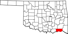 | |
| Towns | ||
| CDPs | ||
| Other unincorporated communities | ||
| Fort Towson |
| |
|---|---|---|
| Hugo |
| |
| Spencerville |
| |
| Swink |
| |