Walters, Oklahoma
| Walters, Oklahoma | |
|---|---|
| City | |
|
Cotton County Courthouse in 2014 | |
| Motto: "Small town; Big heart" | |
 Location of Walters, Oklahoma | |
| Coordinates: 34°21′23″N 98°18′57″W / 34.35639°N 98.31583°WCoordinates: 34°21′23″N 98°18′57″W / 34.35639°N 98.31583°W | |
| Country | United States |
| State | Oklahoma |
| County | Cotton |
| Area | |
| • Total | 8.4 sq mi (21.7 km2) |
| • Land | 8.1 sq mi (21.1 km2) |
| • Water | 0.2 sq mi (0.6 km2) |
| Elevation | 1,001 ft (305 m) |
| Population (2010) | |
| • Total | 2,551 |
| • Density | 314.9/sq mi (120.9/km2) |
| Time zone | Central (CST) (UTC-6) |
| • Summer (DST) | CDT (UTC-5) |
| ZIP code | 73572 |
| Area code(s) | 580 |
| FIPS code | 40-78150[1] |
| GNIS feature ID | 1099338[2] |

Walters is a city in Cotton County, Oklahoma, United States. The population was 2,551 at the 2010 census.[3] The city, nestled in between twin creeks, is the county seat of Cotton County.[4] The city's motto is "Small town; Big heart."
History
The land that is present-day Oklahoma was first settled by prehistoric American Indians including the Clovis 11500 BCE, Folsom 10600 BCE and Plainview 10000 BCE cultures. Western explorers came to the region in the 16th century, with Spanish explorer Francisco Vásquez de Coronado visiting in 1541. Most of the region during this time was settled by the Wichita and Caddo peoples. Around the 1700s, two tribes from the North, the Comanches and Kiowas, migrated to the Oklahoma and Texas region.[5]
For most of the 18th century, the Oklahoma region was under French control as part of Louisiana. In 1803, the Louisiana Purchase by Thomas Jefferson brought the area under United States control. In 1830, Congress passed the Indian Removal Act, which removed American Indian tribes and relocated them to Indian Territory. The southern part of the territory was originally assigned to the Choctaw and Chickasaw, until the 1867 Medicine Lodge Treaty allotted the southwest portion of the Choctaw and Chickasaw’s lands to the Comanche, Kiowa, and Apache.
The City of Walters was organized on August 6, 1901, under the original name of McKnight, Indian Territory. Application for a post office was made, and it was determined that a town in Harmon County had already taken the name of McKnight. This required that the name be changed. The name of Walters was chosen, in honor of W. R. Walters, but the "s" was not included on the post office application, so the post office was named Walter.[6]
The city finally grew large enough to meet the requirements for a government patent, and one was granted in June 1904. On August 12, 1912, an election was held to form a new County (Cotton) from a portion of Comanche County. The election was successful and Cotton County became the last county formed in Oklahoma on August 28, 1912. Shortly thereafter, another election was held to determine whether Walters or Temple would become the county seat; on December 2, 1912, Walters won by 282 votes, officially becoming the seat of Cotton County. The names of Walter and Walters were used interchangeably and confusingly until June 1917, when an application was made to Congress to officially change the post office name to Walters.[6]
Geography
The city is equidistant between the Wichita Mountains and the Red River.
Consisting of grassland, oak savannahs and rolling hills, the city lies within an ecotone on the western edge of the Cross Timbers, which are located to the east. Monsoon-like rains are common in the spring months, while periods of drought can occur throughout other parts of the year. The city is about 19 miles (31 km) south of Lawton, situated between two tributaries of the Red River, the East and West Cache Creeks. The bottom lands around the creeks are thickly surrounded by Burr oak, Escarpment live oak, Shumard oak, Pecan, Eastern Redbud, American Persimmon, and American Elm.[6]
According to the United States Census Bureau, the city has a total area of 8.4 square miles (22 km2), of which 8.1 square miles (21 km2) is land and 0.2 square miles (0.52 km2) (2.75%) water.
Walters is located at 34°21′23″N 98°18′57″W / 34.356353°N 98.315773°W.[7]
| Climate data for Walters, Oklahoma | |||||||||||||
|---|---|---|---|---|---|---|---|---|---|---|---|---|---|
| Month | Jan | Feb | Mar | Apr | May | Jun | Jul | Aug | Sep | Oct | Nov | Dec | Year |
| Average high °F (°C) | 52.5 (11.4) |
58.4 (14.7) |
66.7 (19.3) |
76.2 (24.6) |
83.2 (28.4) |
91.5 (33.1) |
96.7 (35.9) |
96.7 (35.9) |
88.5 (31.4) |
77.6 (25.3) |
64.7 (18.2) |
54.8 (12.7) |
75.63 (24.24) |
| Average low °F (°C) | 28 (−2) |
32.4 (0.2) |
39.4 (4.1) |
49.4 (9.7) |
58.7 (14.8) |
67.5 (19.7) |
71.1 (21.7) |
70.4 (21.3) |
62.9 (17.2) |
51.5 (10.8) |
39.2 (4) |
30.6 (−0.8) |
50.09 (10.06) |
| Average precipitation inches (mm) | 1.4 (36) |
1.6 (41) |
3.2 (81) |
3.8 (97) |
4.7 (119) |
4.8 (122) |
2.4 (61) |
2.6 (66) |
3.4 (86) |
3.3 (84) |
1.7 (43) |
1.5 (38) |
34.4 (874) |
| Source #1: weather.com | |||||||||||||
| Source #2: Weatherbase[8] | |||||||||||||
Demographics
| Historical population | |||
|---|---|---|---|
| Census | Pop. | %± | |
| 1910 | 1,377 | — | |
| 1920 | 3,032 | 120.2% | |
| 1930 | 2,262 | −25.4% | |
| 1940 | 2,238 | −1.1% | |
| 1950 | 2,743 | 22.6% | |
| 1960 | 2,825 | 3.0% | |
| 1970 | 2,611 | −7.6% | |
| 1980 | 2,778 | 6.4% | |
| 1990 | 2,519 | −9.3% | |
| 2000 | 2,657 | 5.5% | |
| 2010 | 2,551 | −4.0% | |
| Est. 2015 | 2,502 | [9] | −1.9% |
As of the census[1] of 2000, there were 2,657 people, 1,063 households, and 721 families residing in the city. The population density was 326.6 people per square mile (126.2/km2). There were 1,256 housing units, for an average density of 154.4 per square mile (59.6/km2). The racial makeup of the city was 84.38% White, 0.38% African American, 10.24% Native American, 0.08% Asian, 1.02% from other races, and 3.91% from two or more races. Hispanic or Latino of any race were 3.42% of the population.
There were 1,063 households, out of which 33.6% had children under the age of 18 living with them, 54.1% were married couples living together, 10.4% had a female householder with no husband present, and 32.1% were non-families. 30.1% of all households were made up of individuals, and 18.3% had someone living alone who was 65 years of age or older. The average household size was 2.45 and the average family size was 3.05.
In age the city's the population was spread out, with 27.8% under the age of 18, 7.4% from 18 to 24, 26.7% from 25 to 44, 19.9% from 45 to 64, and 18.3% who were 65 years of age or older. The median age was 37 years. For every 100 females there were 87.0 males. For every 100 females age 18 and over, there were 84.5 males.
The median income for a household in the city was $25,771 and the median income for a family was $31,532. Males had a median income of $27,578 versus $18,669 for females. The per capita income for the city was $14,398. About 15.9% of families and 19.6% of the population were below the poverty line, including 25.4% of those under age 18 and 17.9% of those age 65 or over.
Culture
Walters has many annual festivals that take place throughout the year. Festivals are centered around the arts, agriculture, western Cowboy culture, and Native American culture.
Spring
Expo Art Fest (Previously Gallery on the Green)- An annual art show that showcases the artistic talent of the people of Walters and surrounding areas.
Summer
Comanche Nation Homecoming and Pow wow
Round-Up Club Rodeo
Notable people
- Fred R. Harris (b. 1930), former U.S Senator from Oklahoma and U.S presidential candidate [6]
- Van Heflin (1910-1971), Hollywood movie actor[6]
- Jed Johnson, Sr. (1888-1963), politician and editor. Practiced law in Walters.[6]
- Abe Lemons (1922-2002), College Basketball Coach and graduate of Walters High School.[6]
- Jesse Brasier (1996- ),politician and independent political party supporter. [11]
References
- 1 2 "American FactFinder". United States Census Bureau. Retrieved 2008-01-31.
- ↑ "US Board on Geographic Names". United States Geological Survey. 2007-10-25. Retrieved 2008-01-31.
- ↑ CensusViewer:Walters, Oklahoma Population
- ↑ "Find a County". National Association of Counties. Retrieved 2011-06-07.
- ↑ Oklahoma Department of Libraries. "Oklahoma Almanac 2005 - Oklahoma History" (pdf). pp. 687–691. Retrieved 2011-04-25.
- 1 2 3 4 5 6 7 Oklahoma Historical Society. Encyclopedia of Oklahoma History and Culture. Retrieved October 6, 2012.
- ↑ "US Gazetteer files: 2010, 2000, and 1990". United States Census Bureau. 2011-02-12. Retrieved 2011-04-23.
- ↑ "Historical Weather for Walters, Oklahoma, United States".
- ↑ "Annual Estimates of the Resident Population for Incorporated Places: April 1, 2010 to July 1, 2015". Retrieved July 2, 2016.
- ↑ "Census of Population and Housing". Census.gov. Retrieved June 4, 2015.
- ↑
Municipalities and communities of Cotton County, Oklahoma, United States | ||
|---|---|---|
| City | 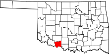 | |
| Towns | ||
| Unincorporated communities | ||