Altus, Oklahoma
| Altus, Oklahoma | |
|---|---|
| City | |
|
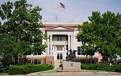
Jackson County Courthouse in Altus | |
 Location of Altus, Oklahoma | |
| Coordinates: 34°38′38″N 99°19′36″W / 34.64389°N 99.32667°WCoordinates: 34°38′38″N 99°19′36″W / 34.64389°N 99.32667°W | |
| Country | United States |
| State | Oklahoma |
| County | Jackson |
| Government | |
| • Mayor | David Webb |
| Area | |
| • Total | 17.0 sq mi (44.1 km2) |
| • Land | 16.8 sq mi (43.6 km2) |
| • Water | 0.2 sq mi (0.5 km2) |
| Elevation | 1,398 ft (426 m) |
| Population (2010)[1] | |
| • Total | 19,813 |
| • Density | 1,200/sq mi (450/km2) |
| Time zone | Central (CST) (UTC-6) |
| • Summer (DST) | CDT (UTC-5) |
| ZIP codes | 73521-73523 |
| Area code(s) | 580 |
| FIPS code | 40-01700 [2] |
| GNIS feature ID | 1089598 [3] |
| Website | cityofaltus.org |
Altus is a city and county seat in Jackson County, Oklahoma, United States.[4] The population was 19,813 at the 2010 census, a loss of 7.7 percent compared to 21,454 at the 2000 census.[5]
Altus is home to Altus Air Force Base, the United States Air Force training base for C-17, and KC-135 aircrews. It is also home to Western Oklahoma State College and Southwest Technology Center.
History
The town that would later be named Altus was founded in 1886.[6] The community was originally called Frazer, a settlement of about 50 people on Bitter Creek that served as a trading post on the Great Western Trail. Cowboys driving herds northward often stopped to buy buttermilk from John McClearan. Thus, the town was known locally as "Buttermilk Station." The Frazer post office opened February 18, 1886. A flash flood nearly destroyed Frazer on June 4, 1891. The residents moved to higher ground 2.5 miles (4.0 km) east of the original site. W. R. Baucum suggested renaming the town Altus, a Latin word meaning "high." This name stuck, although the town was also known as Leger from July 10, 1901, to May 14, 1904,[7]
The city has seen relatively steady growth since the beginning. The population doubled between the time of Oklahoma statehood and the 1910 census and even increased during the Great Depression.[8] Although Altus had been designated as the Jackson county seat at the time of statehood, an election was held in 1908 to determine the permanent seat. The two towns contending were Altus and Olustee. Altus won by a vote of 2,077 to 1,365. The county courthouse was built there in 1910.[7] An irrigation project in the 1940s and World War II led to further growth in the town as the nearby air field was used to train military pilots.[8]
Altus was an important city on the defunct Wichita Falls and Northwestern Railway, one of the Frank Kell and Joseph A. Kemp properties, which stretched from Wichita Falls, Texas, to Forgan in Beaver County in far northwestern Oklahoma. It was later purchased by the Missouri-Kansas-Texas Railroad and since 1991 is operated by the Wichita, Tillman and Jackson Railway.[9]
In 1908, the Kansas City, Mexico and Orient Railway (acquired by the Atchison, Topeka and Santa Fe Railway in 1929) built a line through Altus. Around the same time, the Altus, Wichita Falls and Hollis Railway (which became the Wichita Falls and Northwestern Railway in 1911, then was acquired by the Missouri, Kansas and Texas Railway in 1922) constructed a line from Altus to the Oklahoma-Texas border. The railroads stimulated economic growth in the area and made Altus a regional agricultural center. By 1930, Altus had eight cotton gins, two cotton compresses, and eighteen wholesale businesses.[7]
Geography
Altus is located at 34°38′38″N 99°19′36″W / 34.64389°N 99.32667°W (34.643754, -99.326603).[10] Altus is situated in what used to be Old Greer County, an area with disputed ownership until a Supreme Court decision awarded it to Oklahoma Territory instead of Texas.[8] The city lies between the main channel and north fork of the Red River.[8]
According to the United States Census Bureau, the city has a total area of 17.0 square miles (44.0 km2), of which 16.8 square miles (43.5 km2) is land and 0.2 square miles (0.5 km2) (1.17%) is water.
Climate
| Climate data for Altus, Oklahoma (Elevation 1,380ft) | |||||||||||||
|---|---|---|---|---|---|---|---|---|---|---|---|---|---|
| Month | Jan | Feb | Mar | Apr | May | Jun | Jul | Aug | Sep | Oct | Nov | Dec | Year |
| Record high °F (°C) | 88 (31) |
93 (34) |
103 (39) |
105 (41) |
112 (44) |
116 (47) |
120 (49) |
120 (49) |
109 (43) |
104 (40) |
92 (33) |
88 (31) |
120 (49) |
| Average high °F (°C) | 53.1 (11.7) |
58.3 (14.6) |
67.4 (19.7) |
76.6 (24.8) |
84.3 (29.1) |
92.8 (33.8) |
97.5 (36.4) |
96.6 (35.9) |
88.4 (31.3) |
77.8 (25.4) |
65.0 (18.3) |
54.4 (12.4) |
76.0 (24.4) |
| Average low °F (°C) | 26.8 (−2.9) |
30.8 (−0.7) |
38.1 (3.4) |
47.8 (8.8) |
57.8 (14.3) |
66.8 (19.3) |
70.7 (21.5) |
69.4 (20.8) |
62.0 (16.7) |
50.4 (10.2) |
38.2 (3.4) |
29.4 (−1.4) |
49.0 (9.4) |
| Record low °F (°C) | −11 (−24) |
−7 (−22) |
6 (−14) |
22 (−6) |
34 (1) |
44 (7) |
55 (13) |
49 (9) |
8 (−13) |
17 (−8) |
12 (−11) |
−10 (−23) |
−11 (−24) |
| Average precipitation inches (mm) | 0.93 (23.6) |
1.01 (25.7) |
1.55 (39.4) |
2.36 (59.9) |
3.96 (100.6) |
3.55 (90.2) |
2.05 (52.1) |
2.46 (62.5) |
2.70 (68.6) |
2.84 (72.1) |
1.19 (30.2) |
1.16 (29.5) |
25.76 (654.3) |
| Average snowfall inches (cm) | 1.8 (4.6) |
1.3 (3.3) |
0.7 (1.8) |
0.1 (0.3) |
0 (0) |
0 (0) |
0 (0) |
0 (0) |
0 (0) |
0 (0) |
0.3 (0.8) |
0.8 (2) |
4.9 (12.4) |
| Source: The Western Regional Climate Center[11] | |||||||||||||
Demographics
| Historical population | |||
|---|---|---|---|
| Census | Pop. | %± | |
| 1910 | 4,821 | — | |
| 1920 | 4,522 | −6.2% | |
| 1930 | 8,439 | 86.6% | |
| 1940 | 8,593 | 1.8% | |
| 1950 | 9,735 | 13.3% | |
| 1960 | 21,225 | 118.0% | |
| 1970 | 23,302 | 9.8% | |
| 1980 | 23,101 | −0.9% | |
| 1990 | 21,910 | −5.2% | |
| 2000 | 21,447 | −2.1% | |
| 2010 | 19,813 | −7.6% | |
| Est. 2015 | 19,214 | [12] | −3.0% |
| Sources:[2][13][14][15][16][17] | |||
As of the census of 2010, there were 19,813 people residing in the city.[1] The population density was 1,200 people per square mile (450/km²). There were 8,890 housing units at an average density of 540 per square mile (205/km²).[1] The racial makeup of the city was 72.62% White, 10.41% African American, 1.48% Native American, 1.38% Asian, 0.20% Pacific Islander, 10.32% from other races, and 3.59% from two or more races. Hispanic or Latino of any race were 17.25% of the population.
There were 7,896 households out of which 38.9% had children under the age of 18 living with them, 55.6% were married couples living together, 11.7% had a female householder with no husband present, and 28.7% were non-families. 25.1% of all households were made up of individuals and 9.5% had someone living alone who was 65 years of age or older. The average household size was 2.62 and the average family size was 3.14.
In the city the population was spread out with 29.8% under the age of 18, 11.0% from 18 to 24, 29.8% from 25 to 44, 17.9% from 45 to 64, and 11.5% who were 65 years of age or older. The median age was 32 years. For every 100 females there were 98.9 males. For every 100 females age 18 and over, there were 94.1 males.
The median income for a household in the city was $30,217, and the median income for a family was $38,400. Males had a median income of $28,041 versus $18,856 for females. The per capita income for the city was $15,378. About 14.6% of families and 17.2% of the population were below the poverty line, including 22.7% of those under age 18 and 12.8% of those age 65 or over.
Points of interest
- Lake Altus-Lugert
- Altus City Reservoir
- Altus Speedway
- Morgan Doll Museum
- Altus City Park including 18-hole disc golf course
- Altus Air Force Base
- Museum of the Western Prairie
- Sooner International Raceway has been closed and is grown up in weeds
Education
The Public Schools of Altus are in Oklahoma School District number 18. In the Altus Public School District there are nine schools, including five elementary schools, an intermediate school, a junior high school, a high school, and a learning center. For the 2011-2012 school year there were approximately 3,851 students.[18] The school website is http://www.altusschools.k12.ok.us/district/.
Western Oklahoma State College and Southwest Technology Center provide opportunities for higher education in the area.[7]
Notable people
- Robert Bellah, sociologist of religion
- Jake Colhouer, American football player
- Mark Cotney, National Football League (NFL) player (Tampa Bay Buccaneers)
- Herschal Crow, Oklahoma state senator
- Brandon Dickerson, award-winning music video director
- Eddie Fisher, Relief Pitcher
- Kelly Garrison, 1988 Olympic gymnast (competed as Kelly Garrison-Steves)
- Jason Gildon, NFL player (Pittsburgh Steelers) also all-time sack leader for the Pittsburgh Steelers.
- Juan Pérez, San Francisco Giants, Played at Western Oklahoma State College
- Steve Marino, professional golfer who currently plays on the PGA Tour
- Thomas Oden, an American United Methodist theologian and religious author
- Andrelton Simmons, Shortstop, Los Angeles Angels, Played at Western Oklahoma State College
- John Sterling, NFL player (Green Bay Packers and Denver Broncos)
- Rodney Yee, Yoga instructor
Gallery
|


References
- 1 2 3 "2010 City Population and Housing Occupancy Status". U.S. Census Bureau. Archived from the original on July 21, 2011. Retrieved October 18, 2013.
- 1 2 "American FactFinder". United States Census Bureau. Archived from the original on 2013-09-11. Retrieved 2008-01-31.
- ↑ "US Board on Geographic Names". United States Geological Survey. 2007-10-25. Retrieved 2008-01-31.
- ↑ "Find a County". National Association of Counties. Archived from the original on 2011-05-31. Retrieved 2011-06-07.
- ↑ "CensusViewer:Altus, Oklahoma Population." Retrieved January 16, 2014.
- ↑ Altus, Oklahoma State University County Extension Service (accessed May 10, 2010)
- 1 2 3 4 Herron, Frances (2009). "Altus". Encyclopedia of Oklahoma History and Culture (online ed.). Oklahoma Historical Society. Retrieved January 16, 2014.
- 1 2 3 4 Reconnaissance Level Survey of Certain Parts of the City of Altus (PDF) (Report). Oklahoma Historical Society. 1993. Retrieved May 10, 2010.
- ↑ Hofsommer, Donovan L. (June 15, 2010). "Wichita Falls and Northwestern Railway". Handbook of Texas Online. Texas State Historical Association. Retrieved April 21, 2013.
- ↑ "US Gazetteer files: 2010, 2000, and 1990". United States Census Bureau. 2011-02-12. Retrieved 2011-04-23.
- ↑ "Seasonal Temperature and Precipitation Information". Western Regional Climate Center. Retrieved November 24, 2013.
- ↑ "Annual Estimates of the Resident Population for Incorporated Places: April 1, 2010 to July 1, 2015". Retrieved July 2, 2016.
- ↑ "Population-Oklahoma" (PDF). U.S. Census 1910. U.S. Census Bureau. Retrieved 22 November 2013.
- ↑ "Population-Oklahoma" (PDF). 15th Census of the United States. U.S. Census Bureau. Retrieved 27 November 2013.
- ↑ "Number of Inhabitants: Oklahoma" (PDF). 18th Census of the United States. U.S. Census Bureau. Retrieved 22 November 2013.
- ↑ "Oklahoma: Population and Housing Unit Counts" (PDF). U.S. Census Bureau. Retrieved 22 November 2013.
- ↑ "Incorporated Places and Minor Civil Divisions Datasets: Subcounty Population Estimates: April 1, 2010 to July 1, 2012". U.S. Census Bureau. Archived from the original on 17 June 2013. Retrieved 25 November 2013.
- ↑ "Altus Public Schools". Altus Public Schools. Retrieved 2012-03-06.
External links
- City of Altus
- Western Oklahoma State College
- Altus information, photos and videos on TravelOK.com Official travel and tourism website for the State of Oklahoma
Municipalities and communities of Jackson County, Oklahoma, United States | ||
|---|---|---|
| City | 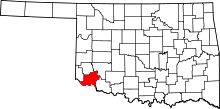 | |
| Towns | ||
| Unincorporated communities | ||
| Ghost towns | ||