Ardmore Airport (Alabama)
| Ardmore Airport | |||||||||||
|---|---|---|---|---|---|---|---|---|---|---|---|
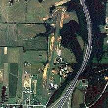 NAIP aerial image, 24 August 2006 | |||||||||||
| IATA: none – ICAO: none – FAA LID: 1M3 | |||||||||||
| Summary | |||||||||||
| Airport type | Public use | ||||||||||
| Owner | Loretta Trulson | ||||||||||
| Serves | Ardmore, Alabama | ||||||||||
| Elevation AMSL | 922 ft / 281 m | ||||||||||
| Coordinates | 34°58′45″N 086°52′59″W / 34.97917°N 86.88306°W | ||||||||||
| Runways | |||||||||||
| |||||||||||
| Statistics (2010) | |||||||||||
| |||||||||||
Ardmore Airport (FAA LID: 1M3) is a privately owned, public-use airport located two nautical miles (4 km) southwest of the central business district of Ardmore, a city in Limestone County, Alabama, United States.[1]
Facilities and aircraft
Ardmore Airport covers an area of 46 acres (19 ha) at an elevation of 922 feet (281 m) above mean sea level. It has one runway designated 1/19 with a turf surface measuring 2,700 by 100 feet (823 x 30 m).[1]
For the 12-month period ending July 8, 2010, the airport had 2,260 aircraft operations, an average of 188 per month: 90% general aviation, 9% military, and 1% air taxi. At that time there were 8 aircraft based at this airport: 75% single-engine and 25% multi-engine.[1]
References
- 1 2 3 4 FAA Airport Master Record for 1M3 (Form 5010 PDF). Federal Aviation Administration. Effective 25 August 2011.
External links
- Aerial image as of 6 March 1997 from USGS The National Map
- Resources for this airport:
- FAA airport information for 1M3
- AirNav airport information for 1M3
- FlightAware airport information and live flight tracker
- SkyVector aeronautical chart for 1M3
This article is issued from Wikipedia - version of the 1/27/2015. The text is available under the Creative Commons Attribution/Share Alike but additional terms may apply for the media files.