Carl Folsom Airport
| Carl Folsom Airport | |||||||||||
|---|---|---|---|---|---|---|---|---|---|---|---|
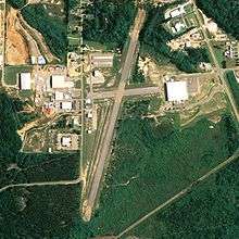 NAIP aerial image, 30 June 2006 | |||||||||||
| IATA: none – ICAO: none – FAA LID: 14J | |||||||||||
| Summary | |||||||||||
| Airport type | Public | ||||||||||
| Owner | Elba Airport Authority | ||||||||||
| Serves | Elba, Alabama | ||||||||||
| Elevation AMSL | 258 ft / 79 m | ||||||||||
| Coordinates | 31°24′36″N 086°05′25″W / 31.41000°N 86.09028°W | ||||||||||
| Runways | |||||||||||
| |||||||||||
| Statistics (2010) | |||||||||||
| |||||||||||
Carl Folsom Airport (FAA LID: 14J) is a public-use airport located two nautical miles (4 km) west of the central business district of Elba, a city in Coffee County, Alabama, United States. It is owned by the Elba Airport Authority.[1]
This airport is included in the FAA's National Plan of Integrated Airport Systems for 2011–2015[2] and 2009–2013,[3] both of which categorized it as a general aviation facility.
Facilities and aircraft
Carl Folsom Airport covers an area of 171 acres (69 ha) at an elevation of 258 feet (79 m) above mean sea level. It has one runway designated 1/19 with an asphalt surface measuring 3,050 by 75 feet (930 x 23 m).[1]
For the 12-month period ending December 9, 2010, the airport had 5,360 aircraft operations, an average of 14 per day: 95% general aviation and 5% military. At that time there were 18 aircraft based at this airport: 78% single-engine, 11% multi-engine, 6% jet and 6% helicopter.[1]
See also
References
- 1 2 3 4 FAA Airport Master Record for 14J (Form 5010 PDF). Federal Aviation Administration. Effective 25 August 2011.
- ↑ "2011–2015 NPIAS Report, Appendix A (PDF, 2.03 MB)" (PDF). 2011–2015 National Plan of Integrated Airport Systems. Federal Aviation Administration. 4 October 2010. Archived from the original (PDF) on 2012-09-27.
- ↑ "2009–2013 NPIAS Report, Appendix A: Part 1 (PDF, 1.33 MB)" (PDF). 2009–2013 National Plan of Integrated Airport Systems. Federal Aviation Administration. 15 October 2008. Archived from the original (PDF) on 2011-08-06.
External links
- Aerial image as of 6 March 1997 from USGS The National Map
- Resources for this airport:
- FAA airport information for 14J
- AirNav airport information for 14J
- FlightAware airport information and live flight tracker
- SkyVector aeronautical chart for 14J