Northeast Alabama Regional Airport
| Northeast Alabama Regional Airport | |||||||||||||||
|---|---|---|---|---|---|---|---|---|---|---|---|---|---|---|---|
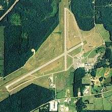 NAIP image, 2006 | |||||||||||||||
| IATA: GAD – ICAO: KGAD – FAA LID: GAD | |||||||||||||||
| Summary | |||||||||||||||
| Airport type | Public | ||||||||||||||
| Owner | Gadsden Airport Authority | ||||||||||||||
| Serves | Gadsden, Alabama | ||||||||||||||
| Elevation AMSL | 569 ft / 173 m | ||||||||||||||
| Coordinates | 33°58′22″N 086°05′21″W / 33.97278°N 86.08917°W | ||||||||||||||
| Website | http://www.nealair.com/ | ||||||||||||||
| Runways | |||||||||||||||
| |||||||||||||||
| Statistics (2009) | |||||||||||||||
| |||||||||||||||
Northeast Alabama Regional Airport (IATA: GAD, ICAO: KGAD, FAA LID: GAD) is five miles southwest of Gadsden, in Etowah County, Alabama.[1] It is owned by Gadsden Airport Authority[1] and it used to be Gadsden Municipal Airport. The FAA's National Plan of Integrated Airport Systems for 2009–2013 categorized as a general aviation facility. The airport has had scheduled passenger flights.
Facilities
The airport covers 1,480 acres (600 ha) at an elevation of 569 feet (173 m). It has two asphalt runways: 6/24 is 6,802 by 150 feet (2,073 x 46 m) and 18/36 is 4,806 by 150 feet (1,465 x 46 m).[1]
In the year ending April 9, 2009 the airport had 23,886 aircraft operations, average 65 per day: 93% general aviation, 5% air taxi and 2% military. 95 aircraft were then based at this airport: 89% single-engine, 4% multi-engine, 3% jet, 2% glider and 1% helicopter.[1]
Former airlines
- Air New Orleans - mid-1980s[2]
- Atlantic Southeast Airlines - early 1990s
- Southern Airways[3]
Incidents and accidents
- On April 9, 1990, a Delta Connection flight operated by Atlantic Southeast Airlines Embraer EMB-120 (Registration N217AS) as Flight 2254, en route to William B. Hartsfield Atlanta International Airport struck a Cessna 172 just after take-off. The Embraer was able to land, but the Cessna was unable to regain control and crashed. Of the seven on the Embraer, there were zero fatalities; the two on board the Cessna were killed.[4] The cause of the crash was attributed to pilots of both aircraft inadequately performing a visual lookout in addition to restricted vision caused by the sun's glare.[4]
References
- 1 2 3 4 5 FAA Airport Master Record for GAD (Form 5010 PDF), effective 2009-07-02.
- ↑ "Air New Orleans". AirTimes: A Collector's Guide to Airline Timetables. Retrieved 2007-10-30.
- ↑ "Southern Airways.org". Retrieved 5 May 2014.
- 1 2 "Brief of Accident". NTSB. Retrieved 2007-10-01.
External links
- Airfield photos for GAD from Civil Air Patrol
- FAA Terminal Procedures for GAD, effective December 8, 2016
- Resources for this airport:
- FAA airport information for GAD
- AirNav airport information for KGAD
- ASN accident history for GAD
- FlightAware airport information and live flight tracker
- NOAA/NWS latest weather observations
- SkyVector aeronautical chart, Terminal Procedures