Scottsboro Municipal Airport
| Scottsboro Municipal Airport Word Field | |||||||||||
|---|---|---|---|---|---|---|---|---|---|---|---|
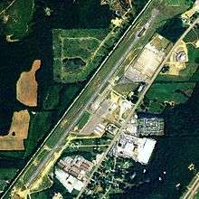 NAIP aerial image, 2006 | |||||||||||
| IATA: none – ICAO: none – FAA LID: 4A6 | |||||||||||
| Summary | |||||||||||
| Airport type | Public | ||||||||||
| Owner | City of Scottsboro | ||||||||||
| Serves | Scottsboro, Alabama | ||||||||||
| Elevation AMSL | 650 ft / 198 m | ||||||||||
| Coordinates | 34°41′19″N 086°00′21″W / 34.68861°N 86.00583°W | ||||||||||
| Website | CityOfScottsboro.com/... | ||||||||||
| Runways | |||||||||||
| |||||||||||
| Statistics (2009) | |||||||||||
| |||||||||||
Scottsboro Municipal Airport (FAA LID: 4A6), also known as Word Field, is a city-owned public-use airport located two nautical miles (3.7 km) northeast of the central business district of Scottsboro, a city in Jackson County, Alabama, United States.[1] According to the FAA's National Plan of Integrated Airport Systems for 2009–2013, it is categorized as a general aviation facility.[2]
Facilities and aircraft
Scottsboro Municipal Airport covers an area of 49 acres (20 ha) at an elevation of 650 feet (198 m) above mean sea level. It has one runway designated 4/22 with an asphalt surface measuring 5,250 by 80 feet (1,600 x 24 m).[1]
For the 12-month period ending May 12, 2009, the airport had 7,745 aircraft operations, an average of 21 per day, all general aviation. At that time there were 40 aircraft based at this airport: 82.5% single-engine, 2.5% multi-engine and 15% ultralight.[1]
References
- 1 2 3 4 FAA Airport Master Record for 4A6 (Form 5010 PDF). Federal Aviation Administration. Effective 3 June 2010.
- ↑ National Plan of Integrated Airport Systems for 2009–2013: Appendix A: Part 1 (PDF, 1.33 MB). Federal Aviation Administration. Updated 15 October 2008.
External links
- Aerial image as of 26 March 1998 from USGS The National Map
- Airfield photos for 4A6 from Civil Air Patrol
- FAA Terminal Procedures for 4A6, effective December 8, 2016
- Resources for this airport:
- FAA airport information for 4A6
- AirNav airport information for 4A6
- FlightAware airport information and live flight tracker
- SkyVector aeronautical chart for 4A6