St. Elmo Airport
| St. Elmo Airport St Elmo Army Auxiliary Airfield | |||||||||||
|---|---|---|---|---|---|---|---|---|---|---|---|
|
NAIP aerial image, 2006 | |||||||||||
| IATA: none – ICAO: none – FAA LID: 2R5 | |||||||||||
| Summary | |||||||||||
| Airport type | Public | ||||||||||
| Owner | State of Alabama | ||||||||||
| Serves | St. Elmo, Alabama | ||||||||||
| Elevation AMSL | 132 ft / 40 m | ||||||||||
| Coordinates | 30°30′07″N 088°16′30″W / 30.50194°N 88.27500°W | ||||||||||
| Map | |||||||||||
 2R5 Location of St. Elmo Airport | |||||||||||
| Runways | |||||||||||
| |||||||||||
| Statistics (2010) | |||||||||||
| |||||||||||
St. Elmo Airport (FAA LID: 2R5) is a state-owned public-use airport located two nautical miles (2.3 mi, 3.7 km) west of the central business district of St. Elmo, in Mobile County, Alabama, United States.[1] It is included in the FAA's National Plan of Integrated Airport Systems for 2011–2015, which categorized it as a general aviation facility.[2]
Facilities and aircraft
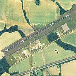
St. Elmo Airport covers an area of 733 acres (297 ha) at an elevation of 132 feet (40 m) above mean sea level. It has one runway designated 6/24 with an asphalt surface measuring 3,998 by 80 feet (1,219 x 24 m).[1]
For the 12-month period ending May 18, 2010, the airport had 20,400 general aviation aircraft operations, an average of 55 per day. At that time there were 31 aircraft based at this airport: 71% single-engine, 7% multi-engine, 3% jet, 3% helicopter and 16% ultralight.[1]
World War II
During World War II, the airport was used as an auxiliary airfield for the Army contract flying school at Bates Army Airfield in Mobile. The contract flying school operated between 1942 and 1944.
References
![]() This article incorporates public domain material from the Air Force Historical Research Agency website http://www.afhra.af.mil/.
This article incorporates public domain material from the Air Force Historical Research Agency website http://www.afhra.af.mil/.
- 1 2 3 4 FAA Airport Master Record for 2R5 (Form 5010 PDF). Federal Aviation Administration. Effective 30 June 2011.
- ↑ National Plan of Integrated Airport Systems for 2011–2015: Appendix A (PDF, 2.03 MB). Federal Aviation Administration. Updated 4 October 2010.
External links
- FAA Terminal Procedures for 2R5, effective December 8, 2016
- Resources for this airport:
- FAA airport information for 2R5
- AirNav airport information for 2R5
- FlightAware airport information and live flight tracker
- SkyVector aeronautical chart for 2R5