Alsvågvatnet
| Alsvågvatnet | |
|---|---|
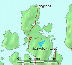 Map of Alsvågvatnet and surrounds | |
| Location | Øksnes, Nordland, Norway |
| Coordinates | 68°53′44″N 15°12′29″E / 68.89556°N 15.20806°E / 68.89556; 15.20806Coordinates: 68°53′44″N 15°12′29″E / 68.89556°N 15.20806°E / 68.89556; 15.20806 |
| Type | Natural lake |
| Basin countries | Norway |
| Max. length | 4.3 kilometres (2.7 mi) |
| Max. width | 1 kilometre (0.62 mi) |
| Surface area | 2.36 km2 (0.91 sq mi) |
| Shore length1 | 17.99 kilometres (11.18 mi) |
| Surface elevation | 8 metres (26 ft) |
| References | NVE |
| 1 Shore length is not a well-defined measure. | |
Alsvågvatnet is a lake which lies in the municipality of Øksnes in Nordland county, Norway. It is on the island of Langøya in the Vesterålen archipelago. There is birch woodland and bogland nearby. The 2.36-square-kilometre (0.91 sq mi) lake sits at an elevation of 8 metres (26 ft), about 1.3 kilometres (0.81 mi) west of Alsvåg, along the road to Myre.[1]
References
- ↑ "185/1 Alsvågvassdraget" (in Norwegian). Norwegian Water Resources and Energy Directorate. Retrieved 2012-07-31.
This article is issued from Wikipedia - version of the 9/4/2015. The text is available under the Creative Commons Attribution/Share Alike but additional terms may apply for the media files.