Aguilar, Colorado
| Aguilar, Colorado | |
|---|---|
| Statutory Town | |
|
Old building on main street of Aguilar, 1946. | |
| Motto: "Gateway to the Spanish Peaks" | |
 Location in Las Animas County and the State of Colorado | |
 Aguilar, Colorado Location in the United States | |
| Coordinates: 37°24′13″N 104°39′18″W / 37.403626°N 104.655036°WCoordinates: 37°24′13″N 104°39′18″W / 37.403626°N 104.655036°W[1] | |
| Country | United States |
| State | Colorado |
| County[2] | Las Animas County[2] |
| Founded | 1894 |
| Incorporated (town) | January 10, 1894[3] |
| Government | |
| • Type | Statutory Town[2] |
| • Mayor | Ellen Larson[4] |
| Area | |
| • Total | 0.4 sq mi (1 km2) |
| • Land | 0.4 sq mi (1 km2) |
| • Water | 0 sq mi (0 km2) |
| Elevation[5] | 6,394 ft (1,949 m) |
| Population (2010) | |
| • Total | 538 |
| • Density | 1,300/sq mi (540/km2) |
| Time zone | MST (UTC-7) |
| • Summer (DST) | MDT (UTC-6) |
| ZIP code | 81020[6] |
| Area code(s) | 719 |
| INCITS place code | 0800760 |
| GNIS feature ID | 0194464 |
| Website |
aguilarco |

Aguilar is a Statutory Town located in Las Animas County, Colorado, United States. The town population was 538 at the 2010 United States Census. Cattleman and prominent pioneer José Ramón Aguilar founded the town in 1894.[5][7]
History
The town was named for state legislator J. Ramon Aguilar. Aguilar owned the land that the town was built on.
In 1894 the town was incorporated.[8]
Geography
Aguilar is located at 37°24′12″N 104°39′16″W / 37.40333°N 104.65444°W (37.403299, -104.654363),[9] about one mile west of Interstate 25.
According to the United States Census Bureau, the town has a total area of 0.4 square miles (1.0 km2), all of it land.
Demographics
| Historical population | |||
|---|---|---|---|
| Census | Pop. | %± | |
| 1900 | 698 | — | |
| 1910 | 858 | 22.9% | |
| 1920 | 1,236 | 44.1% | |
| 1930 | 1,383 | 11.9% | |
| 1940 | 1,397 | 1.0% | |
| 1950 | 1,038 | −25.7% | |
| 1960 | 777 | −25.1% | |
| 1970 | 699 | −10.0% | |
| 1980 | 624 | −10.7% | |
| 1990 | 520 | −16.7% | |
| 2000 | 593 | 14.0% | |
| 2010 | 538 | −9.3% | |
| Est. 2015 | 476 | [10] | −11.5% |
As of the census[12] of 2000, there were 593 people, 243 households, and 165 families residing in the town. The population density was 1,508.8 inhabitants per square mile (582.6/km2). There were 291 housing units at an average density of 740.4 per square mile (288.1/km²). The racial makeup of the town was 86.00% White, 3.04% Native American, 0.34% Asian, 6.91% from other races, and 3.71% from two or more races. Hispanic or Latino of any race were 46.54% of the population.
There were 243 households out of which 23.5% had children under the age of 18 living with them, 48.1% were married couples living together, 14.4% had a female householder with no husband present, and 31.7% were non-families. 27.2% of all households were made up of individuals and 16.0% had someone living alone who was 65 years of age or older. The average household size was 2.44 and the average family size was 2.93.
In the town the population was spread out with 23.3% under the age of 18, 6.6% from 18 to 24, 20.2% from 25 to 44, 28.5% from 45 to 64, and 21.4% who were 65 years of age or older. The median age was 45 years. For every 100 females there were 97.7 males. For every 100 females age 18 and over, there were 88.8 males.
The median income for a household in the town was $23,750, and the median income for a family was $30,815. Males had a median income of $22,500 versus $21,250 for females. The per capita income for the town was $11,249. About 27.8% of families and 34.3% of the population were below the poverty line, including 64.0% of those under age 18 and 25.7% of those age 65 or over.
Climate
| Climate data for Aguilar | |||||||||||||
|---|---|---|---|---|---|---|---|---|---|---|---|---|---|
| Month | Jan | Feb | Mar | Apr | May | Jun | Jul | Aug | Sep | Oct | Nov | Dec | Year |
| Average high °F (°C) | 38.2 (3.4) |
43.9 (6.6) |
51.7 (10.9) |
60.4 (15.8) |
70 (21) |
81.8 (27.7) |
88.7 (31.5) |
86.8 (30.4) |
78.1 (25.6) |
65.6 (18.7) |
49.2 (9.6) |
40.4 (4.7) |
62.9 (17.2) |
| Average low °F (°C) | 11.9 (−11.2) |
17.1 (−8.3) |
23.8 (−4.6) |
31.6 (−0.2) |
41.7 (5.4) |
51 (11) |
56.7 (13.7) |
55 (13) |
45.7 (7.6) |
33.5 (0.8) |
21.7 (−5.7) |
13.7 (−10.2) |
33.6 (0.9) |
| Average precipitation inches (mm) | 0.6 (15) |
0.7 (18) |
1.7 (43) |
2.1 (53) |
2.6 (66) |
1.8 (46) |
2.7 (69) |
3.1 (79) |
1.6 (41) |
1 (30) |
1 (30) |
0.7 (18) |
19.6 (498) |
| Source: Weatherbase[13] | |||||||||||||
Education
Aguilar Public Schools is part of the Aguilar Reorganized School District RE-6. The school district has one elementary school and one junior/senior high school.
Aguilar Elementary School and Aguilar Junior/Senior High School are located in Aguilar.[14]
See also
References
- ↑ "2014 U.S. Gazetteer Files: Places". United States Census Bureau. July 1, 2014. Retrieved January 5, 2015.
- 1 2 3 "Active Colorado Municipalities". State of Colorado, Department of Local Affairs. Archived from the original on 2010-11-23. Retrieved 2007-09-01.
- ↑ "Colorado Municipal Incorporations". State of Colorado, Department of Personnel & Administration, Colorado State Archives. 2004-12-01. Archived from the original on 27 September 2007. Retrieved 2007-08-18.
- ↑ "Town of Aguilar Organization". Town of Aguilar. Retrieved 2008-01-13.
- 1 2 "Geographic Names Information System Feature Detail Report". USGS. Retrieved 2007-08-18.
- ↑ "ZIP Code Lookup" (JavaScript/HTML). United States Postal Service. August 18, 2007. Archived from the original on 18 August 2007. Retrieved August 18, 2007.
- ↑ "The Jose Ramon Aguilar Story". Centennial Aguilar Booklet 1994. Apishapa Valley Historical Society. Archived from the original on 14 September 2007. Retrieved 2007-08-18.
- ↑ "Profile for Aguilar, Colorado, CO". ePodunk. Retrieved 2012-03-07.
- ↑ "US Gazetteer files: 2010, 2000, and 1990". United States Census Bureau. 2011-02-12. Retrieved 2011-04-23.
- ↑ "Annual Estimates of the Resident Population for Incorporated Places: April 1, 2010 to July 1, 2015". Retrieved July 2, 2016.
- ↑ "Census of Population and Housing". Census.gov. Archived from the original on May 11, 2015. Retrieved June 4, 2015.
- ↑ "American FactFinder". United States Census Bureau. Archived from the original on 2013-09-11. Retrieved 2008-01-31.
- ↑ "Weatherbase: Historical Weather for Aguilar, Colorado". Weatherbase. November 2011. Retrieved November 24, 2011.
- ↑ "Aguilar Reorganized School District RE-6". Aguilar Reorganized School District RE-6. Archived from the original on 2012-04-24. Retrieved 2012-03-07.
External links
| Wikimedia Commons has media related to Aguilar, Colorado. |
- Town of Aguilar website
- Town of Aguilar - Office of Emergency Management website
- Town of Aguilar - Marshal's Office website
Municipalities and communities of Las Animas County, Colorado, United States | ||
|---|---|---|
| City | 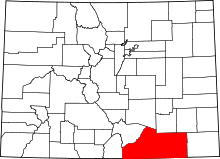 | |
| Towns | ||
| CDPs | ||
| Unincorporated communities | ||
| Ghost towns | ||
