Branson, Colorado
| Town of Branson, Colorado | |
|---|---|
| Statutory Town | |
|
Entering Branson from the south. | |
 Location in Las Animas County and the State of Colorado | |
 Town of Branson, Colorado Location in the United States | |
| Coordinates: 37°00′56″N 103°53′02″W / 37.015493°N 103.883777°WCoordinates: 37°00′56″N 103°53′02″W / 37.015493°N 103.883777°W[1] | |
| Country |
|
| State |
|
| County | Las Animas County[2] |
| Incorporated | 1921-03-26[3] |
| Government | |
| • Type | Statutory Town[2] |
| Area | |
| • Total | 0.2 sq mi (0.6 km2) |
| • Land | 0.2 sq mi (0.6 km2) |
| • Water | 0 sq mi (0 km2) |
| Elevation[4] | 6,256 ft (1,907 m) |
| Population (2010) | |
| • Total | 74 |
| • Density | 370/sq mi (120/km2) |
| Time zone | MST (UTC-7) |
| • Summer (DST) | MDT (UTC-6) |
| ZIP code | 81027[5] |
| Area code(s) | 719 |
| INCITS place code | 0808345 |
| GNIS feature ID | 0196276 |
|
| |

The Town of Branson is a Statutory Town in Las Animas County, Colorado, United States. The town population was 74 at the 2010 United States Census. Branson is the southernmost town in the state of Colorado, located just 0.30 miles (0.48 km) from the New Mexico border.
Branson is located approximately 35 miles east of Trinidad, Colorado, on State Highway 389, in the Great Plains, as well in the Black Mesa area, the town is surrounded by mesa. It is a ranching community today. Farming in the area was severely impacted by the dust bowl. Branson is much smaller than it once was in more optimistic days and features some picturesque abandoned buildings.
History
The town was first known as Wilson, or Wilson Switch; then as Coloflats. A post office was established in 1915, and its name was changed to Branson in 1918. The town is named after Josiah F. Branson who platted the town on his land. The town was incorporated in 1921. Branson is located north of a break in the mesas which separate Southeast Colorado from Northwest New Mexico, the route of a minor branch of the Santa Fe Trail. It was founded near a switch, Wilson Switch, of the Denver, Texas, and Fort Worth Railroad, later merged into the Colorado and Southern Railway, a predecessor of today's Burlington Northern Santa Fe. A depot was built in 1918. Despite being unsuitable for farming, many homesteaders attempted dryland farming in the early 20th century. In good years there were bountiful harvests of grain and in the 1920s the town boasted 1000 people and 3 grain elevators as well as facilities such as a bank and a newspaper. After the drought and dust bowl of the 1930s population decreased rapidly as the economy turned from farming to ranching.
Geography
Branson is located at 37°0′55″N 103°53′1″W / 37.01528°N 103.88361°W (37.015291, -103.883684).[6]
According to the United States Census Bureau, the town has a total area of 0.2 square miles (0.52 km2), all of it land.
Climate
| Climate data for Branson, Colorado (Elevation 6,257ft) | |||||||||||||
|---|---|---|---|---|---|---|---|---|---|---|---|---|---|
| Month | Jan | Feb | Mar | Apr | May | Jun | Jul | Aug | Sep | Oct | Nov | Dec | Year |
| Record high °F (°C) | 71 (22) |
74 (23) |
83 (28) |
86 (30) |
92 (33) |
99 (37) |
100 (38) |
97 (36) |
95 (35) |
86 (30) |
78 (26) |
78 (26) |
100 (38) |
| Average high °F (°C) | 45.8 (7.7) |
47.6 (8.7) |
52.5 (11.4) |
62.8 (17.1) |
71.7 (22.1) |
81.8 (27.7) |
86.4 (30.2) |
84.5 (29.2) |
78.1 (25.6) |
67.0 (19.4) |
55.0 (12.8) |
47.2 (8.4) |
65.0 (18.3) |
| Average low °F (°C) | 21.0 (−6.1) |
22.2 (−5.4) |
25.3 (−3.7) |
35.4 (1.9) |
44.6 (7) |
53.9 (12.2) |
59.1 (15.1) |
58.1 (14.5) |
50.7 (10.4) |
40.4 (4.7) |
29.0 (−1.7) |
23.1 (−4.9) |
38.6 (3.7) |
| Record low °F (°C) | −25 (−32) |
−15 (−26) |
−10 (−23) |
5 (−15) |
19 (−7) |
28 (−2) |
40 (4) |
41 (5) |
25 (−4) |
7 (−14) |
−8 (−22) |
−9 (−23) |
−25 (−32) |
| Average precipitation inches (mm) | 0.44 (11.2) |
0.64 (16.3) |
0.93 (23.6) |
1.71 (43.4) |
2.37 (60.2) |
1.28 (32.5) |
2.68 (68.1) |
2.86 (72.6) |
1.46 (37.1) |
1.01 (25.7) |
0.74 (18.8) |
0.60 (15.2) |
16.72 (424.7) |
| Average snowfall inches (cm) | 6.8 (17.3) |
6.7 (17) |
9.9 (25.1) |
5.8 (14.7) |
0.7 (1.8) |
0 (0) |
0 (0) |
0 (0) |
0.2 (0.5) |
1.9 (4.8) |
6.4 (16.3) |
8.4 (21.3) |
46.9 (119.1) |
| Source: http://www.wrcc.dri.edu/cgi-bin/cliMAIN.pl?co0898. | |||||||||||||
Demographics
| Historical population | |||
|---|---|---|---|
| Census | Pop. | %± | |
| 1930 | 237 | — | |
| 1940 | 250 | 5.5% | |
| 1950 | 157 | −37.2% | |
| 1960 | 124 | −21.0% | |
| 1970 | 70 | −43.5% | |
| 1980 | 73 | 4.3% | |
| 1990 | 58 | −20.5% | |
| 2000 | 77 | 32.8% | |
| 2010 | 74 | −3.9% | |
| Est. 2015 | 67 | [7] | −9.5% |
As of the census[9] of 2000, there were 77 people, 37 households, and 24 families residing in the town. The population density was 309.6 people per square mile (118.9/km²). There were 43 housing units at an average density of 172.9 per square mile (66.4/km²). The racial makeup of the town was 97.40% White, 1.30% Native American, and 1.30% from two or more races. Hispanic or Latino of any race were 19.48% of the population.
There were 37 households out of which 32.4% had children under the age of 18 living with them, 45.9% were married couples living together, 16.2% had a female householder with no husband present, and 35.1% were non-families. 35.1% of all households were made up of individuals and 18.9% had someone living alone who was 65 years of age or older. The average household size was 2.08 and the average family size was 2.63.
In the town the population was spread out with 26.0% under the age of 18, 1.3% from 18 to 24, 29.9% from 25 to 44, 20.8% from 45 to 64, and 22.1% who were 65 years of age or older. The median age was 42 years. For every 100 females there were 71.1 males. For every 100 females age 18 and over, there were 62.9 males.
The median income for a household in the town was $24,583, and the median income for a family was $23,214. Males had a median income of $19,167 versus $20,000 for females. The per capita income for the town was $14,933. There were 26.9% of families and 25.0% of the population living below the poverty line, including 33.3% of under eighteens and none of those over 64.
See also
References
- ↑ "2014 U.S. Gazetteer Files: Places". United States Census Bureau. July 1, 2014. Retrieved January 5, 2015.
- 1 2 "Active Colorado Municipalities". State of Colorado, Department of Local Affairs. Archived from the original on 2010-11-23. Retrieved 2007-11-30.
- ↑ "Colorado Municipal Incorporations". State of Colorado, Department of Personnel & Administration, Colorado State Archives. 2004-12-01. Retrieved 2007-09-02.
- ↑ "US Board on Geographic Names". United States Geological Survey. 2007-10-25. Retrieved 2008-01-31.
- ↑ "ZIP Code Lookup". United States Postal Service. Archived from the original (JavaScript/HTML) on September 3, 2007. Retrieved September 4, 2007.
- ↑ "US Gazetteer files: 2010, 2000, and 1990". United States Census Bureau. 2011-02-12. Retrieved 2011-04-23.
- ↑ "Annual Estimates of the Resident Population for Incorporated Places: April 1, 2010 to July 1, 2015". Retrieved July 2, 2016.
- ↑ "Census of Population and Housing". Census.gov. Archived from the original on May 11, 2015. Retrieved June 4, 2015.
- ↑ "American FactFinder". United States Census Bureau. Archived from the original on 2013-09-11. Retrieved 2008-01-31.
External links
| Wikimedia Commons has media related to Branson, Colorado. |
- CDOT map of the Town of Branson
- History, photos and information on Sangres.com
- Branson School Online Branson School Online
- Branson history
- Article in the New York Times on Branson School Online
Municipalities and communities of Las Animas County, Colorado, United States | ||
|---|---|---|
| City | 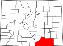 | |
| Towns | ||
| CDPs | ||
| Unincorporated communities | ||
| Ghost towns | ||