Yosemite Village, California
| Yosemite Village | |
|---|---|
| Unincorporated community | |
 Yosemite Village  Yosemite Village Location in California | |
| Coordinates: 37°44′43″N 119°35′54″W / 37.74528°N 119.59833°WCoordinates: 37°44′43″N 119°35′54″W / 37.74528°N 119.59833°W | |
| Country | United States |
| State | California |
| County | Mariposa County |
| Elevation[1] | 3,996 ft (1,218 m) |
Yosemite Village (formerly, Yosemite and Yo Semite)[2] is an unincorporated community in Mariposa County, California.[1] It is located 44 miles (71 km) northeast of Mariposa,[2] at an elevation of 3996 feet (1218 m).[1]
Yosemite Village is the primary developed place in Yosemite Valley. Situated along the north side of the valley floor, its permanent population includes National Park Service staff and some concession workers. The Village is the site of some useful facilities, such as a fire station, a post office (ZIP Code 95389), a medical clinic, a convenience store, restaurants, gift shops, a school (kindergarten through eighth grade), and the park's headquarters facilities, and main visitor center. The Yosemite Lodge is located on the west end of the village near Yosemite Falls. The Ahwahnee Hotel is a few blocks to the north. Like Camp Curry, Yosemite Village is characterized by shed style architecture making heavy use of native wood.
A post office opened in 1869, originally named Yo Semite, with its name changed its name to Yosemite in 1908 and to Yosemite National Park in 1922.[2] In 1906, Major H.C. Benson started Fort Yosemite at the site of what became the Yosemite Lodge.[2] Troops were stationed at Fort Yosemite until 1916, with the creation of the National Park Service.[2]
Yosemite Village was designed by National Park Service landscape architect Charles Punchard, Jr., among others.
Climate
This region experiences warm (but not hot) and dry summers, with no average monthly temperatures above 71.6 °F. According to the Köppen Climate Classification system, Yosemite Village has a warm-summer Mediterranean climate, abbreviated "Csb" on climate maps.[3]
See also
References
- 1 2 3 U.S. Geological Survey Geographic Names Information System: Yosemite Village, California
- 1 2 3 4 5 Durham, David L. (1998). California's Geographic Names: A Gazetteer of Historic and Modern Names of the State. Clovis, Calif.: Word Dancer Press. p. 849. ISBN 1-884995-14-4.
- ↑ Climate Summary for Yosemite Village, California
External links
| Wikimedia Commons has media related to Yosemite Village Historic District. |
| Attractions |
| |||||||
|---|---|---|---|---|---|---|---|---|
| People | ||||||||
| Lodging & camping | ||||||||
| Natural disasters | ||||||||
| Transportation | ||||||||
| Nearby municipalities | ||||||||
| Additional information |
| |||||||

Municipalities and communities of Mariposa County, California, United States | ||
|---|---|---|
| CDPs | 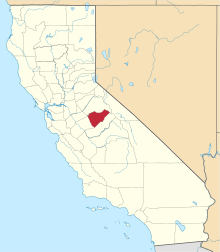 | |
| Unincorporated communities | ||
| Former settlements | ||