Bridgeport, Mariposa County, California
| Bridgeport | |
|---|---|
| Unincorporated community | |
 Bridgeport  Bridgeport Location in California | |
| Coordinates: 37°26′00″N 120°00′16″W / 37.43333°N 120.00444°WCoordinates: 37°26′00″N 120°00′16″W / 37.43333°N 120.00444°W | |
| Country | United States |
| State | California |
| County | Mariposa County |
| Elevation[1] | 1,499 ft (457 m) |
Bridgeport (until 1852, Suckertown)[2] is an unincorporated community in Mariposa County, California.[1] It is located on Agua Fria Creek 5 miles (8 km) east of Catheys Valle,[2] at an elevation of 1499 feet (457 m).[1]
Originally called Suckertown, Andrew Church opened a store in 1852 and bestowed its current name.[2]
References
Municipalities and communities of Mariposa County, California, United States | ||
|---|---|---|
| CDPs | 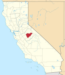 | |
| Unincorporated communities | ||
| Former settlements | ||
This article is issued from Wikipedia - version of the 7/5/2016. The text is available under the Creative Commons Attribution/Share Alike but additional terms may apply for the media files.