Bootjack, California
| Bootjack | |
|---|---|
| census-designated place | |
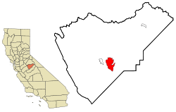 Location in Mariposa County and the state of California | |
 Bootjack Location in the United States | |
| Coordinates: 37°27′54″N 119°53′12″W / 37.46500°N 119.88667°WCoordinates: 37°27′54″N 119°53′12″W / 37.46500°N 119.88667°W | |
| Country |
|
| State |
|
| County | Mariposa |
| Area[1] | |
| • Total | 7.064 sq mi (18.296 km2) |
| • Land | 7.001 sq mi (18.134 km2) |
| • Water | 0.063 sq mi (0.162 km2) 0.89% |
| Elevation[2] | 2,238 ft (682 m) |
| Population (2010) | |
| • Total | 960 |
| • Density | 140/sq mi (52/km2) |
| Time zone | Pacific (PST) (UTC-8) |
| • Summer (DST) | PDT (UTC-7) |
| ZIP code | 95338 |
| Area code(s) | 209 |
| FIPS code | 06-07525 |
| GNIS feature ID | 277477 |
Bootjack is an unincorporated community and census-designated place in Mariposa County, California, United States.[2] Bootjack is located 4.5 miles (7.2 km) east-southeast of Mariposa,[3] at an elevation of 2238 feet (682 m).[2] The population was 960 at the 2010 census, down from 1,588 at the 2000 census.
Geography
Bootjack is located at 37°27′54″N 119°53′12″W / 37.46500°N 119.88667°W.[2]
According to the United States Census Bureau, the CDP has a total area of 7.1 square miles (18 km2), of which 7.0 square miles (18 km2) is land and 0.89% is water.
At the 2000 census, according to the United States Census Bureau, the CDP had a total area of 18.0 square miles (47 km2), of which, 18.0 square miles (47 km2) of it was land and 0.06% was water.
History
Three versions are current of how the town was named.[3] The first, a fork in the road made a boot jack shape (basically, a "Y").[3] The second, is that a landmark tree at the place had a bootjack shape.[3] And third, that after a horse thief's hanging at the place a bootjack was used to remove his boots.[3]
Demographics
2010
The 2010 United States Census[4] reported that Bootjack had a population of 960. The population density was 135.9 people per square mile (52.5/km²). The racial makeup of Bootjack was 811 (84.5%) White, 2 (0.2%) African American, 34 (3.5%) Native American, 11 (1.1%) Asian, 0 (0.0%) Pacific Islander, 31 (3.2%) from other races, and 71 (7.4%) from two or more races. Hispanic or Latino of any race were 76 persons (7.9%).
The Census reported that 960 people (100% of the population) lived in households, 0 (0%) lived in non-institutionalized group quarters, and 0 (0%) were institutionalized.
There were 393 households, out of which 101 (25.7%) had children under the age of 18 living in them, 221 (56.2%) were opposite-sex married couples living together, 26 (6.6%) had a female householder with no husband present, 17 (4.3%) had a male householder with no wife present. There were 24 (6.1%) unmarried opposite-sex partnerships, and 4 (1.0%) same-sex married couples or partnerships. 99 households (25.2%) were made up of individuals and 49 (12.5%) had someone living alone who was 65 years of age or older. The average household size was 2.44. There were 264 families (67.2% of all households); the average family size was 2.85.
The population was spread out with 208 people (21.7%) under the age of 18, 59 people (6.1%) aged 18 to 24, 147 people (15.3%) aged 25 to 44, 347 people (36.1%) aged 45 to 64, and 199 people (20.7%) who were 65 years of age or older. The median age was 49.6 years. For every 100 females there were 95.1 males. For every 100 females age 18 and over, there were 97.4 males.
There were 451 housing units at an average density of 63.8 per square mile (24.6/km²), of which 285 (72.5%) were owner-occupied, and 108 (27.5%) were occupied by renters. The homeowner vacancy rate was 0.3%; the rental vacancy rate was 7.7%. 683 people (71.1% of the population) lived in owner-occupied housing units and 277 people (28.9%) lived in rental housing units.
2000
As of the census[5] of 2000, there were 1,588 people, 636 households, and 471 families residing in the community. The population density was 88.2 people per square mile (34.0/km²). There were 744 housing units at an average density of 41.3 per square mile (15.9/km²). The racial makeup of the community was 92.13% White, 0.31% Black or African American, 4.09% Native American, 0.13% Asian, 0.13% Pacific Islander, 1.07% from other races, and 2.14% from two or more races. 4.47% of the population were Hispanic or Latino of any race.
There were 636 households out of which 29.6% had children under the age of 18 living with them, 59.6% were married couples living together, 8.3% had a female householder with no husband present, and 25.8% were non-families. 21.1% of all households were made up of individuals and 10.1% had someone living alone who was 65 years of age or older. The average household size was 2.50 and the average family size was 2.88.
In the community the population was spread out with 25.2% under the age of 18, 4.0% from 18 to 24, 21.2% from 25 to 44, 31.0% from 45 to 64, and 18.6% who were 65 years of age or older. The median age was 45 years. For every 100 females there were 94.6 males. For every 100 females age 18 and over, there were 96.0 males.
The median income for a household in the community was $30,991, and the median income for a family was $33,092. Males had a median income of $39,145 versus $24,271 for females. The per capita income for the community was $14,771. About 8.2% of families and 10.7% of the population were below the poverty line, including 9.8% of those under age 18 and 7.4% of those age 65 or over.
Government
In the California State Legislature, Bootjack is in the 8th Senate District, represented by Republican Tom Berryhill, and the 5th Assembly District, represented by Republican Frank Bigelow.[6]
In the United States House of Representatives, Bootjack is in California's 4th congressional district, represented by Republican Tom McClintock.[7]
References
- ↑ "2010 Census Gazetteer Files - Places - California". United States Census Bureau. Retrieved March 26, 2015.
- 1 2 3 4 U.S. Geological Survey Geographic Names Information System: Bootjack, California
- 1 2 3 4 5 Durham, David L. (1998). California's Geographic Names: A Gazetteer of Historic and Modern Names of the State. Clovis, Calif.: Word Dancer Press. p. 749. ISBN 1-884995-14-4.
- ↑ "2010 Census Interactive Population Search: CA - Bootjack CDP". U.S. Census Bureau. Retrieved July 12, 2014.
- ↑ "American FactFinder". United States Census Bureau. Archived from the original on 2013-09-11. Retrieved 2008-01-31.
- ↑ "Statewide Database". Regents of the University of California. Retrieved March 26, 2015.
- ↑ "California's 4th Congressional District - Representatives & District Map". Civic Impulse, LLC. Retrieved October 1, 2014.
Municipalities and communities of Mariposa County, California, United States | ||
|---|---|---|
| CDPs | 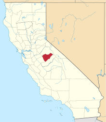 | |
| Unincorporated communities | ||
| Former settlements | ||