Yazgulem Range
| Yazgulem Range Язгулемский хребет | |
|---|---|
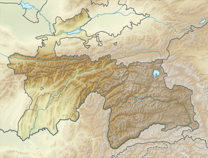 Location in Tajikistan | |
| Highest point | |
| Peak | Independence Peak (Qullai Istiqlol) |
| Elevation | 6,974 m (22,881 ft) |
| Coordinates | 38°30′36″N 72°21′15″E / 38.5100°N 72.3542°ECoordinates: 38°30′36″N 72°21′15″E / 38.5100°N 72.3542°E |
| Geography | |
| Country | Tajikistan |
| Parent range | Pamir Mountains |
| Geology | |
| Type of rock | shale, sandstone, limestone and granite |
Yazgulem Range (Russian: Язгулемский хребет) is a mountain range of the western Pamir Mountains.[1]
It is located in Tajikistan's Gorno-Badakhshan Autonomous Province stretches for about 170 km between the Yazgulyam River and the Bartang River in the western Pamirs. The range rises in a north-eastern direction from the border with Afghanistan toward its highest elevation at Independence Peak, former 'Revolution Peak' (6,974 m). The average elevation ranges between 4,500 and 6,000 m. Glaciers cover about 630 km2 of the range, including the Fedchenko Glacier stretching northwards.
See also
References
| Districts | 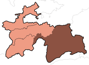 | |
|---|---|---|
| Main cities and towns | ||
| Geography | ||
This article is issued from Wikipedia - version of the 10/4/2016. The text is available under the Creative Commons Attribution/Share Alike but additional terms may apply for the media files.