Rushan Range
| Rushan Range Рушанский хребет | |
|---|---|
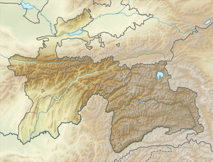 Location in Tajikistan | |
| Highest point | |
| Peak | Patkhor Peak |
| Elevation | 6,083 m (19,957 ft) |
| Coordinates | 37°54′0″N 72°10′0″E / 37.90000°N 72.16667°ECoordinates: 37°54′0″N 72°10′0″E / 37.90000°N 72.16667°E |
| Dimensions | |
| Length | 120 km (75 mi) NE/SW |
| Width | 35 km (22 mi) NW/SE |
| Geography | |
| Country | Tajikistan |
| Parent range | Pamir Mountains |
| Geology | |
| Age of rock | Paleozoic |
| Type of rock | Granite, schist, quartzite, sandstone, limestone and gneiss |
Rushan Range is a mountain range in south-western Pamir in Tajikistan, trending in the south-westerly direction from Sarez Lake toward Khorog, between Gunt River to the south and Bartang River to the north. About 120 km long, it reaches its highest elevation of 6,083 m at Patkhor Peak.[1]
See also
References
| Districts | 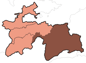 | |
|---|---|---|
| Main cities and towns | ||
| Geography | ||
This article is issued from Wikipedia - version of the 10/5/2016. The text is available under the Creative Commons Attribution/Share Alike but additional terms may apply for the media files.