Ishkoshim Range
| Ishkoshim Range Ишкашимский хребет | |
|---|---|
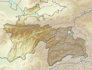 Location in Tajikistan | |
| Highest point | |
| Peak | Mayakovsky Peak |
| Elevation | 6,096 m (20,000 ft) |
| Coordinates | 37°0′N 71°40′E / 37.000°N 71.667°ECoordinates: 37°0′N 71°40′E / 37.000°N 71.667°E |
| Geography | |
| Country | Tajikistan |
| Parent range | Pamir Mountains |
| Geology | |
| Age of rock | Paleozoic |
| Type of rock | sedimentary and metamorphic rocks |
Ishkoshim Range, also Ishkashim Range (Russian: Ишкашимский хребет), is a mountain range in Pamir Mountains in Tajikistan, in the extreme southwest corner of the Gorno-Badakhshan Autonomous Province (Ishkoshim District).
The range is about 90 km long, running along the right bank of the Panj River and the eastern border of Ishkoshim District with Roshtqal'a District. It contains the Ishkashim Important Bird Area. The mountains rise in the south to a maximum altitude of 6,096 m at Mayakovsky Peak, located at the junction of Ishkoshim Range with the east-west Shakhdara Range. There is an abundance of hot springs in these mountains, including the Gharm-Chashma thermal spa.[1]
References
- ↑ Big Soviet Encyclopedia, on-line edition (Russian)
External links
| Districts | 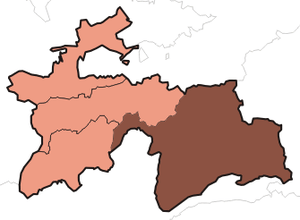 | |
|---|---|---|
| Main cities and towns | ||
| Geography | ||
This article is issued from Wikipedia - version of the 10/4/2016. The text is available under the Creative Commons Attribution/Share Alike but additional terms may apply for the media files.