Darvoz District
| Darvoz District Ноҳияи Дарвоз | |
|---|---|
| District | |
| Ноҳияи Дарвоз | |
 Location of Darvoz District in Tajikistan | |
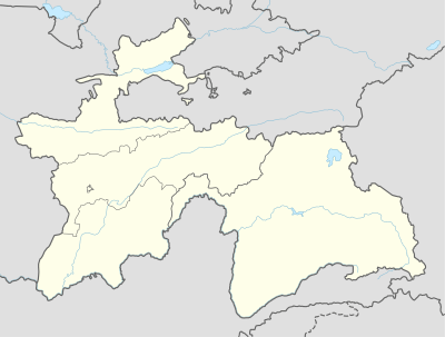 Darvoz District Location of Darvoz District in Tajikistan | |
| Coordinates: 38°27′15″N 70°47′21″E / 38.45417°N 70.78917°ECoordinates: 38°27′15″N 70°47′21″E / 38.45417°N 70.78917°E | |
| Country |
|
| Province | Gorno-Badakhshan Autonomous Region |
| Capital | Qal'ai Khumb |
| Area | |
| • Total | 1,090.5 sq mi (2,824.5 km2) |
| Elevation | 14,711 ft (4,484 m) |
| Population (2008) | |
| • Total | 23 600 |
| as of 1 January 2008 | |
| Time zone | TJT (UTC+5) |
| Postal code | 736400 |
| Area code(s) | +992 3552 |
Darvoz District or Nohiya-i Darvoz (Tajik: Ноҳияи Дарвоз / Persian: ناحیۀ درواز) is a district in Tajikistan, located at the extreme north-west of the Gorno-Badakhshan Autonomous Region. It borders on Afghanistan to the south, along the Panj, and within Tajikistan on Khatlon Province to the west and on the Region of Republican Subordination to the north.[1] Its administrative capital is Qal'ai Khumb. The population in Darvoz district is 23,600 (1 January 2008 estimate).[2] The district was historically part of the Darvaz principality, a semi-independent statelet ruled by a mir.[3]
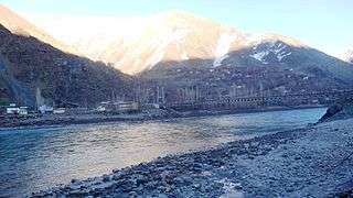
Friendship bridge between 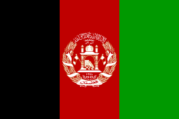 Afghanistan and
  Tajikistan in Region Darwaz-Darvoz, * Qal'ai Khumb, *Nusay.
See also
References
- ↑ Republic of Tajikistan, map showing administrative division as of January 1, 2004, "Tojikkoinot" Cartographic Press, Dushanbe
- ↑ Population of the Republic of Tajikistan as of 1 January 2008, State Committee of Statistics, Dushanbe, 2008 (Russian)
- ↑ Seymour Becker. Russia’s Protectorates in Central Asia: Bukhara and Khiva, 1865-1924. Cambridge: Harvard University Press. 1968.
| Districts | 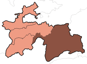 | |
|---|---|---|
| Main cities and towns | ||
| Geography | ||
This article is issued from Wikipedia - version of the 5/18/2016. The text is available under the Creative Commons Attribution/Share Alike but additional terms may apply for the media files.