Murghab, Tajikistan
| Murghab | |
|---|---|
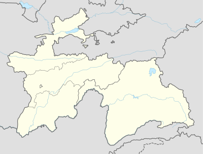 Murghab Location in Tajikistan | |
| Coordinates: 38°10′08″N 73°57′54″E / 38.16889°N 73.96500°E | |
| Country |
|
| Province | Gorno-Badakhshan Autonomous Region |
| Elevation | 3,618 m (11,869 ft) |
| Population (2000) | |
| • Total | 4,000 |
| Time zone | UTC+5 |

Murghab (Tajik Мурғоб; Russian Мургаб, from the Persian word مرغاب (margh-ab) meaning "prairie river") is the capital of Murghob District in the Pamir Mountains of Gorno-Badakhshan Autonomous Region, Tajikistan. With a population of 4,000, Murghab is about the only significant town the eastern half of Gorno-Badakhshan. It is the highest town in Tajikistan (and of the former Soviet Union) at 3,650 m above sea level. It located at the junction of the Murghab River and the Pamir Highway.
The Pamir Highway goes north to Sary-Tash and on to Osh in Kyrgyzstan and southwest to the region's capital Khorog (about 300 kilometers distant). A newer road goes east over the Kulma Pass to the Karakoram Highway in China connecting to Tashkurgan to the south and Kashgar in the north. When the new road opened in May 2004, only Chinese and Tajik nationals were allowed to cross the Tajik–Chinese border at that point;[1] the status of the border crossing in 2010 remains the same and according to locals in near future no plans are to open Kulma for other nationals.
Murghab's location at the hub of these roads makes it a regional center for trade, reputedly including a significant trade in illicit drugs.
Pamirsky Post
The place was founded by the Russians as Pamirsky Post in 1893, as their most advanced military outpost into Central Asia.
The modern town was constructed during the period of Soviet rule of Tajikistan as a rest stop along the Pamir Highway. The population is about 25% Pamiri and 75% Kyrgyz. Murghab is expected to become a major center for trade between Xinjiang and central Asia.[2]
Geography
Climate
The Köppen Climate Classification sub-type for Murghab is "ET" or a Tundra Climate. The average annual temperature is −3.9 °C (25.0 °F). The warmest month is July with an average temperature of 8.7 °C (47.7 °F) and the coolest month is January with an average temperature of −18.7 °C (−1.7 °F). The average annual precipitation is 347.7 mm (13.69 in) and has an average of 87.1 days with precipitation. The wettest month is May with an average of 45.1 mm (1.78 in) of precipitation and the driest month is September with an average of 10.9 mm (0.43 in) of precipitation.[3]
| Climate data for Murghab | |||||||||||||
|---|---|---|---|---|---|---|---|---|---|---|---|---|---|
| Month | Jan | Feb | Mar | Apr | May | Jun | Jul | Aug | Sep | Oct | Nov | Dec | Year |
| Daily mean °C (°F) | −18.7 (−1.7) |
−16.8 (1.8) |
−9.9 (14.2) |
−2.7 (27.1) |
0.8 (33.4) |
5.1 (41.2) |
8.7 (47.7) |
8.5 (47.3) |
4 (39) |
−2.2 (28) |
−9 (16) |
−14.7 (5.5) |
−3.9 (25) |
| Average precipitation mm (inches) | 27.6 (1.087) |
29.4 (1.157) |
40.2 (1.583) |
38.4 (1.512) |
45.1 (1.776) |
28.4 (1.118) |
22.0 (0.866) |
19.9 (0.783) |
10.9 (0.429) |
22.8 (0.898) |
29.4 (1.157) |
33.6 (1.323) |
347.7 (13.689) |
| Average precipitation days (≥ 0.1 mm) | 6.6 | 7.7 | 8.7 | 9.0 | 11.0 | 9.0 | 8.4 | 6.5 | 5.0 | 4.9 | 4.6 | 5.7 | 87.1 |
| Average relative humidity (%) | 59.5 | 60.2 | 56.0 | 52.0 | 50.1 | 43.1 | 43.4 | 44.8 | 43.5 | 45.9 | 49.7 | 56.3 | 50.4 |
| Source: "The Climate of Murghab". Weatherbase. Retrieved 1 August 2014. | |||||||||||||
References
- "Gorno-Badakhshan, Tajikistan: Trekking Routes" (map). www.pamirs.org. Retrieved August 25, 2005.
- Jennings, David. (July 18 – July 25, 2004) "Sixty One Degrees: An Occasional Journal of an Asia-overland adventure".
- ↑ Travel Tajikistan
- ↑ Edward Wong, "China Quietly Extends Footprints Into Central Asia," New York Times, 2 January 2011.
- ↑ "Weatherbase". weatherbase.com. Retrieved 1 August 2014.
Coordinates: 38°10′08″N 73°57′54″E / 38.16889°N 73.96500°E
| Districts | 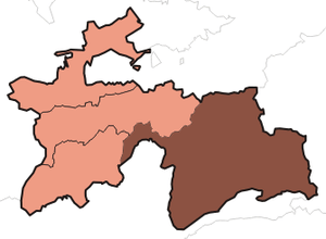 | |
|---|---|---|
| Main cities and towns | ||
| Geography | ||