Sarikol Range
| Sarikol Range Сарыкольский хребет Рашти Куҳи Сариқӯл 萨雷阔勒岭 | |
|---|---|
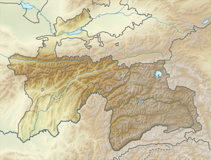 Location in Tajikistan | |
| Highest point | |
| Peak | Mount Lyavirdyr |
| Elevation | 6,351 m (20,837 ft) |
| Coordinates | 38°38′N 74°30′E / 38.633°N 74.500°ECoordinates: 38°38′N 74°30′E / 38.633°N 74.500°E |
| Dimensions | |
| Length | 350 km (220 mi) N/S |
| Width | 35 km (22 mi) E/W |
| Geography | |
| Country | Tajikistan / China |
| Parent range | Pamir Mountains |
| Geology | |
| Age of rock | Paleozoic |
| Type of rock | Granite, schist and gneiss |
The Sarikol Range (Chinese: 萨雷阔勒岭; pinyin: Sèlēikù'ěr Lǐng; Tajik: Рашти Куҳи Сариқӯл; Persian: رشته کوه سريكال or رشته کوه سرقول, Rashte Kūh-e Sarīkol) is a mountain range in the Pamirs on the border of Tajikistan and the People’s Republic of China.
The name Sarikol has also been used to describe the local people who are historically known as Sarikolis; the local Sarikoli language; and Tashkurgan Town, which was historically known as Sarikol.
Geography
The range divides Tajikistan's Gorno-Badakhshan Autonomous Province and China's Xinjiang Uyghur Autonomous Region and it runs parallel with the Muztagh Range to the east. The range extends 346 kilometres (215 mi) from the Markansu River in the north to the Beyik Pass in the south. Its average elevation is roughly 5,000 metres (16,500 ft) and the highest point in the range is Mount Lyavirdyr at 6,351 m (20,837 ft). On the Tajik part of the range there are 240 glaciers with a total area of 144 km².[1] The range’s drainage basin feeds both the Amu Darya and Tarim River. The range is composed of schist, granite, and gneiss.[2]
See also
References
- ↑ Сарыкольский хребет - article from the Great Soviet Encyclopedia
- ↑ "Sarykol Range", Encyclopædia Britannica, 2010-04-17
| Districts | 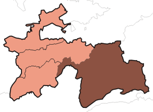 | |
|---|---|---|
| Main cities and towns | ||
| Geography | ||