Wisconsin Highway 60
| ||||
|---|---|---|---|---|
| Route information | ||||
| Maintained by WisDOT | ||||
| Length: | 185.08 mi[1] (297.86 km) | |||
| Major junctions | ||||
| West end: |
| |||
|
| ||||
| East end: |
| |||
| Location | ||||
| Counties: | Crawford, Richland, Sauk, Columbia, Dodge, Washington, Ozaukee | |||
| Highway system | ||||
| ||||

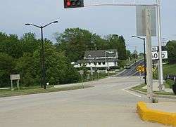
Eastern terminus
State Trunk Highway 60, often called Highway 60, STH 60 or WIS 60, is a state highway in the U.S. state of Wisconsin. It runs east–west in southern Wisconsin from the village of Grafton near Lake Michigan, to Prairie du Chien on the Mississippi River at the Iowa state line.
Major intersections
| County | Location | mi | km | Destinations | Notes |
|---|---|---|---|---|---|
| Clayton | Marquette | Continuation into Iowa | |||
| Mississippi River | 0.00 | 0.00 | Marquette–Joliet Bridge; Iowa–Wisconsin state line | ||
| Crawford | Prairie du Chien | ||||
| Western end of WIS 35 overlap | |||||
| Bridgeport | Eastern end of US 18 and WIS 35 overlaps | ||||
| Town of Wauzeka | |||||
| Town of Marietta | Western end of US 61 overlap | ||||
| Eastern end of US 61 overlap | |||||
| Richland | Town of Eagle | ||||
| Gotham | Western end of US 14 overlap | ||||
| Lone Rock | Western end of WIS 130 overlap | ||||
| Eastern end of WIS 130 overlap | |||||
| Sauk | Spring Green | Western end of WIS 23 overlap | |||
| Eastern end of US 14 and WIS 23 overlaps | |||||
| Town of Prairie du Sac | Western end of US 12 overlap | ||||
| Sauk City | Eastern end of US 12 overlap; western end of WIS 78 overlap | ||||
| Prairie du Sac | Eastern end of WIS 78 overlap | ||||
| Columbia | Town of West Point | Western end of WIS 188 overlap | |||
| Eastern end of WIS 188 overlap | |||||
| Lodi | |||||
| Town of Arlington | |||||
| Arlington | Western end of US 51 overlap | ||||
| Town of Leeds | Eastern end of US 51 overlap | ||||
| Columbus | Western end of WIS 16 overlap | ||||
| Dodge | Town of Clyman | Interchange; eastern end of WIS 16 overlap | |||
| Town of Rubicon | |||||
| Washington | Hartford | ||||
| Slinger | |||||
| Northern terminus of WIS 164 | |||||
| Village of Jackson | |||||
| Ozaukee | Cedarburg | ||||
| Grafton | |||||
1.000 mi = 1.609 km; 1.000 km = 0.621 mi
| |||||
References
- ↑ Bessert, Chris. "Wisconsin Highways: Highways 60-69 (Highway 60)". Wisconsin Highways. Retrieved 2007-03-20.
| Wikimedia Commons has media related to Wisconsin Highway 60. |
This article is issued from Wikipedia - version of the 10/2/2016. The text is available under the Creative Commons Attribution/Share Alike but additional terms may apply for the media files.