Slinger, Wisconsin
| Slinger, Wisconsin | |
|---|---|
| Village | |
 | |
 Location of Slinger, Wisconsin | |
| Coordinates: 43°19′42″N 88°17′0″W / 43.32833°N 88.28333°WCoordinates: 43°19′42″N 88°17′0″W / 43.32833°N 88.28333°W | |
| Country | United States |
| State | Wisconsin |
| County | Washington |
| Area[1] | |
| • Total | 5.31 sq mi (13.75 km2) |
| • Land | 5.29 sq mi (13.70 km2) |
| • Water | 0.02 sq mi (0.05 km2) |
| Elevation[2] | 1,063 ft (324 m) |
| Population (2010)[3] | |
| • Total | 5,068 |
| • Estimate (2012[4]) | 5,117 |
| • Density | 958.0/sq mi (369.9/km2) |
| Time zone | Central (CST) (UTC-6) |
| • Summer (DST) | CDT (UTC-5) |
| Area code(s) | 262 |
| FIPS code | 55-74400[5] |
| GNIS feature ID | 1574278[2] |
| Website |
www |
Slinger is a village in Washington County, Wisconsin, United States. The population was 5,068 at the 2010 census.
History
Originally named Schleisingerville after the founder, state senator Baruch Schleisinger Weil in 1857; it was renamed on December 22, 1921.[6][7]
Geography
Slinger is located at 43°19′42″N 88°17′0″W / 43.32833°N 88.28333°W (43.328466, -88.283461).[8]
According to the United States Census Bureau, the village has a total area of 5.31 square miles (13.75 km2), of which, 5.29 square miles (13.70 km2) of it is land and 0.02 square miles (0.05 km2) is water.[1]
Demographics
| Historical population | |||
|---|---|---|---|
| Census | Pop. | %± | |
| 1880 | 358 | — | |
| 1890 | 432 | 20.7% | |
| 1900 | 549 | 27.1% | |
| 1910 | 538 | −2.0% | |
| 1920 | 730 | 35.7% | |
| 1930 | 769 | 5.3% | |
| 1940 | 775 | 0.8% | |
| 1950 | 919 | 18.6% | |
| 1960 | 1,161 | 26.3% | |
| 1970 | 1,216 | 4.7% | |
| 1980 | 1,612 | 32.6% | |
| 1990 | 2,340 | 45.2% | |
| 2000 | 3,901 | 66.7% | |
| 2010 | 5,068 | 29.9% | |
| Est. 2015 | 5,208 | [9] | 2.8% |
2010 census
As of the census[3] of 2010, there were 5,068 people, 2,029 households, and 1,390 families residing in the village. The population density was 958.0 inhabitants per square mile (369.9/km2). There were 2,182 housing units at an average density of 412.5 per square mile (159.3/km2). The racial makeup of the village was 97.2% White, 0.5% African American, 0.2% Native American, 0.6% Asian, 0.3% from other races, and 1.1% from two or more races. Hispanic or Latino of any race were 2.3% of the population.
There were 2,029 households of which 36.1% had children under the age of 18 living with them, 52.7% were married couples living together, 11.0% had a female householder with no husband present, 4.8% had a male householder with no wife present, and 31.5% were non-families. 25.2% of all households were made up of individuals and 7.5% had someone living alone who was 65 years of age or older. The average household size was 2.48 and the average family size was 2.99.
The median age in the village was 37.2 years. 26.4% of residents were under the age of 18; 6.6% were between the ages of 18 and 24; 28.8% were from 25 to 44; 27.9% were from 45 to 64; and 10.3% were 65 years of age or older. The gender makeup of the village was 49.0% male and 51.0% female.
2000 census
As of the census[5] of 2000, there were 3,901 people, 1,562 households, and 1,040 families residing in the village. The population density was 1,046.8 people per square mile (403.8/km²). There were 1,607 housing units at an average density of 431.2 per square mile (166.3/km²). The racial makeup of the village was 97.95% White, 0.26% African American, 0.15% Native American, 0.18% Asian, 0.05% Pacific Islander, 0.41% from other races, and 1.00% from two or more races. Hispanic or Latino of any race were 1.38% of the population.
There were 1,562 households out of which 34.7% had children under the age of 18 living with them, 51.8% were married couples living together, 10.2% had a female householder with no husband present, and 33.4% were non-families. 26.7% of all households were made up of individuals and 9.0% had someone living alone who was 65 years of age or older. The average household size was 2.46 and the average family size was 3.02.
In the village the population was spread out with 26.8% under the age of 18, 7.4% from 18 to 24, 32.5% from 25 to 44, 21.1% from 45 to 64, and 12.2% who were 65 years of age or older. The median age was 36 years. For every 100 females there were 97.0 males. For every 100 females age 18 and over, there were 95.2 males.
The median income for a household in the village was $47,125, and the median income for a family was $55,607. Males had a median income of $40,783 versus $25,723 for females. The per capita income for the village was $21,450. About 6.0% of families and 6.4% of the population were below the poverty line, including 6.2% of those under age 18 and 10.7% of those age 65 or over.
Recreation
- Little Switzerland Ski area is in Slinger.
- Slinger is home to the Slinger Super Speedway, the world's fastest quarter mile paved oval.
- Slinger contains the 1.14 acre Slinger Pond.
Education
Slinger is served by the School District of Slinger.[11] Schools include Slinger Elementary School, St. Peter Catholic School, Allenton Elementary, Addison Elementary, Slinger Middle School, and Slinger High School.
References
- 1 2 "US Gazetteer files 2010". United States Census Bureau. Retrieved 2012-11-18.
- 1 2 "US Board on Geographic Names". United States Geological Survey. 2007-10-25. Retrieved 2008-01-31.
- 1 2 "American FactFinder". United States Census Bureau. Retrieved 2012-11-18.
- ↑ "Population Estimates". United States Census Bureau. Retrieved 2013-06-24.
- 1 2 "American FactFinder". United States Census Bureau. Retrieved 2008-01-31.
- ↑ 'Schleisingerville to Slinger 1869-1969: historical album and centennial program book,' Municipal buildings, Slinger (Wisconsin) Centennial Committee: 1969
- ↑ Wisconsin Small Jewish Communities History Project
- ↑ "US Gazetteer files: 2010, 2000, and 1990". United States Census Bureau. 2011-02-12. Retrieved 2011-04-23.
- ↑ "Annual Estimates of the Resident Population for Incorporated Places: April 1, 2010 to July 1, 2015". Retrieved July 2, 2016.
- ↑ "Census of Population and Housing". Census.gov. Retrieved June 4, 2015.
- ↑ "School District of Slinger".
External links
- Village of Slinger
- Sanborn fire insurance maps: 1894 1900 1913
Municipalities and communities of Washington County, Wisconsin, United States | ||
|---|---|---|
| Cities | 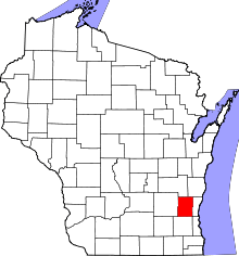 | |
| Villages | ||
| Towns | ||
| CDP | ||
| Unincorporated communities |
| |
| Footnotes | ‡This populated place also has portions in an adjacent county or counties | |