Wisconsin Dells, Wisconsin
Coordinates: 43°38′15″N 89°46′44″W / 43.6374°N 89.7788°W
| Wisconsin Dells, Wisconsin Kilbourn City | |
|---|---|
| City | |
|
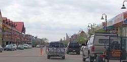
Downtown Wisconsin Dells looking west | |
| Nickname(s): The Dells | |
 Location of Wisconsin Dells in the state of Wisconsin | |
| Coordinates: 43°37′39″N 89°46′15″W / 43.62750°N 89.77083°W | |
| Country | United States |
| State | Wisconsin |
| Counties | Columbia, Sauk, Adams, Juneau |
| Founded | 1857 |
| Renamed | 1931 |
| Government | |
| • Type | Mayor–council |
| • Mayor | Brian L. Landers |
| Area[1] | |
| • Total | 7.73 sq mi (20.02 km2) |
| • Land | 7.36 sq mi (19.06 km2) |
| • Water | 0.37 sq mi (0.96 km2) |
| Elevation[2] | 909 ft (277 m) |
| Population (2010)[3][4] | |
| • Total | 2,678 |
| • Estimate (2012) | 2,701 |
| • Density | 363.9/sq mi (140.5/km2) |
| Time zone | Central (UTC-6) |
| • Summer (DST) | Central (UTC-5) |
| ZIP code | 53965 |
| Area code(s) | 608 |
| FIPS code | 55-88150[5] |
| GNIS feature ID | 1576900[6] |
| Website |
www |
Wisconsin Dells is a city in south-central Wisconsin, with a population of 2,678 people as of the 2010 census.[7] It straddles four counties: Adams, Columbia, Juneau, and Sauk. The city takes its name from the Dells of the Wisconsin River, a scenic, glacially formed gorge that features striking sandstone formations along the banks of the Wisconsin River. Together with the nearby village of Lake Delton, the city forms an area known as "the Dells", a popular Midwestern tourist destination.[8]
History
Origin of the name
Early French explorers named the Dells of the Wisconsin River as dalles, a rapids or narrows on a river in voyageur French.[9]
History
Wisconsin Dells was founded as Kilbourn City in 1857 by Byron Kilbourn, who also founded Kilbourntown, one of the three original towns at the confluence of the Milwaukee, Menomonee, and Kinnickinnic Rivers that joined to become Milwaukee. Before the establishment of Kilbourn City, the region around the dells of the Wisconsin River was primarily a lumbering area until 1851, when the La Crosse and Milwaukee Railroad was chartered, with Kilbourn as its president. The railroad made plans to bridge the Wisconsin River near the river's dells, and a boomtown named Newport sprang up at the expected site of the bridge in 1853. The population of this new city quickly swelled to over 2,000, but when the railroad finally came through the area in 1857 it took nearly everyone by surprise by crossing the river a mile upstream from the site of Newport. As a result, Newport was rapidly turned into a ghost town as the settlers flocked to the new city at the site of the railroad bridge, Kilbourn City. The land at the point of crossing was originally owned by Parley Eaton. Byron Kilbourn bought the land from Eaton for a reduced price as everyone expected the railroad to cross at Newport. However, Kilbourn then went to Madison and lobbied the state to allow for the railroad right-of-way to be moved to cross at the point where he owned the land and greatly increased its value. Gradually, tourism became a large part of Kilbourn City. To make it easier for tourists to identify Kilbourn City with the natural landscape for which it was famous, the name of the city was changed to Wisconsin Dells in 1931. As the twentieth century progressed, new attractions began to draw even more tourists.
Tourism
Because of the scenery provided by the dells of the Wisconsin River, Kilbourn City quickly became a popular travel destination in the Midwest. In 1856, Leroy Gates began taking tourists on boat tours of the Wisconsin Dells. These tours were given using wooden rowboats until 1873 when the first steamboat, the Modocawanda, was used. In 1875, early landscape photographer H. H. Bennett established a studio in the city and took many photos of the sandstone formations in the dells, including stereoscopic views. Prints of these photographs were distributed across the United States, further enhancing the status of Kilbourn City as a destination for sightseers. Taking advantage of this, Bennett began offering to take souvenir pictures of visitors to the dells, becoming one of the first to capitalize on the area's burgeoning tourist trade. Today, the H. H. Bennett Studio is a historic site operated by the Wisconsin Historical Society.
The Dells region remained primarily a place for sightseers to escape the bustle of the city for many decades. By 1894, distillate-powered tour boats began to be used. In 1908, the Kilbourn Dam was installed by what is now Alliant Energy, over the protests of people such as H. H. Bennett, separating the Dells into the Upper and Lower Dells.
Since the time of LeRoy Gates, the Dells Boat Tours have gone through many operators. Some of the previous companies were The Riverview Boat Line, the Olson Boat Line, the Dells Boat Company, the Consolidated Boat Company, and the Silver Dollar Boat Line.
A few other events of interest took place during this time, including the June 16, 1911 impact of a 772-gram stony meteorite in rural Columbia County near the city, damaging a barn. In 1928 Mr. Clinton Berry established Berry's Dells airport. It occupied sixty acres and was designated on government maps as beacon No. 19. Berry built the airport to carry visitors to the Dells from the surrounding metropolitan areas.[10]
Growth
Lake Delton, Wisconsin Dells's sister city to the south, gradually became popular as the Dells attractions spread out. The Wonder Spot was founded in Lake Delton in 1952, and remained open until 2006.[11] In 1952, a new traveling performance from Chicago called "Tommy Bartlett's Thrill Show" came to Lake Delton on its second stop. Following the show's huge success in the city, its owner, Tommy Bartlett, chose to keep the performance permanently in Wisconsin Dells. To promote the show, Bartlett gave away bumper stickers advertising his thrill show and the city, effectively spreading word about the area across the nation. Soon more attractions followed to serve the ever-increasing tourists, along with countless hotels, shops, and restaurants.
Geography
According to the United States Census Bureau, the city has a total area of 7.73 square miles (20.02 km2), of which, 7.36 square miles (19.06 km2) is land and 0.37 square miles (0.96 km2) is water.[1] According to the Wisconsin Department of Administration,[12] on January 19, 2004 the city annexed land from the Town of Lyndon in Juneau County, thus expanding the city to include area in four counties. It is mostly located in Columbia County.
Climate
Wisconsin Dells has a humid continental climate.
On July 13, 1936, the temperature in Wisconsin Dells reached 114 °F (46 °C), the highest ever recorded in the state of Wisconsin.[13]
| Climate data for Wisconsin Dells, Wisconsin (1981–2010 normals) | |||||||||||||
|---|---|---|---|---|---|---|---|---|---|---|---|---|---|
| Month | Jan | Feb | Mar | Apr | May | Jun | Jul | Aug | Sep | Oct | Nov | Dec | Year |
| Record high °F (°C) | 56 (13) |
64 (18) |
84 (29) |
91 (33) |
93 (34) |
99 (37) |
114 (46) |
102 (39) |
98 (37) |
90 (32) |
76 (24) |
63 (17) |
114 (46) |
| Average high °F (°C) | 26.9 (−2.8) |
31.7 (−0.2) |
43.5 (6.4) |
57.9 (14.4) |
69.8 (21) |
78.7 (25.9) |
82.4 (28) |
80.3 (26.8) |
72.2 (22.3) |
59.5 (15.3) |
44.2 (6.8) |
30.7 (−0.7) |
56.48 (13.6) |
| Average low °F (°C) | 7.2 (−13.8) |
10.9 (−11.7) |
21.5 (−5.8) |
33.0 (0.6) |
44.2 (6.8) |
54.2 (12.3) |
58.6 (14.8) |
56.8 (13.8) |
47.8 (8.8) |
35.8 (2.1) |
24.9 (−3.9) |
12.4 (−10.9) |
33.94 (1.09) |
| Record low °F (°C) | −43 (−42) |
−37 (−38) |
−29 (−34) |
5 (−15) |
22 (−6) |
31 (−1) |
41 (5) |
36 (2) |
24 (−4) |
9 (−13) |
−11 (−24) |
−27 (−33) |
−43 (−42) |
| Average precipitation inches (mm) | .89 (22.6) |
1.06 (26.9) |
1.87 (47.5) |
3.37 (85.6) |
3.72 (94.5) |
4.84 (122.9) |
4.17 (105.9) |
4.32 (109.7) |
3.49 (88.6) |
2.38 (60.5) |
2.04 (51.8) |
1.42 (36.1) |
33.56 (852.4) |
| Average snowfall inches (cm) | 11.4 (29) |
8.1 (20.6) |
5.5 (14) |
1.8 (4.6) |
0 (0) |
0 (0) |
0 (0) |
0 (0) |
0 (0) |
.3 (0.8) |
3.1 (7.9) |
11.0 (27.9) |
41.2 (104.6) |
| Average precipitation days (≥ 0.01 in) | 4.7 | 4.6 | 6.8 | 9.4 | 10.2 | 9.9 | 8.7 | 8.5 | 8.7 | 8.7 | 6.9 | 7.0 | 94.2 |
| Average snowy days (≥ 0.1 in) | 5.3 | 4.2 | 2.5 | .8 | 0 | 0 | 0 | 0 | 0 | .1 | 1.8 | 5.3 | 20 |
| Source: NOAA [14] | |||||||||||||
Demographics
| Historical population | |||
|---|---|---|---|
| Census | Pop. | %± | |
| 1870 | 1,114 | — | |
| 1880 | 945 | −15.2% | |
| 1890 | 961 | 1.7% | |
| 1900 | 1,134 | 18.0% | |
| 1910 | 1,170 | 3.2% | |
| 1920 | 1,206 | 3.1% | |
| 1930 | 1,489 | 23.5% | |
| 1940 | 1,762 | 18.3% | |
| 1950 | 1,957 | 11.1% | |
| 1960 | 2,105 | 7.6% | |
| 1970 | 2,401 | 14.1% | |
| 1980 | 2,521 | 5.0% | |
| 1990 | 2,393 | −5.1% | |
| 2000 | 2,418 | 1.0% | |
| 2010 | 2,678 | 10.8% | |
| Est. 2015 | 2,705 | [15] | 1.0% |
Because it straddles multiple counties, Wisconsin Dells is part of several Core Based Statistical Areas (CBSAs). The Columbia County portion of the city is part of the Madison Metropolitan Statistical Area, while the Sauk County portion is part of the Baraboo Micropolitan Statistical Area. The Adams and Juneau county portions are not part of any metropolitan or micropolitan area.
2010 census
As of the census[3] of 2010, there were 2,678 people, 1,148 households, and 659 families residing in the city. The population density was 363.9 inhabitants per square mile (140.5/km2). There were 1,485 housing units at an average density of 201.8 per square mile (77.9/km2). The racial makeup of the city was 91.5% White, 0.7% African American, 1.8% Native American, 0.8% Asian, 0.1% Pacific Islander, 3.3% from other races, and 1.8% from two or more races. Hispanic or Latino of any race were 7.4% of the population.
There were 1,148 households of which 27.4% had children under the age of 18 living with them, 40.9% were married couples living together, 10.3% had a female householder with no husband present, 6.3% had a male householder with no wife present, and 42.6% were non-families. 33.9% of all households were made up of individuals and 12.8% had someone living alone who was 65 years of age or older. The average household size was 2.26 and the average family size was 2.87.
The median age in the city was 40.3 years. 20.6% of residents were under the age of 18; 9.5% were between the ages of 18 and 24; 25.4% were from 25 to 44; 26.6% were from 45 to 64; and 17.7% were 65 years of age or older. The gender makeup of the city was 49.6% male and 50.4% female.
Of the 2010 total population of 2,678, the population by county was:
- Adams County: 61
- Columbia County: 2,440
- Juneau County: 2
- Sauk County: 175
2000 census
As of the census[5] of 2000, there were 2,418 people, 1,019 households, and 609 families residing in the city. The population density was 583.1 people per square mile (225.0/km²). There were 1,178 housing units at an average density of 284.1 per square mile (109.6/km²). The racial makeup of the city was 97.56% White, 0.37% African American, 0.87% Native American, 0.25% Asian, 0.33% from other races, and 0.62% from two or more races. Hispanic or Latino of any race were 1.70% of the population.
There were 1,019 households out of which 26.7% had children under the age of 18 living with them, 45.5% were married couples living together, 10.2% had a female householder with no husband present, and 40.2% were non-families. 34.6% of all households were made up of individuals and 15.4% had someone living alone who was 65 years of age or older. The average household size was 2.28 and the average family size was 2.93.
In the city the population was spread out with 22.0% under the age of 18, 7.8% from 18 to 24, 27.3% from 25 to 44, 23.6% from 45 to 64, and 19.3% who were 65 years of age or older. The median age was 41 years. For every 100 females there were 87.9 males. For every 100 females age 18 and over, there were 86.7 males.
The median income for a household in the city was $35,699, and the median income for a family was $46,304. Males had a median income of $29,830 versus $22,553 for females. The per capita income for the city was $23,447. About 4.0% of families and 7.5% of the population were below the poverty line, including 9.7% of those under age 18 and 3.0% of those age 65 or over.
Economy

Tourism is the major contributor to the economy of Wisconsin Dells. The Dells area has many indoor and outdoor waterparks, proclaiming itself the "Waterpark Capital of the World".[8] Other attractions include boat tours, ziplining, golf courses, mini golf, go-kart tracks, water sports, horseback riding, a water ski show known as the Tommy Bartlett's Thrill Show, museums, amusement parks, and a casino.[17] Most attractions are located on the Strip, otherwise known as the Wisconsin Dells Parkway. Accommodations range from economical motels to RV parks to chain hotels to themed resorts featuring indoor and outdoor waterparks and other amenities.
Amphibious DUKW vehicles called "ducks" began offering duck tours to tourists in Wisconsin Dells in 1946. The tours visit wilderness trails, and enter nearby Lake Delton and the Wisconsin River. One company, Original Wisconsin Ducks, has more than 90 vehicles and is the largest operator of duck tours in the United States. Mayor Brian Landers stated "Many of our own residents take duck rides. I've taken duck rides myself".[18][19]
Since the late 1970s, the Dells area (Wisconsin Dells and Lake Delton) has become a water park mecca. Noah's Ark Waterpark opened in Lake Delton in 1979, and has become the largest and the eighth most visited water park in the U.S. Other outdoor amusement and water parks followed, featuring water slides, mini golf, roller coasters, go-karts, and other attractions.
The Polynesian Resort Hotel opened the United States' and the Dells area's first indoor waterpark in 1994. Since then, the number of combination resort/indoor waterparks in the Wisconsin Dells area has swelled, with each new indoor waterpark trying to have the latest innovations in waterslides and to be able to claim the title of America's largest park.
The Big 5 Dells resorts with large indoor waterparks are the Mt. Olympus Water & Theme Park, Wilderness Territory, Kalahari Resort, Chula Vista Resort, and Great Wolf Lodge. Other smaller hotels with waterparks include the Atlantis Resort.
In 2005, Big Chief Karts and Coasters merged with the former Family Land Waterpark and Treasure Island Hotel to create a large theme park on the border of Lake Delton and Wisconsin Dells, with a resort called Hotel Rome, an indoor waterpark, outdoor waterpark, theme park, and the area's first indoor theme park. The park, which has roller coasters, go-karts, and water slides, is called Mt. Olympus Water & Theme Park.
The Tanger Outlet Center opened in 2006 near the Great Wolf Lodge, replacing the defunct Wisconsin Dells Greyhound Park, which opened in May 1990, but closed in 1996 due to heavy competition from the nearby Ho-Chunk Gaming Wisconsin Dells Bingo/Casino. Since Mt. Olympus opened the Parthenon Indoor Theme Park in 2006, two more indoor theme parks were constructed in the area: Knuckleheads outside the Tanger Complex in 2007, and Kalahari Resort in December 2008. New attractions being constructed include more indoor waterpark resorts, the Grand Cambrian Resort, and the Wedge Resort.
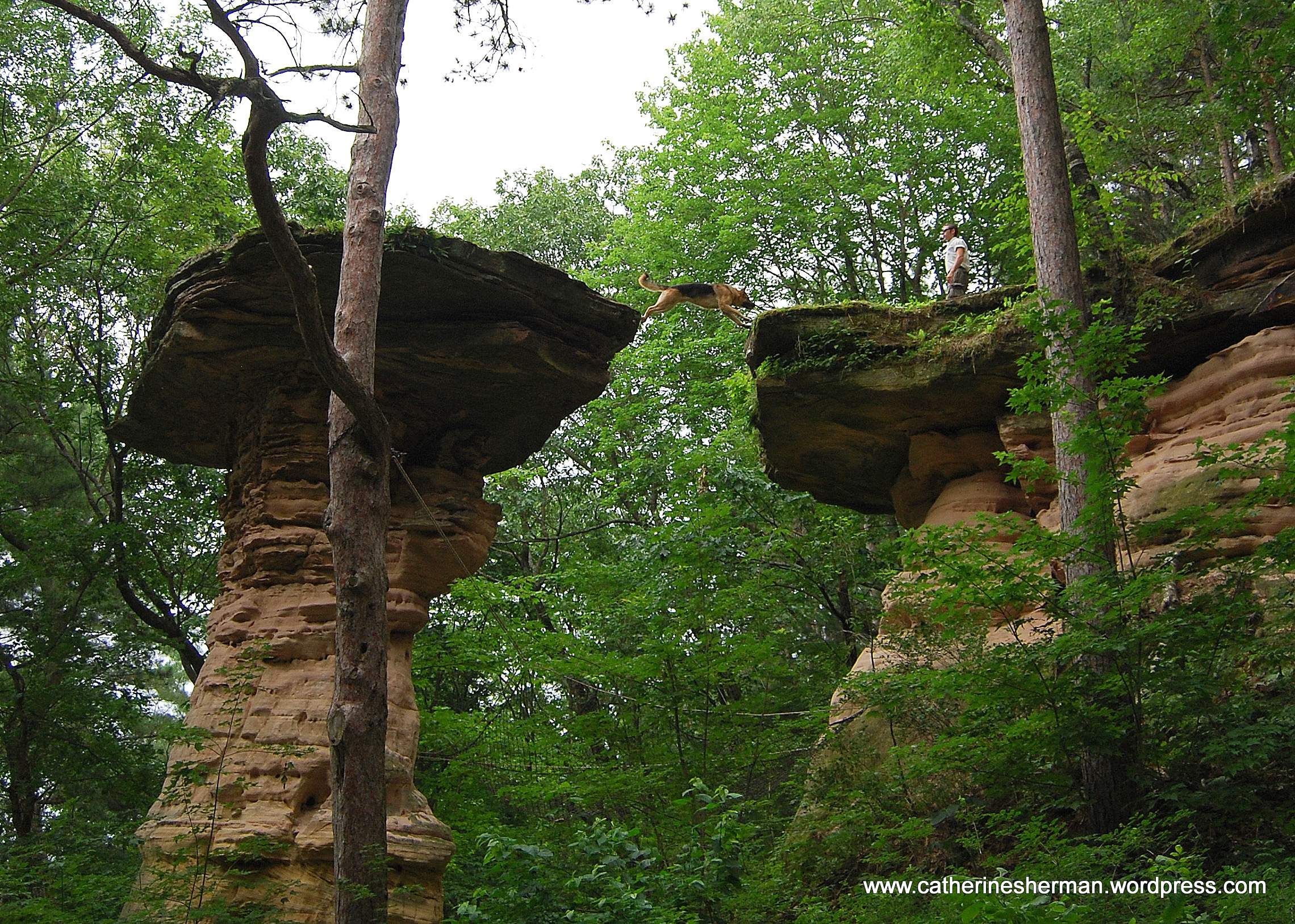
A further attractions are the show of a jump of a trained dog on a standing rock over an approximately 1.5 metres wide gap .
Media
Wisconsin Dells is served by a local newspaper, Wisconsin Dells Events, and 2 local radio stations, WNNO and WDLS.[20] The Wisconsin Dells Events is published by Capital Newspapers, which publishes multiple newspapers in south central Wisconsin.[21] WNNO-FM broadcasts at 106.9 MHz and covers an area 20 miles in radius centered on Wisconsin Dells.[22] WDLS broadcasts on 900 AM
Infrastructure
Buildings
Transportation
Greyhound Lines provides intrastate and interstate bus service to Wisconsin Dells[23] on its Chicago - Milwaukee - Madison - Minneapolis route.[24]
Amtrak, the national railroad passenger system, provides rail service. The Empire Builder provides daily service[25] at the Wisconsin Dells Amtrak station at 100 Lacrosse Street in the historic downtown.[26] The station was built in the 1980s in the style of the original station.
Utilities
- Frontier Communications
Notable people
- Belle Boyd, Confederate spy[27]
- Lynn N. Coapman, Wisconsin State Assemblyman[28]
- Jack Flannery, CORR and SODA driver
- Thomas Gillespie, Wisconsin State Assemblyman
- Michael Griffin, U.S. Representative
- Alanson Holly, Wisconsin State Assemblyman and newspaper editor
- Frank Kreyer, NASCAR driver
- G. M. Marshall, Wisconsin State Assemblyman
- Jack B. Olson, Lieutenant Governor of Wisconsin, businessman, and U.S. diplomat
- James H. Quinn, Minnesota Supreme Court justice[29]
- Yellow Thunder, Ho-Chunk chief[30]
Gallery
 Lower Dells intersection between downtown and "The Strip"
 Pirate's Cove, a miniature golf business
 Hades Rollercoaster at Mt. Olympus
 Trojan Horse go-kart track at Mt. Olympus
 Poseidons Rage surf pool at Mt. Olympus
 "Top Secret", an upside-down White House
 Municipal Building
Sister city
Wisconsin Dells has one sister city.
-
 Iwaizumi-Cho (Japan) since 1990[31]
See also
Notes
- 1 2 "US Gazetteer files 2010". United States Census Bureau. Retrieved 2012-11-18.
- ↑ "Wisconsin Dells". Geographic Names Information System. United States Geological Survey.
- 1 2 "American FactFinder". United States Census Bureau. Retrieved 2012-11-18.
- ↑ "Population Estimates - Incorporated Places and Minor Civil Divisions Datasets: Subcounty Resident Population Estimates: April 1, 2010 to July 1, 2012". United States Census Bureau. Retrieved 2013-06-24.
- 1 2 "American FactFinder". United States Census Bureau. Retrieved 2008-01-31.
- ↑ "US Board on Geographic Names". United States Geological Survey. 2007-10-25. Retrieved 2008-01-31.
- ↑ "Wisconsin Dells, Wisconsin Population: Census 2010 and 2000 Interactive Map, Demographics, Statistics, Quick Facts". Census Viewer. Retrieved 13 November 2012.
- 1 2 "Wisconsin Dells Area Information". Wisconsin Dells Visitor & Convention Bureau. Retrieved 18 July 2013.
- ↑ Goc (1999), p. 5
- ↑ Airport at dells. (1928, May 26). The Daily Northwestern, p. 13.
- ↑ George Hesselberg. "The Wonder Spot’ to disappear: Old-school Dells tourist attraction closing for good". La Crosse Tribune. January 12, 2007. Retrieved on June 5, 2009.
- ↑ http://www.doa.state.wi.us/docs_view2.asp?docid=2270
- ↑ "Climatological Extremes for Wisconsin - Highest Temperature by Month". Wisconsin State Climatology Office. 8 April 2010. Retrieved 26 August 2013.
- ↑ "National Weather Service Climate - Milwaukee/Sullivan". NowData - NOAA Online Weather Data. National Oceanic and Atmospheric Administration. Retrieved 2012-04-12.
- ↑ "Annual Estimates of the Resident Population for Incorporated Places: April 1, 2010 to July 1, 2015". Retrieved July 2, 2016.
- ↑ "Census of Population and Housing". Census.gov. Retrieved June 4, 2015.
- ↑ "Wisconsin Dells Attractions". Wisconsin Dells Tourism Authority. Retrieved 18 July 2013.
- ↑ Severson, Gordon (October 12, 2015). "City Leaders Confident in Safety of Wisconsin Dells "Duck Rides" After Fatal Accident in Seattle". WKOW Television.
- ↑ "Original Wisconsin Ducks Celebrates 70 Years of Operation". Amusement Today. May 8, 2015.
- ↑ "Wisconsin Dells Media". Wisconsin Dells Tourism Authority. Retrieved 18 July 2013.
- ↑ "About Capital Newspapers". Capital Newspapers. Retrieved 18 July 2013.
- ↑ "Mix 106.9 WNNO-FM - Station Info". Mix 106.9 WNNO-FM. Retrieved 18 July 2013.
- ↑ "Greyhound - Wisconsin Dells, WI". Greyhound Lines, Inc. Retrieved 19 July 2013.
- ↑ "Chicago - Milwaukee - Madison - Minneapolis: Table 304" (PDF). Greyhound Lines, Inc. 19 June 2013. Retrieved 19 July 2013.
- ↑ "Amtrak - Empire Builder Train". National Railroad Passenger Corporation. Retrieved 19 July 2013.
- ↑ "Amtrak - Stations - Wisconsin Dells, WI (WDL)". National Railroad Passenger Corporation. Retrieved 19 July 2013.
- ↑ "Belle Boyd". Wisconsin Historical Society. Retrieved 2013-09-15.
- ↑ 'Coapman Services,' Wisconsin State Journal, March 9, 1943, pg. 14
- ↑ Minnesota State Law Library-James H. Quinn
- ↑ Joan Jensen, Calling this Place Home: Women on the Wisconsin Frontier, 1850-1925 p. 33
- ↑ Krejci, Anna (22 October 2010). "Dells-Iwaizumi mark 20 years of sister city relations". Wisconsin Dells Events. Retrieved 20 July 2013.
References
- Goc, Michael J. (1999). The Dells: An Illustrated History of Wisconsin Dells. Dells County Historical Society. ISBN 978-0-938627-45-6.
External links
| Wikimedia Commons has media related to Wisconsin Dells, Wisconsin. |
| Wikivoyage has a travel guide for Wisconsin Dells. |
- Official website
- Sanborn fire insurance maps: 1885 1892 1902 1909
Municipalities and communities of Adams County, Wisconsin, United States | ||
|---|---|---|
| Cities | 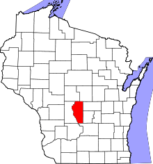 | |
| Village | ||
| Towns | ||
| CDPs | ||
| Unincorporated communities | ||
| Ghost towns | ||
| Footnotes | ‡This populated place also has portions in an adjacent county or counties | |
Municipalities and communities of Columbia County, Wisconsin, United States | ||
|---|---|---|
| Cities | 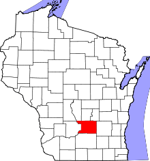 | |
| Villages | ||
| Towns | ||
| CDP | ||
| Unincorporated communities | ||
| Ghost town | ||
| Footnotes | ‡This populated place also has portions in an adjacent county or counties | |
Municipalities and communities of Juneau County, Wisconsin, United States | ||
|---|---|---|
| Cities | 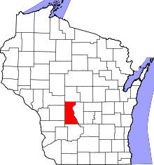 | |
| Villages | ||
| Towns | ||
| Unincorporated communities | ||
| Indian reservation | ||
| Footnotes | ‡This populated place also has portions in an adjacent county or counties | |
Municipalities and communities of Sauk County, Wisconsin, United States | ||
|---|---|---|
| Cities | 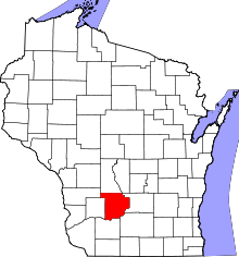 | |
| Villages | ||
| Towns | ||
| CDPs | ||
| Unincorporated communities | ||
| Indian reservation | ||
| Footnotes | ‡This populated place also has portions in an adjacent county or counties | |