Wisconsin Highway 133
| ||||
|---|---|---|---|---|
| Route information | ||||
| Maintained by WisDOT | ||||
| Length: | 91.07 mi[1] (146.56 km) | |||
| Major junctions | ||||
| South end: |
| |||
|
| ||||
| North end: |
| |||
| Location | ||||
| Counties: | Grant, Iowa, Richland | |||
| Highway system | ||||
| ||||

State Trunk Highway 133 (often called Highway 133, STH 133 or WIS 133) is a state highway in the U.S. state of Wisconsin. It runs in north–south in south central Wisconsin from near Tennyson to near Lone Rock.
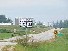
US 18/WIS 133 in Patch Grove
Major intersections
| County | Location | mi | km | Destinations | Notes |
|---|---|---|---|---|---|
| Grant | Tennyson | ||||
| Cassville | |||||
| Bloomington | Southern end of WIS 35 overlap | ||||
| Town of Patch Grove | Northern end of WIS 35 overlap; western end of US 18 overlap | ||||
| Mount Hope | Eastern end of US 18 overlap | ||||
| Boscobel | Western end of US 61 overlap | ||||
| Eastern end of US 61 overlap | |||||
| Muscoda | Western end of WIS 80 overlap | ||||
| Iowa | Town of Pulaski | Eastern end of WIS 80 overlap | |||
| Town of Clyde | Southern end of WIS 130 overlap | ||||
| Richland | Lone Rock | Northern end of WIS 130 overlap | |||
1.000 mi = 1.609 km; 1.000 km = 0.621 mi
| |||||
References
- ↑ Bessert, Chris. "Wisconsin Highways: Highways 130-139 (Highway 133)". Wisconsin Highways. Retrieved 2007-03-20.
This article is issued from Wikipedia - version of the 9/1/2016. The text is available under the Creative Commons Attribution/Share Alike but additional terms may apply for the media files.