Watervliet, Michigan
| Watervliet, Michigan | |
|---|---|
| City | |
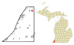 Location of Watervliet, Michigan | |
| Coordinates: 42°11′N 86°16′W / 42.183°N 86.267°WCoordinates: 42°11′N 86°16′W / 42.183°N 86.267°W | |
| Country | United States |
| State | Michigan |
| County | Berrien |
| Government | |
| • Mayor | David Brinker |
| Area[1] | |
| • Total | 1.23 sq mi (3.19 km2) |
| • Land | 1.19 sq mi (3.08 km2) |
| • Water | 0.04 sq mi (0.10 km2) |
| Elevation | 646 ft (197 m) |
| Population (2010)[2] | |
| • Total | 1,735 |
| • Estimate (2012[3]) | 1,720 |
| • Density | 1,458.0/sq mi (562.9/km2) |
| Time zone | Eastern (EST) (UTC-5) |
| • Summer (DST) | EDT (UTC-4) |
| ZIP code | 49098 |
| Area code(s) | 269 |
| FIPS code | 26-84500[4] |
| GNIS feature ID | 1615862[5] |
Watervliet is a city in Berrien County in the U.S. state of Michigan. Watervliet is also in the Charter Township of Watervliet. The population was 1,843 at the 2000 census. It is Dutch for "where the waters meet" and it is a rural farming community. As of the 2010 census, the population was 1,735 with 47.9% being males and 52.1% being females. The downtown area has an old-fashioned Main Street with antique stores and gift shops that attract tourists.
Geography
According to the United States Census Bureau, the city has a total area of 1.23 square miles (3.19 km2), of which 1.19 square miles (3.08 km2) is land and 0.04 square miles (0.10 km2) is water.[1]
Demographics
| Historical population | |||
|---|---|---|---|
| Census | Pop. | %± | |
| 1880 | 179 | — | |
| 1900 | 717 | — | |
| 1910 | 728 | 1.5% | |
| 1920 | 1,073 | 47.4% | |
| 1930 | 1,207 | 12.5% | |
| 1940 | 1,193 | −1.2% | |
| 1950 | 1,327 | 11.2% | |
| 1960 | 1,818 | 37.0% | |
| 1970 | 2,059 | 13.3% | |
| 1980 | 1,867 | −9.3% | |
| 1990 | 1,867 | 0.0% | |
| 2000 | 1,843 | −1.3% | |
| 2010 | 1,735 | −5.9% | |
| Est. 2015 | 1,692 | [6] | −2.5% |
2010 census
As of the census[2] of 2010, there were 1,735 people, 677 households, and 448 families residing in the city. The population density was 1,458.0 inhabitants per square mile (562.9/km2). There were 752 housing units at an average density of 631.9 per square mile (244.0/km2). The racial makeup of the city was 94.3% White, 1.0% African American, 0.8% Native American, 0.2% Asian, 1.0% from other races, and 2.7% from two or more races. Hispanic or Latino of any race were 3.9% of the population.
There were 677 households of which 38.1% had children under the age of 18 living with them, 43.7% were married couples living together, 14.8% had a female householder with no husband present, 7.7% had a male householder with no wife present, and 33.8% were non-families. 28.7% of all households were made up of individuals and 13.5% had someone living alone who was 65 years of age or older. The average household size was 2.55 and the average family size was 3.11.
The median age in the city was 35.8 years. 27.9% of residents were under the age of 18; 8.2% were between the ages of 18 and 24; 26.1% were from 25 to 44; 26.2% were from 45 to 64; and 11.6% were 65 years of age or older. The gender makeup of the city was 47.9% male and 52.1% female.
2000 census
As of the census[4] of 2000, there were 1,843 people, 719 households, and 473 families residing in the city. The population density was 1,495.9 per square mile (578.5/km²). There were 760 housing units at an average density of 616.9 per square mile (238.6/km²). The racial makeup of the city was 97.40% White, 0.33% African American, 0.22% Native American, 0.49% Asian, 0.38% from other races, and 1.19% from two or more races. Hispanic or Latino of any race were 1.09% of the population.
There were 719 households out of which 36.0% had children under the age of 18 living with them, 44.6% were married couples living together, 15.9% had a female householder with no husband present, and 34.2% were non-families. 28.5% of all households were made up of individuals and 16.0% had someone living alone who was 65 years of age or older. The average household size was 2.55 and the average family size was 3.09.
In the city the population was spread out with 29.0% under the age of 18, 8.0% from 18 to 24, 30.3% from 25 to 44, 19.2% from 45 to 64, and 13.6% who were 65 years of age or older. The median age was 35 years. For every 100 females there were 88.8 males. For every 100 females age 18 and over, there were 83.6 males.
The median income for a household in the city was $38,681, and the median income for a family was $42,391. Males had a median income of $37,500 versus $21,250 for females. The per capita income for the city was $16,691. About 3.8% of families and 6.9% of the population were below the poverty line, including 6.9% of those under age 18 and 11.5% of those age 65 or over.
Education
Watervliet is home to six schools and the Watervliet School District. The six schools are as follows:
- Watervliet High School (Watervliet, Michigan)
- South Elementary School
- North Elementary School
- Watervliet Middle School
- St. Joseph Catholic School
- Grace Christian School
References
- 1 2 "US Gazetteer files 2010". United States Census Bureau. Retrieved 2012-11-25.
- 1 2 "American FactFinder". United States Census Bureau. Retrieved 2012-11-25.
- ↑ "Population Estimates". United States Census Bureau. Retrieved 2013-06-03.
- 1 2 "American FactFinder". United States Census Bureau. Retrieved 2008-01-31.
- ↑ "US Board on Geographic Names". United States Geological Survey. 2007-10-25. Retrieved 2008-01-31.
- ↑ "Annual Estimates of the Resident Population for Incorporated Places: April 1, 2010 to July 1, 2015". Retrieved July 2, 2016.
- ↑ "Census of Population and Housing". Census.gov. Retrieved June 4, 2015.
External links
- Watervliet Website
- Watervliet Public Schools Website
- Panther Stadium, Home of Watervliet Football
- The Tri-City Record, the local newspaper
Municipalities and communities of Berrien County, Michigan, United States | ||
|---|---|---|
| Cities | 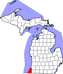 | |
| Villages | ||
| Charter townships | ||
| General law townships | ||
| CDPs | ||
| Other unincorporated communities | ||
| Footnotes | ‡This populated place also has portions in an adjacent county or counties | |